
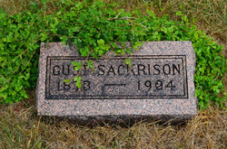
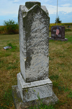
Gustaf Wesley Sackrison
| Birth | : | 5 Feb 1873 Webster County, Iowa, USA |
| Death | : | 7 Feb 1904 Webster County, Iowa, USA |
| Burial | : | Blessed Virgin Mary Churchyard, Huish Episcopi, South Somerset District, England |
| Coordinate | : | 51.0362250, -2.8182410 |
| Description | : | Stratford Courier February 11, 1904 Deaths Perhaps as sad a funeral as has been held in Stratford for some time was the one held Tuesday over the remains of Gust Sackrison. A week ago a strong healthy man, now he has returned to the dust from whence he came. About ten days ago he went to his father's home here so sick with pneumonia he could hardly walk. He lay there very ill for several days and on Saturday morning evaded his father, who is an aged man, and wandered out of doors in his stocking feet. He walked several blocks in the... Read More |
frequently asked questions (FAQ):
-
Where is Gustaf Wesley Sackrison's memorial?
Gustaf Wesley Sackrison's memorial is located at: Blessed Virgin Mary Churchyard, Huish Episcopi, South Somerset District, England.
-
When did Gustaf Wesley Sackrison death?
Gustaf Wesley Sackrison death on 7 Feb 1904 in Webster County, Iowa, USA
-
Where are the coordinates of the Gustaf Wesley Sackrison's memorial?
Latitude: 51.0362250
Longitude: -2.8182410
Family Members:
Parent
Siblings


Flowers:


Nearby Cemetories:
1. Blessed Virgin Mary Churchyard
Huish Episcopi, South Somerset District, England
Coordinate: 51.0362250, -2.8182410
2. All Saints Churchyard
Langport, South Somerset District, England
Coordinate: 51.0369970, -2.8254530
3. Langport Cemetery
Langport, South Somerset District, England
Coordinate: 51.0426200, -2.8244600
4. St. Peter and St. Paul's Churchyard
Muchelney, South Somerset District, England
Coordinate: 51.0207389, -2.8154595
5. Low Ham Church in the Field
High Ham, South Somerset District, England
Coordinate: 51.0583449, -2.8155268
6. St John the Baptist Churchyard
Pitney, South Somerset District, England
Coordinate: 51.0532200, -2.7937320
7. St. Catherine's Churchyard
Drayton, South Somerset District, England
Coordinate: 51.0191860, -2.8494960
8. Curry Rivel Cemetery
Curry Rivel, South Somerset District, England
Coordinate: 51.0257667, -2.8676226
9. St. Andrew's Churchyard
Curry Rivel, South Somerset District, England
Coordinate: 51.0246570, -2.8687410
10. Saint Andrew's Churchyard
Aller, South Somerset District, England
Coordinate: 51.0554000, -2.8627000
11. Long Sutton Friends Burial Ground
Long Sutton, South Somerset District, England
Coordinate: 51.0302700, -2.7612300
12. High Ham Cemetery
High Ham, South Somerset District, England
Coordinate: 51.0739931, -2.8216351
13. Holy Trinity Churchyard
Long Sutton, South Somerset District, England
Coordinate: 51.0246110, -2.7577940
14. St. Andrew's Churchyard
High Ham, South Somerset District, England
Coordinate: 51.0760320, -2.8218400
15. Christ Church Cemetery
Long Load, South Somerset District, England
Coordinate: 51.0054700, -2.7639100
16. St. Martin's Churchyard
Kingsbury Episcopi, South Somerset District, England
Coordinate: 50.9863950, -2.8043130
17. St. Catherine's Churchyard
Fivehead, South Somerset District, England
Coordinate: 51.0083009, -2.9000973
18. St. James the Less Churchyard
Hambridge, South Somerset District, England
Coordinate: 50.9849380, -2.8669180
19. Othery Cemetery
Othery, Sedgemoor District, England
Coordinate: 51.0771222, -2.8906189
20. Ash Parish Cemetery
Ash, South Somerset District, England
Coordinate: 50.9833540, -2.7538380
21. Holy Trinity Churchyard
Ash, South Somerset District, England
Coordinate: 50.9834250, -2.7528400
22. St Michael Churchyard
Burrowbridge, Taunton Deane Borough, England
Coordinate: 51.0698090, -2.9174960
23. Saint Andrew Churchyard
Compton Dundon, South Somerset District, England
Coordinate: 51.0897330, -2.7442800
24. Stoke St Gregory
Stoke St Gregory, Taunton Deane Borough, England
Coordinate: 51.0398130, -2.9310570