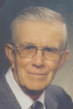
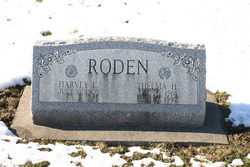
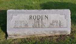
Harvey L. Roden
| Birth | : | 11 Jul 1905 Lost Nation, Clinton County, Iowa, USA |
| Death | : | 1 Sep 2006 Wheatland, Clinton County, Iowa, USA |
| Burial | : | Bellevue Cemetery, Bellevue, Sarpy County, USA |
| Coordinate | : | 41.1492004, -95.8944016 |
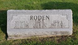
| Description | : | Harvey L. Roden was born on July 11, 1905 at the century family farm home in rural Lost Nation, Iowa, to Otto Roden and Matilda (Adrian) Roden. He was educated in rural Clinton County country schools. He married Thelma H. Cain on August 26, 1933 in Lyons, Iowa. She preceded him in death on March 4, 1997. Harvey had farmed the family farm in the rural Lost Nation area for many years. He and his wife, Thelma, were the third generation of Roden's to celebrate their Golden Wedding Anniversary while living on the farm. They... Read More |
frequently asked questions (FAQ):
-
Where is Harvey L. Roden's memorial?
Harvey L. Roden's memorial is located at: Bellevue Cemetery, Bellevue, Sarpy County, USA.
-
When did Harvey L. Roden death?
Harvey L. Roden death on 1 Sep 2006 in Wheatland, Clinton County, Iowa, USA
-
Where are the coordinates of the Harvey L. Roden's memorial?
Latitude: 41.1492004
Longitude: -95.8944016
Family Members:
Parent
Spouse
Siblings
Flowers:
Nearby Cemetories:
1. Bellevue Cemetery
Bellevue, Sarpy County, USA
Coordinate: 41.1492004, -95.8944016
2. Moscrip Cemetery
Bellevue, Sarpy County, USA
Coordinate: 41.1413500, -95.8917000
3. Columban Martyrs Memorial Garden
Bellevue, Sarpy County, USA
Coordinate: 41.1403220, -95.9034390
4. Fontenelle Forest Cemetery
Bellevue, Sarpy County, USA
Coordinate: 41.1636430, -95.8887200
5. Offutt AFB Cemetery
Sarpy County, USA
Coordinate: 41.1325607, -95.9096451
6. Church of the Holy Spirit Columbarium
Bellevue, Sarpy County, USA
Coordinate: 41.1475000, -95.9244000
7. Immanuel Lutheran Church Columbarium
Bellevue, Sarpy County, USA
Coordinate: 41.1602700, -95.9218900
8. Saint Marys Cemetery
Mills County, USA
Coordinate: 41.1517580, -95.8514000
9. Tunison Cemetery
Bellevue, Sarpy County, USA
Coordinate: 41.1357570, -95.9481150
10. Laurel Hill Cemetery
Omaha, Douglas County, USA
Coordinate: 41.1918983, -95.9417038
11. Anderson Grove Cemetery
Bellevue, Sarpy County, USA
Coordinate: 41.1285286, -95.9670334
12. Council Point Cemetery
Council Bluffs, Pottawattamie County, USA
Coordinate: 41.2110830, -95.8788610
13. Fisher Farm Cemetery
Bellevue, Sarpy County, USA
Coordinate: 41.1727982, -95.9760971
14. Hrabik Cemetery
Bellevue, Sarpy County, USA
Coordinate: 41.1726540, -95.9768200
15. Saint Johns Cemetery
Bellevue, Sarpy County, USA
Coordinate: 41.1864014, -95.9682999
16. Wall Cemetery
Mineola, Mills County, USA
Coordinate: 41.1157990, -95.8153000
17. Saint Mary's Cemetery
Omaha, Douglas County, USA
Coordinate: 41.2042007, -95.9646988
18. LaPlatte Cemetery
La Platte, Sarpy County, USA
Coordinate: 41.0694008, -95.9336014
19. Saint Mary Magdalene Cemetery
Omaha, Douglas County, USA
Coordinate: 41.2039420, -95.9850610
20. Graceland Park Cemetery
Omaha, Douglas County, USA
Coordinate: 41.2113991, -95.9785995
21. Saar's Field Cemetery
Mills County, USA
Coordinate: 41.1255500, -95.7725000
22. Maple Grove Cemetery
Council Bluffs, Pottawattamie County, USA
Coordinate: 41.2265560, -95.8187100
23. Lewis Township Cemetery
Council Bluffs, Pottawattamie County, USA
Coordinate: 41.2117004, -95.7938995
24. Salem Lutheran Church Cemetery
Glenwood, Mills County, USA
Coordinate: 41.1556015, -95.7617035

