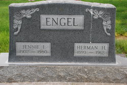
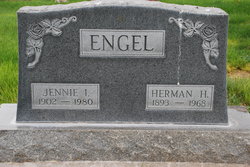
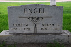
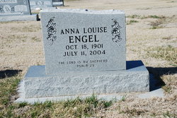
Herman H. Engel
| Birth | : | 10 Mar 1893 Perkins County, Nebraska, USA |
| Death | : | 8 Jul 1968 Grant, Perkins County, Nebraska, USA |
| Burial | : | Williams Cemetery, Polkton, Anson County, USA |
| Coordinate | : | 35.0026910, -80.2119000 |
frequently asked questions (FAQ):
-
Where is Herman H. Engel's memorial?
Herman H. Engel's memorial is located at: Williams Cemetery, Polkton, Anson County, USA.
-
When did Herman H. Engel death?
Herman H. Engel death on 8 Jul 1968 in Grant, Perkins County, Nebraska, USA
-
Where are the coordinates of the Herman H. Engel's memorial?
Latitude: 35.0026910
Longitude: -80.2119000
Family Members:
Parent
Spouse
Siblings
Children
Flowers:
Nearby Cemetories:
1. Williams Cemetery
Polkton, Anson County, USA
Coordinate: 35.0026910, -80.2119000
2. Griffin and Old Davis Cemetery
Polkton, Anson County, USA
Coordinate: 35.0123010, -80.2169750
3. W Edmund Horne Family Cemetery
Polkton, Anson County, USA
Coordinate: 34.9924040, -80.2159670
4. Branch-Old Polkton Cemetery
Polkton, Anson County, USA
Coordinate: 35.0052580, -80.1982100
5. May Cemetery
Polkton, Anson County, USA
Coordinate: 35.0236050, -80.1982000
6. Preslars Cemetery
Polkton, Anson County, USA
Coordinate: 35.0266100, -80.2131720
7. Covington Cemetery
Peachland, Anson County, USA
Coordinate: 34.9942320, -80.2457020
8. Beeman Cemetery
Peachland, Anson County, USA
Coordinate: 34.9981610, -80.2533140
9. Bennett Grove Cemetery
Polkton, Anson County, USA
Coordinate: 34.9847908, -80.1757202
10. Richmond-Sturdivant Cemetery
Polkton, Anson County, USA
Coordinate: 35.0036011, -80.1592026
11. Peachland Cemetery
Peachland, Anson County, USA
Coordinate: 34.9854730, -80.2620790
12. J. W. Beachum Family Cemetery
Anson County, USA
Coordinate: 35.0401360, -80.2498330
13. Gray Cemetery
Peachland, Anson County, USA
Coordinate: 34.9873410, -80.2685380
14. J.T. Beachum Family Cemetery
Anson County, USA
Coordinate: 35.0463200, -80.2448040
15. Edwards Memorial Marker
Peachland, Anson County, USA
Coordinate: 34.9819790, -80.2732210
16. Westview Memorial Park
Russellville, Anson County, USA
Coordinate: 34.9867440, -80.1476560
17. Lawrence & Tabitha Moore Family Cemetery
Anson County, USA
Coordinate: 34.9531410, -80.1789090
18. German Hill Cemetery
Peachland, Anson County, USA
Coordinate: 35.0043520, -80.2840360
19. Deep Springs Baptist Church Cemetery
Peachland, Anson County, USA
Coordinate: 35.0308160, -80.2759470
20. Mineral Springs Baptist Church Cemetery
Peachland, Anson County, USA
Coordinate: 34.9440660, -80.2407720
21. Brown Creek Baptist Church Cemetery
Wadesboro, Anson County, USA
Coordinate: 35.0240000, -80.1388000
22. Poplar Hill United Methodist Church Cemetery
Polkton, Anson County, USA
Coordinate: 34.9383230, -80.2031990
23. Phillips Cemetery
Peachland, Anson County, USA
Coordinate: 34.9668010, -80.2831610
24. Caudle-Phifer Cemetery
Peachland, Anson County, USA
Coordinate: 35.0319410, -80.2881170

