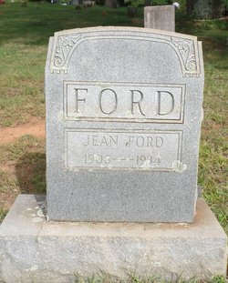
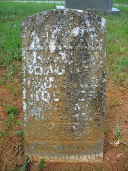
Imogene “Jean” Hodge Ford
| Birth | : | 1906 Grainger County, Tennessee, USA |
| Death | : | 20 Apr 1934 Cleveland, Cuyahoga County, Ohio, USA |
| Burial | : | Dalton Cemetery, Bean Station, Grainger County, USA |
| Coordinate | : | 36.3428001, -83.3296967 |
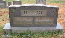
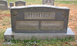
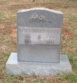
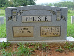
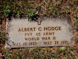
| Description | : | Grainger County News, 1 May 1935: "Mrs. Clyde H. Ford ----- Funeral services were conducted, Tuesday for Mrs. Clyde Hodge Ford whose death occurred at a Cleveland, Ohio, hospital on Saturday, April 20. The services were conducted by Rev. Mr. Clear and Rev. C. B. Cabbage. The body was buried in the Dalton cemetery. Mrs. Ford was the daughter of Mr. and Mrs. Frank Hodge of near Tate Springs, where the funeral services were held. Surviving: the parents; her husband, Clyde Ford; two sons, Jack and John I. Ford of Cleveland; two brothers, Hie and Albert Hodge; four sisters, Mrs. Marie Harmon, Mrs. Nora White,... Read More |
frequently asked questions (FAQ):
-
Where is Imogene “Jean” Hodge Ford's memorial?
Imogene “Jean” Hodge Ford's memorial is located at: Dalton Cemetery, Bean Station, Grainger County, USA.
-
When did Imogene “Jean” Hodge Ford death?
Imogene “Jean” Hodge Ford death on 20 Apr 1934 in Cleveland, Cuyahoga County, Ohio, USA
-
Where are the coordinates of the Imogene “Jean” Hodge Ford's memorial?
Latitude: 36.3428001
Longitude: -83.3296967
Family Members:
Parent
Siblings
Flowers:
Nearby Cemetories:
1. Samsel Lakeview Cemetery
Bean Station, Grainger County, USA
Coordinate: 36.3475800, -83.3189468
2. Samsel Cemetery
Bean Station, Grainger County, USA
Coordinate: 36.3424020, -83.3167060
3. Garrett Cemetery
Grainger County, USA
Coordinate: 36.3414001, -83.3082962
4. Buck Hollow Cemetery
Grainger County, USA
Coordinate: 36.3344120, -83.3589440
5. Moores Chapel Cemetery
Bean Station, Grainger County, USA
Coordinate: 36.3488998, -83.2897034
6. Bean Station Cemetery
Bean Station, Grainger County, USA
Coordinate: 36.3283000, -83.3697000
7. Cobb Cemetery
Grainger County, USA
Coordinate: 36.3189011, -83.3644028
8. Harris Cemetery
Grainger County, USA
Coordinate: 36.3055992, -83.3308029
9. Harrell Cemetery
Bean Station, Grainger County, USA
Coordinate: 36.3074989, -83.3463974
10. DeBord Cemetery
Bean Station, Grainger County, USA
Coordinate: 36.3315000, -83.2834000
11. Central United Methodist Church Cemetery
Bean Station, Grainger County, USA
Coordinate: 36.3422740, -83.2798470
12. Atkins Cemetery
Grainger County, USA
Coordinate: 36.3506000, -83.3792000
13. Meadow Branch Cemetery
Bean Station, Grainger County, USA
Coordinate: 36.3572006, -83.2822037
14. Holt Cemetery #2
Bean Station, Grainger County, USA
Coordinate: 36.3630560, -83.2844440
15. Noeton Baptist Church Cemetery Original
Bean Station, Grainger County, USA
Coordinate: 36.3012600, -83.3342200
16. Helton Cemetery
Bean Station, Grainger County, USA
Coordinate: 36.3451190, -83.3831290
17. Harville Cemetery
Grainger County, USA
Coordinate: 36.3811802, -83.3543986
18. Samsel Cemetery
Bean Station, Grainger County, USA
Coordinate: 36.3114014, -83.2925034
19. Adriel Baptist Church Cemetery
Bean Station, Grainger County, USA
Coordinate: 36.3125000, -83.2897034
20. First Independent Freewill Baptist Church Cemetery
Bean Station, Grainger County, USA
Coordinate: 36.3158860, -83.2855850
21. Meek Cemetery
Bean Station, Grainger County, USA
Coordinate: 36.3207180, -83.2797150
22. County Line Cemetery
Bean Station, Grainger County, USA
Coordinate: 36.3207700, -83.2789850
23. Marys Chapel Cemetery
Grainger County, USA
Coordinate: 36.3011017, -83.3569031
24. Ford Cemetery
Grainger County, USA
Coordinate: 36.2902985, -83.3071976

