
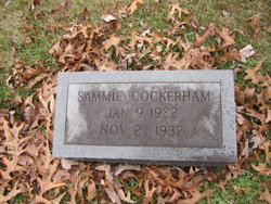
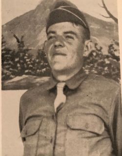
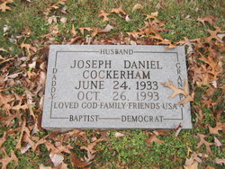
James Sammy Cockerham
| Birth | : | 9 Jan 1932 Surry County, North Carolina, USA |
| Death | : | 27 Nov 1932 Mountain Park, Surry County, North Carolina, USA |
| Burial | : | All Saints Churchyard, Rotherfield Peppard, South Oxfordshire District, England |
| Coordinate | : | 51.5280531, -0.9725009 |
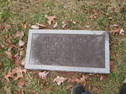
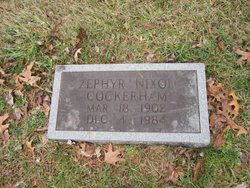
| Description | : | Infant son of Alex and Zephyr (Nixon) Cockerham. |
frequently asked questions (FAQ):
-
Where is James Sammy Cockerham's memorial?
James Sammy Cockerham's memorial is located at: All Saints Churchyard, Rotherfield Peppard, South Oxfordshire District, England.
-
When did James Sammy Cockerham death?
James Sammy Cockerham death on 27 Nov 1932 in Mountain Park, Surry County, North Carolina, USA
-
Where are the coordinates of the James Sammy Cockerham's memorial?
Latitude: 51.5280531
Longitude: -0.9725009
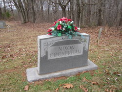
Family Members:
Parent
Siblings
Flowers:


Nearby Cemetories:
1. All Saints Churchyard
Rotherfield Peppard, South Oxfordshire District, England
Coordinate: 51.5280531, -0.9725009
2. St. Nicholas' Churchyard
Rotherfield Greys, South Oxfordshire District, England
Coordinate: 51.5351017, -0.9541395
3. St. John the Baptist Churchyard
Kidmore End, South Oxfordshire District, England
Coordinate: 51.5085170, -0.9951240
4. Kidmore End Cemetery
Kidmore End, South Oxfordshire District, England
Coordinate: 51.5071600, -0.9942160
5. St. Pauls Highmoor Cross
Highmoor, South Oxfordshire District, England
Coordinate: 51.5532740, -0.9910110
6. St. James's Churchyard
Bix and Assendon, South Oxfordshire District, England
Coordinate: 51.5610070, -0.9511270
7. Henley-on-Thames Cemetery
Henley-on-Thames, South Oxfordshire District, England
Coordinate: 51.5543570, -0.9271320
8. St. John the Evangalist Churchyard
Stoke Row, South Oxfordshire District, England
Coordinate: 51.5510570, -1.0226630
9. Stoke Row Independant Chapel
Stoke Row, South Oxfordshire District, England
Coordinate: 51.5510570, -1.0226630
10. Stoke Row Independent Chapel Cemetery
Stoke Row, South Oxfordshire District, England
Coordinate: 51.5510570, -1.0226630
11. All Saints Churchyard
Dunsden Green, South Oxfordshire District, England
Coordinate: 51.4917730, -0.9461650
12. Holy Trinity Churchyard
Henley-on-Thames, South Oxfordshire District, England
Coordinate: 51.5338500, -0.9066600
13. Christ Church
Henley-on-Thames, South Oxfordshire District, England
Coordinate: 51.5347880, -0.9032820
14. St Margaret's Churchyard
Harpsden, South Oxfordshire District, England
Coordinate: 51.5219160, -0.9012270
15. St. Mary the Virgin Churchyard
Henley-on-Thames, South Oxfordshire District, England
Coordinate: 51.5377790, -0.9017520
16. Checkendon Churchyard
Checkendon, South Oxfordshire District, England
Coordinate: 51.5424461, -1.0449720
17. St. Bartholomew's Churchyard
Nettlebed, South Oxfordshire District, England
Coordinate: 51.5752360, -0.9936230
18. St. James' Old Churchyard
South Oxfordshire District, England
Coordinate: 51.5769360, -0.9532550
19. Caversham Cemetery
Caversham, Reading Borough, England
Coordinate: 51.4745850, -0.9758020
20. Saint Bartholomew Chapelyard
Goring Heath, South Oxfordshire District, England
Coordinate: 51.5102184, -1.0545583
21. Reading Cemetery and Crematorium
Caversham, Reading Borough, England
Coordinate: 51.4737690, -0.9546570
22. St. Peter and St. Paul Churchyard
Shiplake, South Oxfordshire District, England
Coordinate: 51.4980750, -0.8963940
23. Chapel of St Michael the Archangel
Mapledurham, South Oxfordshire District, England
Coordinate: 51.4849140, -1.0355910
24. St. Margaret's Churchyard
Mapledurham, South Oxfordshire District, England
Coordinate: 51.4850830, -1.0364690