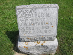
| Birth | : | 12 Jul 1852 |
| Death | : | 1 Aug 1898 |
| Burial | : | Forks of the Brandywine Presbyterian Cemetery, Glenmoore, Chester County, USA |
| Coordinate | : | 40.0604000, -75.8106000 |
frequently asked questions (FAQ):
-
Where is James Winfield McFarlan's memorial?
James Winfield McFarlan's memorial is located at: Forks of the Brandywine Presbyterian Cemetery, Glenmoore, Chester County, USA.
-
When did James Winfield McFarlan death?
James Winfield McFarlan death on 1 Aug 1898 in
-
Where are the coordinates of the James Winfield McFarlan's memorial?
Latitude: 40.0604000
Longitude: -75.8106000
Family Members:
Flowers:
Nearby Cemetories:
1. Forks of the Brandywine Presbyterian Cemetery
Glenmoore, Chester County, USA
Coordinate: 40.0604000, -75.8106000
2. Forks of the Brandywine New Side Presbyterian Burial Ground
Glenmoore, Chester County, USA
Coordinate: 40.0601501, -75.8068695
3. Forks of the Brandywine Seceder Cemetery
Glenmoore, Chester County, USA
Coordinate: 40.0592003, -75.8161011
4. All Souls Cemetery
Coatesville, Chester County, USA
Coordinate: 40.0540340, -75.8121820
5. Hibernia United Methodist Cemetery
Cedar Knoll, Chester County, USA
Coordinate: 40.0250015, -75.8339005
6. Glen Moore United Methodist Cemetery
Glenmoore, Chester County, USA
Coordinate: 40.0881996, -75.7718964
7. Living God Lutheran Church Columbarium
Honey Brook Township, Chester County, USA
Coordinate: 40.0790000, -75.8690000
8. West Caln Baptist Cemetery
Wagontown, Chester County, USA
Coordinate: 40.0172005, -75.8491974
9. Fairview Presbyterian Church Cemetery
Glenmoore, Chester County, USA
Coordinate: 40.0947189, -75.7580261
10. East Brandywine Baptist Church Cemetery
Guthriesville, Chester County, USA
Coordinate: 40.0256004, -75.7491989
11. Beth Israel Cemetery
Coatesville, Chester County, USA
Coordinate: 40.0053497, -75.8470131
12. Hopewell United Methodist Church Cemetery
Downingtown, Chester County, USA
Coordinate: 40.0382996, -75.7351990
13. Saint Stanislaus Kostka Polish Catholic Cemetery
Coatesville, Chester County, USA
Coordinate: 40.0046349, -75.8459930
14. Old Caln Friends Meeting Burial Ground
Coatesville, Chester County, USA
Coordinate: 40.0074997, -75.7647018
15. Caln Orthodox Friends Burial Ground
Coatesville, Chester County, USA
Coordinate: 40.0071710, -75.7634290
16. West Caln Friends Burial Ground
Wagontown, Chester County, USA
Coordinate: 40.0109000, -75.8694000
17. Saint Cecelia's Roman Catholic Cemetery
Coatesville, Chester County, USA
Coordinate: 39.9906006, -75.8114014
18. Stoltzfus Old Order Amish Cemetery
Honey Brook Township, Chester County, USA
Coordinate: 40.1013700, -75.8957000
19. Coatesville Presbyterian Cemetery
Coatesville, Chester County, USA
Coordinate: 39.9831543, -75.8184738
20. Lutheran Church of the Good Shepherd Columbarium
Coatesville, Chester County, USA
Coordinate: 39.9842680, -75.7891530
21. Dawson Family Cemetery
West Caln Township, Chester County, USA
Coordinate: 40.0009930, -75.8796790
22. Fairview Cemetery
Coatesville, Chester County, USA
Coordinate: 39.9789009, -75.8071976
23. Honey Brook Presbyterian Cemetery
Honey Brook Borough, Chester County, USA
Coordinate: 40.0927010, -75.9089966
24. Honey Brook United Methodist Church Cemetery
Honey Brook Township, Chester County, USA
Coordinate: 40.0956001, -75.9076004

