
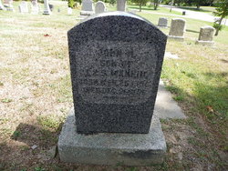

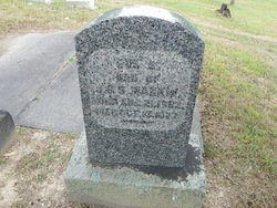
John H. Mankin
| Birth | : | 25 Mar 1856 Ohio, USA |
| Death | : | 31 Dec 1881 Gads Hill, Wayne County, Missouri, USA |
| Burial | : | Holy Rosary Cemetery, Monroe City, Monroe County, USA |
| Coordinate | : | 39.6528000, -91.7450000 |
| Inscription | : | Son of J & S Mankin |
frequently asked questions (FAQ):
-
Where is John H. Mankin's memorial?
John H. Mankin's memorial is located at: Holy Rosary Cemetery, Monroe City, Monroe County, USA.
-
When did John H. Mankin death?
John H. Mankin death on 31 Dec 1881 in Gads Hill, Wayne County, Missouri, USA
-
Where are the coordinates of the John H. Mankin's memorial?
Latitude: 39.6528000
Longitude: -91.7450000
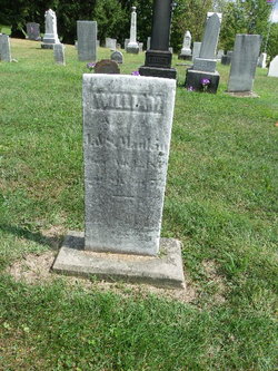
Family Members:
Parent
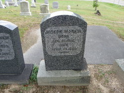
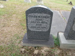
Siblings

Flowers:


Nearby Cemetories:
1. Holy Rosary Cemetery
Monroe City, Monroe County, USA
Coordinate: 39.6528000, -91.7450000
2. Saint Jude Cemetery
Monroe City, Monroe County, USA
Coordinate: 39.6528015, -91.7450027
3. Sharpsburg Cemetery
Marion County, USA
Coordinate: 39.6822160, -91.7678850
4. Shaw Family Gravesite
Sharpsburg, Marion County, USA
Coordinate: 39.6874900, -91.7736050
5. Young Burial Ground
Sharpsburg, Marion County, USA
Coordinate: 39.6997200, -91.7611100
6. Howe Cemetery
Marion County, USA
Coordinate: 39.7155991, -91.7630997
7. Saint Stephens Catholic Cemetery
Indian Creek, Monroe County, USA
Coordinate: 39.5925800, -91.7762400
8. DeMoss Chapel Cemetery
Hassard, Ralls County, USA
Coordinate: 39.6044846, -91.6873856
9. Bethlehem Cemetery
Ralls County, USA
Coordinate: 39.6069400, -91.6733300
10. Browne Cemetery
Hunnewell, Shelby County, USA
Coordinate: 39.6737500, -91.8509600
11. IOOF Cemetery
Hunnewell, Shelby County, USA
Coordinate: 39.6736800, -91.8523800
12. Cobb Cemetery
Marion County, USA
Coordinate: 39.7393990, -91.7292023
13. Jeter Cemetery
Monroe County, USA
Coordinate: 39.6175003, -91.8563995
14. Mount Vernon United Methodist Church Cemetery
Sees Branch Settlement, Marion County, USA
Coordinate: 39.7297800, -91.6767200
15. Kincaid Cemetery
Warren, Marion County, USA
Coordinate: 39.7498110, -91.7764030
16. Saint Johns Cemetery
Hunnewell, Shelby County, USA
Coordinate: 39.6617012, -91.8778000
17. Godfrey Cemetery
Hunnewell, Shelby County, USA
Coordinate: 39.6699982, -91.8788986
18. New Oakland Cemetery
The Landing, Ralls County, USA
Coordinate: 39.5660200, -91.6651200
19. Yager Cemetery
The Landing, Ralls County, USA
Coordinate: 39.5600640, -91.6719080
20. Union Chapel Cemetery
Hunnewell, Shelby County, USA
Coordinate: 39.7162323, -91.8602524
21. Brush Creek Cemetery
Ralls County, USA
Coordinate: 39.6197650, -91.6040461
22. Warren Cemetery
Warren, Marion County, USA
Coordinate: 39.7712200, -91.7517200
23. Greathouse Cemetery
Ralls County, USA
Coordinate: 39.6142006, -91.5991974
24. Shannon Cemetery
Woodland, Marion County, USA
Coordinate: 39.7375500, -91.6301000