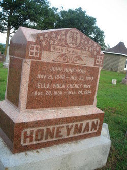
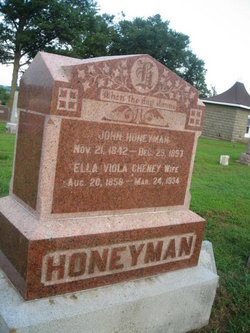
John Honeyman
| Birth | : | 21 Nov 1842 Scotland |
| Death | : | 29 Dec 1897 Malvern, Mills County, Iowa, USA |
| Burial | : | St Peter Churchyard, Needham, South Norfolk District, England |
| Coordinate | : | 52.3896320, 1.2773700 |
| Plot | : | Original Section #77 |
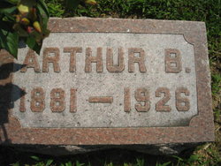
| Description | : | Arthur Honeyman met with a painful accident last week. He was getting hay from the mow at a barn at the Elmer Bass farm when the hook he was using slipped, letting Mr. Honeyman fall across the manger below, tearing one rib loose and braking sever more. He was alone for sometime, when Harry Rhoads found him and took him home. Malvern Leader, March 18, 1918, page 6 Well Known Farmer of Emerson Passes Away in Red Oak Hospital Sunday Afternoon Emerson, March 23, This community was greatly shocked last Sunday afternoon to learn of the death of Arthur Honeyman,... Read More |
frequently asked questions (FAQ):
-
Where is John Honeyman's memorial?
John Honeyman's memorial is located at: St Peter Churchyard, Needham, South Norfolk District, England.
-
When did John Honeyman death?
John Honeyman death on 29 Dec 1897 in Malvern, Mills County, Iowa, USA
-
Where are the coordinates of the John Honeyman's memorial?
Latitude: 52.3896320
Longitude: 1.2773700
Family Members:
Spouse
Children
Flowers:
Nearby Cemetories:
1. St Peter Churchyard
Needham, South Norfolk District, England
Coordinate: 52.3896320, 1.2773700
2. St Mary Churchyard
Dickleburgh and Rushall, South Norfolk District, England
Coordinate: 52.3978750, 1.2290680
3. St. Peter and St. Paul Churchyard
Brockdish, South Norfolk District, England
Coordinate: 52.3705240, 1.2366100
4. St Mary the Virgin Churchyard
Pulham St Mary, South Norfolk District, England
Coordinate: 52.4205290, 1.2520380
5. St. Margaret's Churchyard
Syleham, Mid Suffolk District, England
Coordinate: 52.3641870, 1.2372060
6. All Saints Churchyard
Mendham, Mid Suffolk District, England
Coordinate: 52.3976310, 1.3349670
7. Church of the Assumption of the Blessed Virgin Mar
Redenhall, South Norfolk District, England
Coordinate: 52.4104780, 1.3272680
8. Fressingfield Methodist Churchyard
Fressingfield, Mid Suffolk District, England
Coordinate: 52.3472430, 1.3133970
9. St. Peter and St. Paul Churchyard
Fressingfield, Mid Suffolk District, England
Coordinate: 52.3487940, 1.3190390
10. Saint Mary Magdalene Churchyard
Metfield, Mid Suffolk District, England
Coordinate: 52.3773540, 1.3538467
11. Pulham Market Cemetery
Pulham Market, South Norfolk District, England
Coordinate: 52.4281900, 1.2297700
12. Saint Mary Magdalene Churchyard
Pulham Market, South Norfolk District, England
Coordinate: 52.4285200, 1.2301100
13. Baptist Churchyard
Fressingfield, Mid Suffolk District, England
Coordinate: 52.3481570, 1.3216200
14. Fressingfield Cemetery
Fressingfield, Mid Suffolk District, England
Coordinate: 52.3392240, 1.3135440
15. All Saints Churchyard
Dickleburgh and Rushall, South Norfolk District, England
Coordinate: 52.3968580, 1.1848010
16. Metfield Cemetery
Metfield, Mid Suffolk District, England
Coordinate: 52.3678410, 1.3635810
17. Saint Mary Churchyard
Homersfield, Waveney District, England
Coordinate: 52.4191670, 1.3595410
18. Saint John the Baptist Churchyard
Metfield, Mid Suffolk District, England
Coordinate: 52.3728810, 1.3689930
19. Saint Peter and St. Paul Churchyard
Hoxne, Mid Suffolk District, England
Coordinate: 52.3522270, 1.2016300
20. All Saints Churchyard
Alburgh, South Norfolk District, England
Coordinate: 52.4362610, 1.3386490
21. St Leonard Churchyard
Billingford, South Norfolk District, England
Coordinate: 52.3666290, 1.1834260
22. St George's Churchyard
South Elmham St Cross, Waveney District, England
Coordinate: 52.4080410, 1.3794272
23. St. George's Churchyard
Shimpling, Babergh District, England
Coordinate: 52.3994010, 1.1680910
24. Saint George Churchyard
Shimpling, South Norfolk District, England
Coordinate: 52.3993000, 1.1680000

