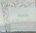
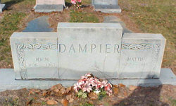
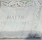
John “Johnnie” Dampier
| Birth | : | 27 May 1895 La Crosse, Alachua County, Florida, USA |
| Death | : | 12 Apr 1963 La Crosse, Alachua County, Florida, USA |
| Burial | : | St Michael Churchyard, Cold Kirby, Ryedale District, England |
| Coordinate | : | 54.2534580, -1.1827120 |
| Plot | : | N.W. Row 8 |
| Description | : | 1920 United States Federal Census about John Dampier Name: John Dampier Home in 1920: La Crosse, Alachua, Florida Age: 24 Estimated birth year: abt 1896 Birthplace: Florida Relation to Head of House: Self (Head) [Head] Spouse's name: Hattie Dampier Father's Birth Place: Florida Mother's Birth Place: Florida Marital Status: Married Race: White Sex: Male Home owned: Rent Able to read: Yes Able to Write: Yes Neighbors: View others on page Household Members: Name Age John Dampier 24 Hattie Dampier 19 [17] View Original Record View original image |
frequently asked questions (FAQ):
-
Where is John “Johnnie” Dampier's memorial?
John “Johnnie” Dampier's memorial is located at: St Michael Churchyard, Cold Kirby, Ryedale District, England.
-
When did John “Johnnie” Dampier death?
John “Johnnie” Dampier death on 12 Apr 1963 in La Crosse, Alachua County, Florida, USA
-
Where are the coordinates of the John “Johnnie” Dampier's memorial?
Latitude: 54.2534580
Longitude: -1.1827120
Family Members:
Parent
Spouse
Siblings
Children
Flowers:
Nearby Cemetories:
1. St Michael Churchyard
Cold Kirby, Ryedale District, England
Coordinate: 54.2534580, -1.1827120
2. Saint Mary’s Churchyard
Scawton, Ryedale District, England
Coordinate: 54.2451000, -1.1591000
3. All Saints Churchyard
Old Byland, Ryedale District, England
Coordinate: 54.2663000, -1.1558000
4. Holy Trinity Churchyard
Boltby, Hambleton District, England
Coordinate: 54.2732340, -1.2480700
5. All Saints Churchyard
Hawnby, Ryedale District, England
Coordinate: 54.3000380, -1.1770300
6. St Mary Churchyard
Kilburn, Hambleton District, England
Coordinate: 54.2102360, -1.2138820
7. Byland Abbey
Coxwold, Hambleton District, England
Coordinate: 54.2034480, -1.1589660
8. St Felix Churchyard
Felixkirk, Hambleton District, England
Coordinate: 54.2564000, -1.2832000
9. Ampleforth Friends Burial Ground
Ampleforth, Ryedale District, England
Coordinate: 54.2023420, -1.1213330
10. St. Wilfrid's Churchyard
Kirby Knowle, Hambleton District, England
Coordinate: 54.2788910, -1.2823040
11. St. Michael's Churchyard
Coxwold, Hambleton District, England
Coordinate: 54.1878500, -1.1847120
12. St Hilda Churchyard
Ampleforth, Ryedale District, England
Coordinate: 54.2000630, -1.1075590
13. Our Lady & St Benedict RC Churchyard
Ampleforth, Ryedale District, England
Coordinate: 54.2009700, -1.1055400
14. Rievaulx Abbey
Helmsley, Ryedale District, England
Coordinate: 54.2449170, -1.0639570
15. All Saints Churchyard
Helmsley, Ryedale District, England
Coordinate: 54.2469000, -1.0625000
16. Helmsley Town Cemetery
Helmsley, Ryedale District, England
Coordinate: 54.2483300, -1.0620300
17. St Mary Churchyard
Bagby, Hambleton District, England
Coordinate: 54.2192130, -1.2907820
18. Newburgh Priory
Coxwold, Hambleton District, England
Coordinate: 54.1811000, -1.1731000
19. All Saints Churchyard
Great Thirkleby, Hambleton District, England
Coordinate: 54.2020800, -1.2762700
20. Ampleforth Abbey - Monk's Wood
Ampleforth, Ryedale District, England
Coordinate: 54.2028689, -1.0841344
21. Ampleforth Abbey
Ampleforth, Ryedale District, England
Coordinate: 54.2019630, -1.0838000
22. St. Michael's and All Angels Churchyard
Cowesby, Hambleton District, England
Coordinate: 54.3029750, -1.2875840
23. St Nicholas Churchyard
Husthwaite, Hambleton District, England
Coordinate: 54.1692000, -1.2075900
24. Husthwaite Cemetery
Husthwaite, Hambleton District, England
Coordinate: 54.1684400, -1.2142000

