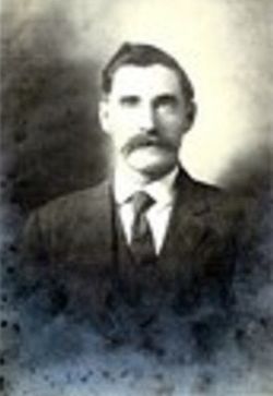
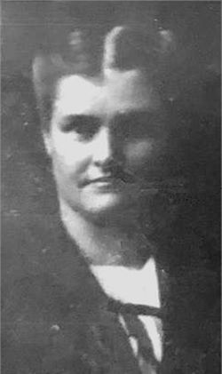
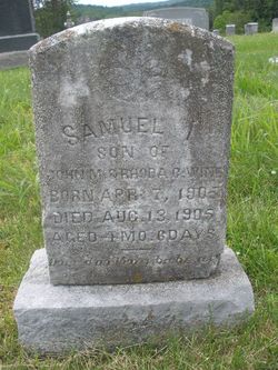
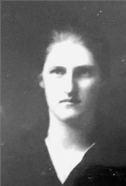
John Wilfong Wine
| Birth | : | 21 Apr 1868 Boyer, Pocahontas County, West Virginia, USA |
| Death | : | 22 Jul 1944 Norfolk, Norfolk City, Virginia, USA |
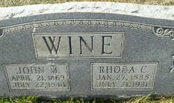
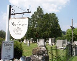
| Burial | : | Pine Grove United Methodist Church Cemetery, De Haven, Frederick County, USA |
| Coordinate | : | 39.3513985, -78.1857986 |
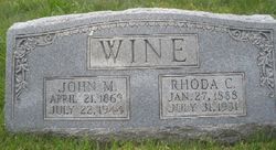
| Inscription | : | John M. Wine April 21, 1869 July 22,1944 |
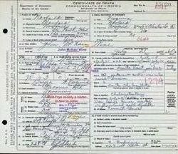
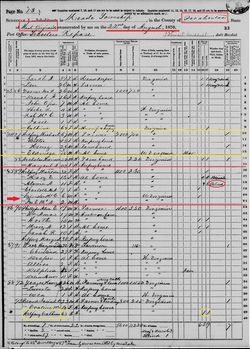
| Description | : | Son of John Wilfong and Matilda Wilfong. He was adopted by the Wine family. Husband of Ida May Taylor Lambert m. 24 Jan 1886 Rockingham Co, VA & div. bef. 1900. Husband of Rhoda Catherine De Haven m. 2 Nov 1903 De Haven, De Haven, VA. Husband of Emma Hodges. VA Deaths: Name: John Mcnain Wine Gender: Male Race: White Death Age: 75 Birth Date: 21 Apr 1869 Death Date: 21 Jul 1944 Death Place: Norfolk, Virginia, USA Registration Date: 24 Jul 1944 Spouse: Roda Dehavin Wine COD: Acute heart failure Certificate Number: 1944015020 From the files... Read More |
frequently asked questions (FAQ):
-
Where is John Wilfong Wine's memorial?
John Wilfong Wine's memorial is located at: Pine Grove United Methodist Church Cemetery, De Haven, Frederick County, USA.
-
When did John Wilfong Wine death?
John Wilfong Wine death on 22 Jul 1944 in Norfolk, Norfolk City, Virginia, USA
-
Where are the coordinates of the John Wilfong Wine's memorial?
Latitude: 39.3513985
Longitude: -78.1857986
Family Members:
Parent
Spouse
Siblings
Children
Flowers:
Left by Anonymous on 26 Nov 2014
Birth in 1868 through 1900 show John's name as Wilfong, ONLY. NO adoption by ANY Wine family. Records ONLY show that name in 1903. His age was 35 by these records. NO ADOPTION WAS DONE FOR THIS MAN.
Left by Anonymous on 17 Sep 2021

Great grandpa has been long gone but not forgotten.
Left by Anonymous on 28 Apr 2022
Nearby Cemetories:
1. Pine Grove United Methodist Church Cemetery
De Haven, Frederick County, USA
Coordinate: 39.3513985, -78.1857986
2. Brannon Cemetery
Glengary, Berkeley County, USA
Coordinate: 39.3626100, -78.1798300
3. Howards Chapel United Methodist Church Cemetery
Siler, Frederick County, USA
Coordinate: 39.3585014, -78.2171021
4. Mount Carmel Methodist Church Cemetery
Glengary, Berkeley County, USA
Coordinate: 39.3908950, -78.1887700
5. Strowbridge Cemetery
Siler, Frederick County, USA
Coordinate: 39.3635530, -78.2354260
6. Chestnut Grove Cemetery
Siler, Frederick County, USA
Coordinate: 39.3306007, -78.2304001
7. Moutainview Baptist Church Cemetery
Glengary, Berkeley County, USA
Coordinate: 39.3853500, -78.1561500
8. Mount Pleasant Cemetery
Gerrardstown, Berkeley County, USA
Coordinate: 39.3338730, -78.1343120
9. Mount Olive Cemetery
Gerrardstown, Berkeley County, USA
Coordinate: 39.3647780, -78.1253350
10. Old Stone Church Cemetery
Green Spring, Frederick County, USA
Coordinate: 39.3011017, -78.1675034
11. Kaes Park
Frederick County, USA
Coordinate: 39.3218200, -78.2454900
12. Heironimus Gravesite
Siler, Frederick County, USA
Coordinate: 39.3558899, -78.2574669
13. Roe Chapel Cemetery
Berkeley County, USA
Coordinate: 39.4074650, -78.1849660
14. Shockeysville United Methodist Church Cemetery
Shockeysville, Frederick County, USA
Coordinate: 39.3861008, -78.2432022
15. Weidman - Suver Cemetery
Bunker Hill, Berkeley County, USA
Coordinate: 39.3335340, -78.1162690
16. Files Chapel Cemetery
Shockeysville, Frederick County, USA
Coordinate: 39.3781013, -78.2515335
17. Ganotown United Methodist Church Cemetery
Glengary, Berkeley County, USA
Coordinate: 39.4056900, -78.1492000
18. White Hall United Methodist Church Cemetery
White Hall, Frederick County, USA
Coordinate: 39.2937012, -78.1489029
19. Pleasant Valley United Methodist Church Cemetery
Cedar Grove, Frederick County, USA
Coordinate: 39.2834015, -78.1800995
20. Gerrardstown Presbyterian Church Cemetery
Gerrardstown, Berkeley County, USA
Coordinate: 39.3692398, -78.0989532
21. Central Chapel Cemetery
Hedgesville, Berkeley County, USA
Coordinate: 39.4151993, -78.1471024
22. Lutheran Cemetery
Gerrardstown, Berkeley County, USA
Coordinate: 39.3735008, -78.0972977
23. Little Mountain United Methodist Church Cemetery
Cedar Grove, Frederick County, USA
Coordinate: 39.2728004, -78.1891022
24. Buck Hill Bible Church Cemetery
Berkeley County, USA
Coordinate: 39.4138500, -78.1124900

