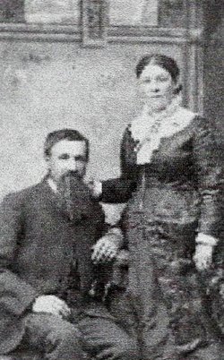
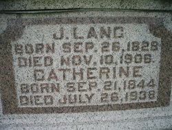
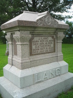
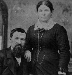
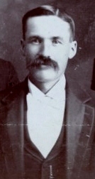
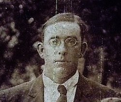
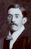
John William Lang
| Birth | : | 26 Sep 1828 Alsace, France |
| Death | : | 10 Nov 1906 Emerson, Mills County, Iowa, USA |
| Burial | : | Woodstock Baptist Cemetery, Woodstock, Oxford County Municipality, Canada |
| Coordinate | : | 43.1416460, -80.7655790 |
| Plot | : | Original Section #332 |
| Description | : | DEATH OF JOHN LANG ANOTHER PIONEER OF MILLS COUNTY PASSED TO HIS REWARD John Lang, one of the oldest and most prominent resident of the east side, died at his home in Emerson, Saturday, November 10, after an illness of some weeks. In fact he had been far from well for more than a year. The immediate cause of his death was dropsy. The funeral was held from the Emerson Methodist Church Monday afternoon at 2 o'clock and was largely attended by his old friends and neighbors for he was well and widely known. Rev. G. W. Maine of the... Read More |
frequently asked questions (FAQ):
-
Where is John William Lang's memorial?
John William Lang's memorial is located at: Woodstock Baptist Cemetery, Woodstock, Oxford County Municipality, Canada.
-
When did John William Lang death?
John William Lang death on 10 Nov 1906 in Emerson, Mills County, Iowa, USA
-
Where are the coordinates of the John William Lang's memorial?
Latitude: 43.1416460
Longitude: -80.7655790
Family Members:
Spouse
Children
Flowers:
Nearby Cemetories:
1. Woodstock Baptist Cemetery
Woodstock, Oxford County Municipality, Canada
Coordinate: 43.1416460, -80.7655790
2. Woodstock Presbyterian Cemetery
Woodstock, Oxford County Municipality, Canada
Coordinate: 43.1409440, -80.7651600
3. Anglican Cemetery
Woodstock, Oxford County Municipality, Canada
Coordinate: 43.1426000, -80.7653300
4. Old St. Paul's Anglican Cemetery
Woodstock, Oxford County Municipality, Canada
Coordinate: 43.1325600, -80.7462300
5. House of Refuge Cemetery
Woodstock, Oxford County Municipality, Canada
Coordinate: 43.1476245, -80.7873872
6. Hillview Cemetery
Woodstock, Oxford County Municipality, Canada
Coordinate: 43.1206703, -80.7675400
7. Saint Marys Roman Catholic Cemetery
Woodstock, Oxford County Municipality, Canada
Coordinate: 43.1089400, -80.7998900
8. Oxford Memorial Park Cemetery
Woodstock, Oxford County Municipality, Canada
Coordinate: 43.1148200, -80.8150400
9. Huntingford Christ Church Anglican Cemetery
Huntingford, Oxford County Municipality, Canada
Coordinate: 43.2000280, -80.7960970
10. Vandecar Cemetery
Vandecar, Oxford County Municipality, Canada
Coordinate: 43.2010640, -80.8148020
11. Beachville Cemetery
Beachville, Oxford County Municipality, Canada
Coordinate: 43.0889511, -80.8313599
12. Old Log Church Cemetery
Embro, Oxford County Municipality, Canada
Coordinate: 43.1529121, -80.8626785
13. Sweaburg Union Cemetery
Sweaburg, Oxford County Municipality, Canada
Coordinate: 43.0690800, -80.7623200
14. Oxford Centre Christ Church Anglican Cemetery
Oxford Centre, Oxford County Municipality, Canada
Coordinate: 43.0996310, -80.6814490
15. East Oxford Pioneer Cemetery
Oxford Centre, Oxford County Municipality, Canada
Coordinate: 43.0999370, -80.6804350
16. Pleasant View Cemetery
Curries, Oxford County Municipality, Canada
Coordinate: 43.0716390, -80.7196470
17. Saint Johns Anglican Cemetery
Eastwood, Oxford County Municipality, Canada
Coordinate: 43.1443080, -80.6575850
18. Innerkip Cemetery
Innerkip, Oxford County Municipality, Canada
Coordinate: 43.2050000, -80.6929000
19. Methodist Cemetery
Embro, Oxford County Municipality, Canada
Coordinate: 43.1495018, -80.8983841
20. North Embro Cemetery
Embro, Oxford County Municipality, Canada
Coordinate: 43.1667920, -80.9040350
21. West Oxford United Church Cemetery
Centreville, Oxford County Municipality, Canada
Coordinate: 43.0521710, -80.8451320
22. Ingersoll Rural Cemetery
Ingersoll, Oxford County Municipality, Canada
Coordinate: 43.0545040, -80.8732690
23. Zion Oriel Cemetery
Oriel, Oxford County Municipality, Canada
Coordinate: 43.0650630, -80.6425670
24. Red Star Cemetery
Embro, Oxford County Municipality, Canada
Coordinate: 43.1124175, -80.9326897

