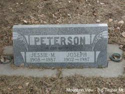
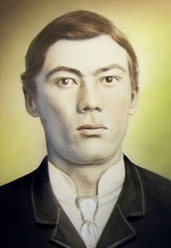
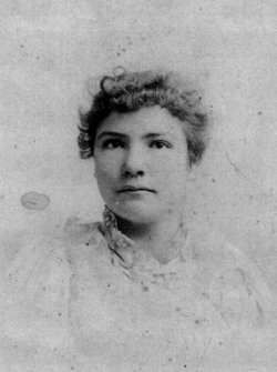
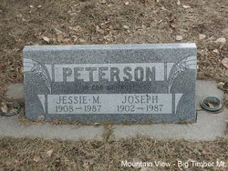
Joseph Peterson
| Birth | : | 15 Mar 1902 Big Timber, Sweet Grass County, Montana, USA |
| Death | : | 22 Nov 1987 Big Timber, Sweet Grass County, Montana, USA |
| Burial | : | Driffield Cemetery, Driffield, East Riding of Yorkshire Unitary Authority, England |
| Coordinate | : | 54.0112620, -0.4254680 |
| Plot | : | Section 6 Block 34B Lot 2 Grave 3 |
| Description | : | Big Timber Pioneer November 25, 1987 Joseph Peterson, age 85, passed away Saturday, November 21, 1987in St. Vincent's Hospital in Billings, Montana following a short illness. He was born March 15, 1902 on upper Deer Creek, a son of Andrew and Josephine Peterson. He was the eldest of eight children and spent his early years in the upper Bridgers. He broke horses and hauled lumber with a wagon and team over the Bridgers to Absarokee and Reed Point. In 1917 he began working for the Northern Pacific Railroad and worked there for 50 years, retiring in 1967. On June 30, 1925... Read More |
frequently asked questions (FAQ):
-
Where is Joseph Peterson's memorial?
Joseph Peterson's memorial is located at: Driffield Cemetery, Driffield, East Riding of Yorkshire Unitary Authority, England.
-
When did Joseph Peterson death?
Joseph Peterson death on 22 Nov 1987 in Big Timber, Sweet Grass County, Montana, USA
-
Where are the coordinates of the Joseph Peterson's memorial?
Latitude: 54.0112620
Longitude: -0.4254680
Family Members:
Parent
Spouse
Siblings
Children
Flowers:
Nearby Cemetories:
1. Driffield Cemetery
Driffield, East Riding of Yorkshire Unitary Authority, England
Coordinate: 54.0112620, -0.4254680
2. All Saints Churchyard
Driffield, East Riding of Yorkshire Unitary Authority, England
Coordinate: 54.0077480, -0.4419340
3. St Peter Churchyard
Hutton Cranswick, East Riding of Yorkshire Unitary Authority, England
Coordinate: 53.9660000, -0.4405180
4. St. Michael and All Angels Churchyard
Garton-on-the-Wolds, East Riding of Yorkshire Unitary Authority, England
Coordinate: 54.0204960, -0.5030440
5. St. Martin's Churchyard
Lowthorpe, East Riding of Yorkshire Unitary Authority, England
Coordinate: 54.0318880, -0.3537900
6. St Mary Churchyard
Kirkburn, East Riding of Yorkshire Unitary Authority, England
Coordinate: 53.9820470, -0.5073770
7. St. John of Beverley Churchyard
Harpham, East Riding of Yorkshire Unitary Authority, England
Coordinate: 54.0387080, -0.3336340
8. All Saints Churchyard
Kilham, East Riding of Yorkshire Unitary Authority, England
Coordinate: 54.0645570, -0.3750570
9. St Andrew Churchyard
Foston, East Riding of Yorkshire Unitary Authority, England
Coordinate: 53.9864230, -0.3227200
10. Kilham Cemetery
Kilham, East Riding of Yorkshire Unitary Authority, England
Coordinate: 54.0687100, -0.3690310
11. Cottam Church
Cottam, East Riding of Yorkshire Unitary Authority, England
Coordinate: 54.0707320, -0.4833770
12. Burton Agnes Cemetery
Burton Agnes, East Riding of Yorkshire Unitary Authority, England
Coordinate: 54.0535070, -0.3202460
13. St Martin Churchyard
Burton Agnes, East Riding of Yorkshire Unitary Authority, England
Coordinate: 54.0534690, -0.3180740
14. St. Andrew's Churchyard
Bainton, East Riding of Yorkshire Unitary Authority, England
Coordinate: 53.9583420, -0.5309270
15. All Saints Churchyard
Kilnwick, East Riding of Yorkshire Unitary Authority, England
Coordinate: 53.9320900, -0.4830980
16. St. Mary Churchyard
Cowlam, East Riding of Yorkshire Unitary Authority, England
Coordinate: 54.0787700, -0.5292200
17. St Leonard Churchyard
Beeford, East Riding of Yorkshire Unitary Authority, England
Coordinate: 53.9731490, -0.2801510
18. St Margaret Churchyard
Beswick, East Riding of Yorkshire Unitary Authority, England
Coordinate: 53.9194140, -0.4599290
19. Octon Crematorium
Langtoft, East Riding of Yorkshire Unitary Authority, England
Coordinate: 54.1089720, -0.4506760
20. St James of Compostella Churchyard
Lissett, East Riding of Yorkshire Unitary Authority, England
Coordinate: 54.0059600, -0.2552300
21. St Mary Churchyard
Lockington, East Riding of Yorkshire Unitary Authority, England
Coordinate: 53.9081670, -0.4837860
22. All Saints Churchyard
Barmston, East Riding of Yorkshire Unitary Authority, England
Coordinate: 54.0128770, -0.2363350
23. St John the Baptist Churchyard
Carnaby, East Riding of Yorkshire Unitary Authority, England
Coordinate: 54.0735150, -0.2524190
24. St. Nicholas Churchyard
Dunnington, East Riding of Yorkshire Unitary Authority, England
Coordinate: 53.9504440, -0.2442030

