

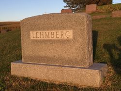
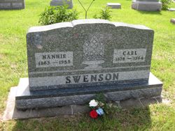
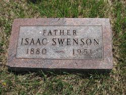
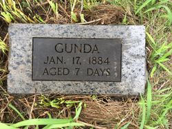
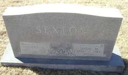
Josephine Mathilde “Josie” Swenson Sexton
| Birth | : | 14 Jan 1885 Monona County, Iowa, USA |
| Death | : | 25 Nov 1967 Sioux City, Woodbury County, Iowa, USA |
| Burial | : | St. Mary the Virgin Churchyard, Bromfield, Shropshire Unitary Authority, England |
| Coordinate | : | 52.3873900, -2.7636700 |
| Plot | : | Sect D B 101 |
frequently asked questions (FAQ):
-
Where is Josephine Mathilde “Josie” Swenson Sexton's memorial?
Josephine Mathilde “Josie” Swenson Sexton's memorial is located at: St. Mary the Virgin Churchyard, Bromfield, Shropshire Unitary Authority, England.
-
When did Josephine Mathilde “Josie” Swenson Sexton death?
Josephine Mathilde “Josie” Swenson Sexton death on 25 Nov 1967 in Sioux City, Woodbury County, Iowa, USA
-
Where are the coordinates of the Josephine Mathilde “Josie” Swenson Sexton's memorial?
Latitude: 52.3873900
Longitude: -2.7636700
Family Members:
Parent
Siblings


Children
Flowers:


Nearby Cemetories:
1. St. Mary the Virgin Churchyard
Bromfield, Shropshire Unitary Authority, England
Coordinate: 52.3873900, -2.7636700
2. All Saints Churchyard
Culmington, Shropshire Unitary Authority, England
Coordinate: 52.4334800, -2.7463500
3. St. George's Churchyard
Burrington, Herefordshire Unitary Authority, England
Coordinate: 52.3440700, -2.8200100
4. St. Mary the Virgin Churchyard
Elton, Shropshire Unitary Authority, England
Coordinate: 52.3345972, -2.7969324
5. St. Andrew, Ashford Bowdler.
Ashford Bowdler, Shropshire Unitary Authority, England
Coordinate: 52.3308770, -2.7065930
6. St. Thomas' Churchyard
Craven Arms, Shropshire Unitary Authority, England
Coordinate: 52.4450630, -2.8306870
7. St. Mary's Churchyard
Caynham, Shropshire Unitary Authority, England
Coordinate: 52.3558260, -2.6564540
8. St Cuthbert Churchyard
Clungunford, Shropshire Unitary Authority, England
Coordinate: 52.4032350, -2.8909360
9. St. Peter's Churchyard
Diddlebury, Shropshire Unitary Authority, England
Coordinate: 52.4640570, -2.7249740
10. St. Mary's Churchyard
Bitterley, Shropshire Unitary Authority, England
Coordinate: 52.3922280, -2.6319790
11. Knowbury, St Paul
Caynham, Shropshire Unitary Authority, England
Coordinate: 52.3734750, -2.6300130
12. Westhope Chapel Burial Ground
Diddlebury, Shropshire Unitary Authority, England
Coordinate: 52.4714690, -2.7818850
13. St. Mary Magdalene Churchyard
Little Hereford, Herefordshire Unitary Authority, England
Coordinate: 52.3112129, -2.6572039
14. Clee St. Margaret Churchyard
Clee St Margaret, Shropshire Unitary Authority, England
Coordinate: 52.4554270, -2.6423086
15. St Marys Churchyard
Hopesay, Shropshire Unitary Authority, England
Coordinate: 52.4440470, -2.8999020
16. St Mary Churchyard
Bedstone, Shropshire Unitary Authority, England
Coordinate: 52.3759660, -2.9284570
17. St. Swithin Churchyard
Clunbury, Shropshire Unitary Authority, England
Coordinate: 52.4201670, -2.9261080
18. St. Edward Churchyard
Hopton Castle, Shropshire Unitary Authority, England
Coordinate: 52.3985700, -2.9369700
19. St Mary's Churchyard
Hopton Castle, Shropshire Unitary Authority, England
Coordinate: 52.3985640, -2.9369870
20. St. Barnabas Churchyard
Brampton Bryan, Herefordshire Unitary Authority, England
Coordinate: 52.3470760, -2.9255360
21. St Michael and All Angels Churchyard
Croft, Herefordshire Unitary Authority, England
Coordinate: 52.2841090, -2.8079510
22. St Margaret's Churchyard
Acton Scott, Shropshire Unitary Authority, England
Coordinate: 52.5001670, -2.8060920
23. St Michael Churchyard
Edgton, Shropshire Unitary Authority, England
Coordinate: 52.4660500, -2.9044570
24. Church of St John the Baptist and St Alkmund
Aymestrey, Herefordshire Unitary Authority, England
Coordinate: 52.2813000, -2.8428000