
| Birth | : | 25 Sep 1887 Russia |
| Death | : | 1 Jul 1982 Chester, Thayer County, Nebraska, USA |
| Burial | : | Ōpōtiki Lawn Cemetery, Ōpōtiki, Ōpōtiki District, New Zealand |
| Coordinate | : | -38.0180870, 177.2882760 |
| Plot | : | Block 16, Lot 4, Grave 2 |
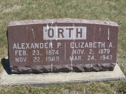
| Inscription | : | Married Sept. 3, 1904 Mother |
| Description | : | Emil Moore (sic), 21, born Russia, son of Jacob & Barbara (Galte) Moore (sic), and Katie Stroh, 18, born Russia, daughter of George Stroh, were married September 3, 1904 at Lincoln, Neb. (Source: Lancaster County, NE Marriage Records) ======================== The Belleville Telescope (Belleville, KS), Thursday, July 8, 1982; pg. 12 Katherine Margaret Mohr, daughter of George and Katherine M. Brungard Stroh, was born in Frankford, Russia on September 25, 1887 and died, at her home in Chester, Nebr. on July 1, 1982, at the age of 94 years nine months and six days. She received... Read More |
frequently asked questions (FAQ):
-
Where is Katherine Margaret Stroh Mohr's memorial?
Katherine Margaret Stroh Mohr's memorial is located at: Ōpōtiki Lawn Cemetery, Ōpōtiki, Ōpōtiki District, New Zealand.
-
When did Katherine Margaret Stroh Mohr death?
Katherine Margaret Stroh Mohr death on 1 Jul 1982 in Chester, Thayer County, Nebraska, USA
-
Where are the coordinates of the Katherine Margaret Stroh Mohr's memorial?
Latitude: -38.0180870
Longitude: 177.2882760
Family Members:
Parent

Spouse
Siblings
Children
Flowers:


Nearby Cemetories:
1. Ōpōtiki Lawn Cemetery
Ōpōtiki, Ōpōtiki District, New Zealand
Coordinate: -38.0180870, 177.2882760
2. Old Military Cemetery
Ōpōtiki, Ōpōtiki District, New Zealand
Coordinate: -38.0025964, 177.2851815
3. Woodlands Cemetery
Ōpōtiki, Ōpōtiki District, New Zealand
Coordinate: -38.0305569, 177.2635720
4. Opape Urupā
Ōpōtiki, Ōpōtiki District, New Zealand
Coordinate: -37.9746540, 177.4244230
5. Hillcrest Cemetery
Whakatāne, Whakatāne District, New Zealand
Coordinate: -37.9673630, 177.0136840
6. Ōpihi Whanaunga Kore Urupā
Whakatāne, Whakatāne District, New Zealand
Coordinate: -37.9436107, 177.0046426
7. Domain Road Cemetery
Whakatāne, Whakatāne District, New Zealand
Coordinate: -37.9583600, 176.9840800
8. Ruatoki North Māori Cemetery
Ruatoki North, Whakatāne District, New Zealand
Coordinate: -38.1501100, 177.0073300
9. Pupuaruhe Urupā
Whakatāne, Whakatāne District, New Zealand
Coordinate: -37.9555600, 176.9624100
10. Maraenui Māori Cemetery
Houpoto, Ōpōtiki District, New Zealand
Coordinate: -37.8694900, 177.5849900
11. Ngahina Māori Cemetery
Ruatoki North, Whakatāne District, New Zealand
Coordinate: -38.1736200, 176.9892600
12. Motu Cemetery
Motu, Gisborne District, New Zealand
Coordinate: -38.2477500, 177.5385700
13. Matariu Urupā
Te Teko, Whakatāne District, New Zealand
Coordinate: -38.0390400, 176.8016400
14. Rangiaohia Māori Cemetery
Matatā, Whakatāne District, New Zealand
Coordinate: -37.8905100, 176.7639600
15. Te Kaha Māori Cemetery
Te Kaha, Ōpōtiki District, New Zealand
Coordinate: -37.7262100, 177.6930600
16. Awakaponga Cemetery
Matatā, Whakatāne District, New Zealand
Coordinate: -37.9308200, 176.7465100
17. Howie Family Cemetery
Te Kaha, Ōpōtiki District, New Zealand
Coordinate: -37.7171680, 177.7103060
18. Rakauroa Cemetery
Matawai, Gisborne District, New Zealand
Coordinate: -38.4358900, 177.5711400
19. Kawerau Cemetery
Kawerau, Kawerau District, New Zealand
Coordinate: -38.0990990, 176.6762150
20. White Island Burial Site
Whakatāne District, New Zealand
Coordinate: -37.5241910, 177.1863520
21. Tapuae o te Rangi Urupā
Whatatutu, Gisborne District, New Zealand
Coordinate: -38.3791200, 177.8134180
22. Raukokore Anglican Church Cemetery
Raukokore, Ōpōtiki District, New Zealand
Coordinate: -37.6389240, 177.8785240
23. Murupara-Galatea Cemetery
Galatea, Whakatāne District, New Zealand
Coordinate: -38.4411700, 176.7164800
24. Te Papa Marae Māori Cemetery
Murupara, Whakatāne District, New Zealand
Coordinate: -38.4499600, 176.6989500