
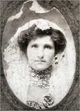
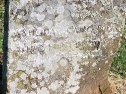
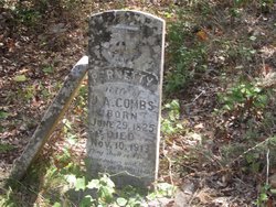
Kissiah Bloyed Yoes
| Birth | : | 24 Dec 1813 Green County, Kentucky, USA |
| Death | : | 1845 West Fork, Washington County, Arkansas, USA |
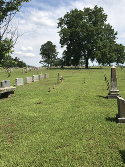
| Burial | : | Mudlick Cemetery, Plank, Clay County, USA |
| Coordinate | : | 37.0486120, -83.6191600 |
frequently asked questions (FAQ):
-
Where is Kissiah Bloyed Yoes's memorial?
Kissiah Bloyed Yoes's memorial is located at: Mudlick Cemetery, Plank, Clay County, USA.
-
When did Kissiah Bloyed Yoes death?
Kissiah Bloyed Yoes death on 1845 in West Fork, Washington County, Arkansas, USA
-
Where are the coordinates of the Kissiah Bloyed Yoes's memorial?
Latitude: 37.0486120
Longitude: -83.6191600
Family Members:
Parent

Spouse
Siblings
Children
Flowers:


Nearby Cemetories:
1. Mudlick Cemetery
Plank, Clay County, USA
Coordinate: 37.0486120, -83.6191600
2. Smith-Couch Cemetery
Plank, Clay County, USA
Coordinate: 37.0397230, -83.6299430
3. Delph Cemetery
Spring Creek, Clay County, USA
Coordinate: 37.0299500, -83.6018600
4. Walker Cemetery #1
Plank, Clay County, USA
Coordinate: 37.0760800, -83.6466400
5. Smallwood Cemetery
Brightshade, Clay County, USA
Coordinate: 37.0363130, -83.6608080
6. Eversole Cemetery
Brightshade, Clay County, USA
Coordinate: 37.0218620, -83.6504270
7. Lewis Family Cemetery
Ashers Fork, Clay County, USA
Coordinate: 37.0114160, -83.6161130
8. Smith-Henson Cemetery
Plank, Clay County, USA
Coordinate: 37.0766100, -83.6503200
9. Wagers Cemetery
Brightshade, Clay County, USA
Coordinate: 37.0220060, -83.6523220
10. Andy Hubbard Cemetery
Brightshade, Clay County, USA
Coordinate: 37.0275400, -83.6584200
11. Speed Smith Cemetery
Ogle, Clay County, USA
Coordinate: 37.0534900, -83.6667700
12. Farmer Smith Cemetery
Goose Rock, Clay County, USA
Coordinate: 37.0519130, -83.6679080
13. Joe Smith Cemetery
Plank, Clay County, USA
Coordinate: 37.0794100, -83.6522600
14. Stewart Cemetery
Clay County, USA
Coordinate: 37.0632580, -83.5715500
15. Smith-Gray Cemetery
Goose Rock, Clay County, USA
Coordinate: 37.0568600, -83.6691890
16. Mills Cemetery
Ashers Fork, Clay County, USA
Coordinate: 37.0095600, -83.6357800
17. Carpenter Cemetery
Plank, Clay County, USA
Coordinate: 37.0825390, -83.6507220
18. Riley-Wagers Cemetery
Plank, Clay County, USA
Coordinate: 37.0842300, -83.6506200
19. Ted Woods Cemetery
Ogle, Clay County, USA
Coordinate: 37.0543800, -83.6774900
20. W O Wagers Cemetery
Plank, Clay County, USA
Coordinate: 37.0735000, -83.6699900
21. Smith Family Cemetery
Ashers Fork, Clay County, USA
Coordinate: 37.0067500, -83.5902220
22. Lipps Cemetery
Goose Rock, Clay County, USA
Coordinate: 37.0823300, -83.6618300
23. John Woods Sr. Cemetery
Brightshade, Clay County, USA
Coordinate: 37.0569200, -83.6790100
24. Smith Cemetery
Brightshade, Clay County, USA
Coordinate: 36.9966200, -83.6330400