
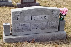
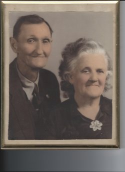
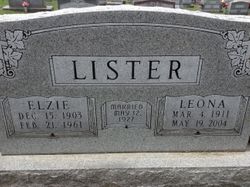
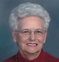
Leona Tracy Bolden Lister
| Birth | : | 4 Mar 1911 Russellville, Cole County, Missouri, USA |
| Death | : | 19 May 2004 Jefferson City, Cole County, Missouri, USA |
| Burial | : | St. Mary the Virgin, Farthingstone, Daventry District, England |
| Coordinate | : | 52.1899123, -1.1043480 |
| Inscription | : | Wife of Elzie L. Lister. |
| Description | : | Add siblings: Lloyd Bolden 77436481, Lottie Hodges 99262881, Catherine Gemeinhardt 20511078, Leona Lister 55569882, William E Bolten 107202404, Lydia Christina Bolden Gemeinhardt Bishop (1895-1984 and died in Santa Barbara CA but I can't find burial info), and Minnie Pace 113855274 and Mary Abbot 95959827 |
frequently asked questions (FAQ):
-
Where is Leona Tracy Bolden Lister's memorial?
Leona Tracy Bolden Lister's memorial is located at: St. Mary the Virgin, Farthingstone, Daventry District, England.
-
When did Leona Tracy Bolden Lister death?
Leona Tracy Bolden Lister death on 19 May 2004 in Jefferson City, Cole County, Missouri, USA
-
Where are the coordinates of the Leona Tracy Bolden Lister's memorial?
Latitude: 52.1899123
Longitude: -1.1043480
Family Members:
Parent
Spouse
Siblings
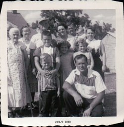

Children
Flowers:


Nearby Cemetories:
1. St. Mary the Virgin
Farthingstone, Daventry District, England
Coordinate: 52.1899123, -1.1043480
2. Everdon Parish CHurchyard
Everdon, Daventry District, England
Coordinate: 52.2123168, -1.1310740
3. St Michael's Church
Stowe Nine Churches, Daventry District, England
Coordinate: 52.2120000, -1.0721000
4. St. Peter and St. Paul Churchyard
Preston Capes, Daventry District, England
Coordinate: 52.1893410, -1.1614570
5. All Saints Churchyard
Adstone, South Northamptonshire Borough, England
Coordinate: 52.1574740, -1.1306620
6. United Reformed Churchyard
Weedon Bec, Daventry District, England
Coordinate: 52.2278000, -1.0776000
7. St. Peter & St. Paul's Churchyard
Weedon Bec, Daventry District, England
Coordinate: 52.2281180, -1.0741343
8. St. Mary's Churchyard
Blakesley, South Northamptonshire Borough, England
Coordinate: 52.1490000, -1.0850000
9. St Mary Churchyard
Blakesley, South Northamptonshire Borough, England
Coordinate: 52.1489310, -1.0850410
10. Weedon Bec Cemetery
Weedon Bec, Daventry District, England
Coordinate: 52.2275500, -1.0715300
11. St. Luke's Churchyard
Cold Higham, South Northamptonshire Borough, England
Coordinate: 52.1759000, -1.0323000
12. St Mary the Virgin Churchyard
Dodford, Daventry District, England
Coordinate: 52.2396800, -1.1044500
13. All Saints Churchyard
Flore, Daventry District, England
Coordinate: 52.2331000, -1.0615000
14. Canons Ashby
Daventry District, England
Coordinate: 52.1504600, -1.1566400
15. St. Mary’s Churchyard
Canons Ashby, Daventry District, England
Coordinate: 52.1502747, -1.1568058
16. Nether Heyford Cemetery
Nether Heyford, South Northamptonshire Borough, England
Coordinate: 52.2220715, -1.0385032
17. Church of the Holy Cross
Pattishall, South Northamptonshire Borough, England
Coordinate: 52.1828670, -1.0197770
18. St Michael & All Angels Churchyard
Bugbrooke, South Northamptonshire Borough, England
Coordinate: 52.2096900, -1.0149000
19. St. Mary the Virgin
Badby, Daventry District, England
Coordinate: 52.2240200, -1.1820100
20. Holy Trinity Churchyard
Charwelton, Daventry District, England
Coordinate: 52.1952913, -1.2044410
21. Church of St. Mary The Virgin
Moreton Pinkney, South Northamptonshire Borough, England
Coordinate: 52.1369170, -1.1628810
22. St Bartholomew Churchyard
Greens Norton, South Northamptonshire Borough, England
Coordinate: 52.1434200, -1.0234100
23. St Mary and St Peter Churchyard
Weedon Lois, South Northamptonshire Borough, England
Coordinate: 52.1178320, -1.1228690
24. St. Botolph's Churchyard
Slapton, South Northamptonshire Borough, England
Coordinate: 52.1166000, -1.0666000