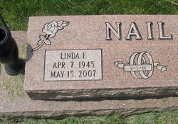
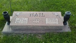
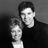
Linda Faye Woods Nail
| Birth | : | 7 Apr 1945 Orrick, Ray County, Missouri, USA |
| Death | : | 15 May 2007 Orrick, Ray County, Missouri, USA |
| Burial | : | St. Mary's Churchyard, Wharram le Street, Ryedale District, England |
| Coordinate | : | 54.0820040, -0.6810779 |
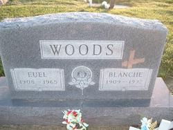
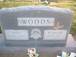
| Description | : | Linda Faye Nail, 62, Orrick, MO, died May 15, 2007, at her home. Mrs. Nail was born April 7, 1945, in Orrick, the daughter of Euel and Blanche (Tucker) Woods. She worked for the Orrick School District and was also an activities coordinator at Shirkey Nursing and Rehabilitation Center in Richmond for 23 years. She was preceded in death by her parents and her sister, Marilyn Greer. Survivors include her husband, Donald Nail, of the home; sons, Steve Nail, Mike Nail, Dave Nail, Darrin McGlothlin, and Tony McGlothlin, all of Orrick, MO; daughter, Joan Lichty of Gladstone, MO; sisters, Myra... Read More |
frequently asked questions (FAQ):
-
Where is Linda Faye Woods Nail's memorial?
Linda Faye Woods Nail's memorial is located at: St. Mary's Churchyard, Wharram le Street, Ryedale District, England.
-
When did Linda Faye Woods Nail death?
Linda Faye Woods Nail death on 15 May 2007 in Orrick, Ray County, Missouri, USA
-
Where are the coordinates of the Linda Faye Woods Nail's memorial?
Latitude: 54.0820040
Longitude: -0.6810779
Family Members:
Parent
Spouse
Siblings
Nearby Cemetories:
1. St. Mary's Churchyard
Wharram le Street, Ryedale District, England
Coordinate: 54.0820040, -0.6810779
2. St. Martin Churchyard
Wharram Percy, Ryedale District, England
Coordinate: 54.0665700, -0.6901300
3. St. Nicholas Churchyard
North Grimston, Ryedale District, England
Coordinate: 54.0989220, -0.7148680
4. St. Andrew's Churchyard
Kirby Grindalythe, Ryedale District, England
Coordinate: 54.0955440, -0.6200050
5. St Mary Churchyard
Birdsall, Ryedale District, England
Coordinate: 54.0780000, -0.7508000
6. All Saints Churchyard
Settrington, Ryedale District, England
Coordinate: 54.1212780, -0.7178830
7. St. Mary's Churchyard
Thixendale, Ryedale District, England
Coordinate: 54.0387360, -0.7154888
8. Settrington Cemetery
Settrington, Ryedale District, England
Coordinate: 54.1254200, -0.7221700
9. St. Mary's Churchyard
Fimber, East Riding of Yorkshire Unitary Authority, England
Coordinate: 54.0337830, -0.6361950
10. St. Mary's Churchyard
Fridaythorpe, East Riding of Yorkshire Unitary Authority, England
Coordinate: 54.0220090, -0.6667190
11. St Andrew Churchyard
Langton, Ryedale District, England
Coordinate: 54.0934510, -0.7834680
12. St. Mary's Church Luttons Ambo
West Lutton, Ryedale District, England
Coordinate: 54.1105340, -0.5779463
13. Burythorpe Churchyard
Burythorpe, Ryedale District, England
Coordinate: 54.0752951, -0.7955984
14. All Saints' Churchyard
Thorpe Bassett, Ryedale District, England
Coordinate: 54.1496503, -0.6875921
15. St Peter Churchyard
Wintringham, Ryedale District, England
Coordinate: 54.1467660, -0.6431680
16. St. Andrew’s Churchyard Extension
Rillington, Ryedale District, England
Coordinate: 54.1558500, -0.6926500
17. St. Andrew's Churchyard
Rillington, Ryedale District, England
Coordinate: 54.1579700, -0.6959800
18. Norton Cemetery
Norton, Ryedale District, England
Coordinate: 54.1306400, -0.7834200
19. St Peter Churchyard
Norton, Ryedale District, England
Coordinate: 54.1289040, -0.7861910
20. St John the Baptist
Acklam, Ryedale District, England
Coordinate: 54.0451010, -0.8006330
21. All Saints Churchyard
Kirby Underdale, East Riding of Yorkshire Unitary Authority, England
Coordinate: 54.0166200, -0.7677100
22. St Mary the Virgin Priory Churchyard
Malton, Ryedale District, England
Coordinate: 54.1427520, -0.7786450
23. St. Leonard with St. Mary Churchyard
Malton, Ryedale District, England
Coordinate: 54.1348110, -0.7946110
24. Old Malton Cemetery
Malton, Ryedale District, England
Coordinate: 54.1443200, -0.7808900

