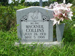
Mackneil “Big Mac” Collins
| Birth | : | 26 Jul 1931 |
| Death | : | 5 May 1998 Morristown, Hamblen County, Tennessee, USA |
| Burial | : | Dalton Cemetery, Bean Station, Grainger County, USA |
| Coordinate | : | 36.3428001, -83.3296967 |
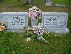
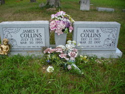
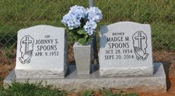
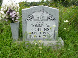
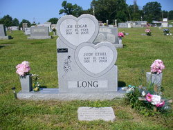
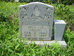
| Description | : | Grainger County News, 14 May 1998: "Mack Neil "Big Mack" Collins, 65, of Morristown died Tuesday, May 5, at his residence. Of the Baptist faith, he was preceded in death by his parents, James and Annie Collins, and brother, Arlie "Pete" Collins. Surviving are his son, Bobby Neil Collins of Jefferson City; daughter, Sue Collins Greene of Greeneville; ex-wife, Faye Collins Duncan; one grandson; brothers and sister-in-law, Randy and Glenda Collins and Tommy Collins of Bean Station; sisters and brother-in-law, Madge Spoons and Judy and Joe Long of Bean Station and Patsy Collins of Mooresburg, and several... Read More |
frequently asked questions (FAQ):
-
Where is Mackneil “Big Mac” Collins's memorial?
Mackneil “Big Mac” Collins's memorial is located at: Dalton Cemetery, Bean Station, Grainger County, USA.
-
When did Mackneil “Big Mac” Collins death?
Mackneil “Big Mac” Collins death on 5 May 1998 in Morristown, Hamblen County, Tennessee, USA
-
Where are the coordinates of the Mackneil “Big Mac” Collins's memorial?
Latitude: 36.3428001
Longitude: -83.3296967
Family Members:
Parent
Spouse
Siblings
Flowers:
Nearby Cemetories:
1. Samsel Lakeview Cemetery
Bean Station, Grainger County, USA
Coordinate: 36.3475800, -83.3189468
2. Samsel Cemetery
Bean Station, Grainger County, USA
Coordinate: 36.3424020, -83.3167060
3. Garrett Cemetery
Grainger County, USA
Coordinate: 36.3414001, -83.3082962
4. Buck Hollow Cemetery
Grainger County, USA
Coordinate: 36.3344120, -83.3589440
5. Moores Chapel Cemetery
Bean Station, Grainger County, USA
Coordinate: 36.3488998, -83.2897034
6. Bean Station Cemetery
Bean Station, Grainger County, USA
Coordinate: 36.3283000, -83.3697000
7. Cobb Cemetery
Grainger County, USA
Coordinate: 36.3189011, -83.3644028
8. Harris Cemetery
Grainger County, USA
Coordinate: 36.3055992, -83.3308029
9. Harrell Cemetery
Bean Station, Grainger County, USA
Coordinate: 36.3074989, -83.3463974
10. DeBord Cemetery
Bean Station, Grainger County, USA
Coordinate: 36.3315000, -83.2834000
11. Central United Methodist Church Cemetery
Bean Station, Grainger County, USA
Coordinate: 36.3422740, -83.2798470
12. Atkins Cemetery
Grainger County, USA
Coordinate: 36.3506000, -83.3792000
13. Meadow Branch Cemetery
Bean Station, Grainger County, USA
Coordinate: 36.3572006, -83.2822037
14. Holt Cemetery #2
Bean Station, Grainger County, USA
Coordinate: 36.3630560, -83.2844440
15. Noeton Baptist Church Cemetery Original
Bean Station, Grainger County, USA
Coordinate: 36.3012600, -83.3342200
16. Helton Cemetery
Bean Station, Grainger County, USA
Coordinate: 36.3451190, -83.3831290
17. Harville Cemetery
Grainger County, USA
Coordinate: 36.3811802, -83.3543986
18. Samsel Cemetery
Bean Station, Grainger County, USA
Coordinate: 36.3114014, -83.2925034
19. Adriel Baptist Church Cemetery
Bean Station, Grainger County, USA
Coordinate: 36.3125000, -83.2897034
20. First Independent Freewill Baptist Church Cemetery
Bean Station, Grainger County, USA
Coordinate: 36.3158860, -83.2855850
21. Meek Cemetery
Bean Station, Grainger County, USA
Coordinate: 36.3207180, -83.2797150
22. County Line Cemetery
Bean Station, Grainger County, USA
Coordinate: 36.3207700, -83.2789850
23. Marys Chapel Cemetery
Grainger County, USA
Coordinate: 36.3011017, -83.3569031
24. Ford Cemetery
Grainger County, USA
Coordinate: 36.2902985, -83.3071976

