
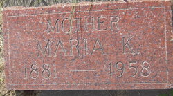
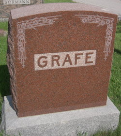
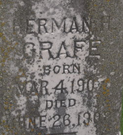
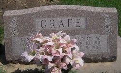
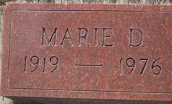
Maria Katherine Minderman Grafe
| Birth | : | 13 Feb 1881 Avoca, Cass County, Nebraska, USA |
| Death | : | 3 Oct 1958 Avoca, Cass County, Nebraska, USA |
| Burial | : | St. Oswald's Churchyard, Thornton Steward, Richmondshire District, England |
| Coordinate | : | 54.2776700, -1.7398000 |
frequently asked questions (FAQ):
-
Where is Maria Katherine Minderman Grafe's memorial?
Maria Katherine Minderman Grafe's memorial is located at: St. Oswald's Churchyard, Thornton Steward, Richmondshire District, England.
-
When did Maria Katherine Minderman Grafe death?
Maria Katherine Minderman Grafe death on 3 Oct 1958 in Avoca, Cass County, Nebraska, USA
-
Where are the coordinates of the Maria Katherine Minderman Grafe's memorial?
Latitude: 54.2776700
Longitude: -1.7398000
Family Members:
Spouse
Children

Flowers:


Nearby Cemetories:
1. St. Oswald's Churchyard
Thornton Steward, Richmondshire District, England
Coordinate: 54.2776700, -1.7398000
2. Jervaulx Abbey
East Witton, Richmondshire District, England
Coordinate: 54.2670280, -1.7379870
3. St Simon and St Jude Roman Catholic Churchyard
Ulshaw Bridge, Richmondshire District, England
Coordinate: 54.2809800, -1.7771600
4. St John the Evangelist Churchyard
East Witton, Richmondshire District, England
Coordinate: 54.2696020, -1.7760850
5. St. Andrew's Churchyard
Finghall, Richmondshire District, England
Coordinate: 54.3068300, -1.7085500
6. St Michael and All Angels Churchyard Spennithorne
Spennithorne, Richmondshire District, England
Coordinate: 54.2960200, -1.7910200
7. St. Mary and St. Alkelda Churchyard
Middleham, Richmondshire District, England
Coordinate: 54.2864000, -1.8074000
8. Low Ellington Friends Burial Ground
Harrogate Borough, England
Coordinate: 54.2488730, -1.6896440
9. Spennithorne & Harmby Cemetery
Harmby, Richmondshire District, England
Coordinate: 54.3002500, -1.7989900
10. St Patrick Churchyard
Patrick Brompton, Richmondshire District, England
Coordinate: 54.3112400, -1.6647300
11. St Oswald Churchyard
Hauxwell, Richmondshire District, England
Coordinate: 54.3333300, -1.7333300
12. St Mary Churchyard
Thornton Watlass, Hambleton District, England
Coordinate: 54.2627000, -1.6445300
13. St. Paul's Churchyard
Healey, Harrogate Borough, England
Coordinate: 54.2211220, -1.7208450
14. Coverham Abbey
Coverham, Richmondshire District, England
Coordinate: 54.2728510, -1.8392460
15. Holy Trinity Churchyard
Coverham, Richmondshire District, England
Coordinate: 54.2727230, -1.8429440
16. Leyburn Cemetery
Leyburn, Richmondshire District, England
Coordinate: 54.3093030, -1.8348630
17. St Gregory Churchyard
Crakehall, Hambleton District, England
Coordinate: 54.3046690, -1.6255660
18. St John the Evangelist Churchyard
Bellerby, Richmondshire District, England
Coordinate: 54.3303200, -1.8239000
19. Wensley Cemetery
Wensley, Richmondshire District, England
Coordinate: 54.3013320, -1.8568169
20. Crakehall and Langthorne Cemetery
Crakehall, Hambleton District, England
Coordinate: 54.3086800, -1.6272800
21. Holy Trinity Churchyard
Wensley, Richmondshire District, England
Coordinate: 54.3014000, -1.8600000
22. St. Mary the Virgin Churchyard
Masham, Harrogate Borough, England
Coordinate: 54.2212500, -1.6538320
23. St Mary Churchyard
Hornby, Richmondshire District, England
Coordinate: 54.3388470, -1.6594880
24. Thorp Perrow Pet Cemetery
Bedale, Hambleton District, England
Coordinate: 54.2631350, -1.6050920