
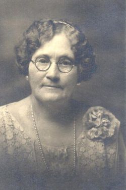
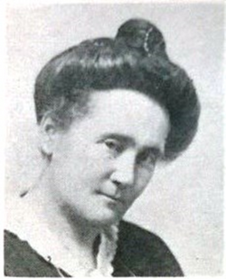
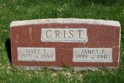
Mary Elizabeth Franklin Crist
| Birth | : | 4 Sep 1865 Birmingham, Jefferson County, Alabama, USA |
| Death | : | 21 May 1944 Sterling, Logan County, Colorado, USA |
| Burial | : | Brightwell Baldwin St Bartholomews Churchyard, Brightwell Baldwin, South Oxfordshire District, England |
| Coordinate | : | 51.6500670, -1.0569610 |
| Description | : | A biography written by her daughter, Jane Belle: Mary Elizabeth Franklin lost her father as a result of the Civil War in the south. At the age of nine when her mother died she went to live with her grandmother in Nashville, Tennessee. Her grandmother had a large family and found life pretty hard since she had lost her home and wealth during the war. Thus the little girl’s schooling was limited and she became self-supporting at an early age. Those few years in Nashville, where she was permitted to attend a good school, were the bright spots in... Read More |
frequently asked questions (FAQ):
-
Where is Mary Elizabeth Franklin Crist's memorial?
Mary Elizabeth Franklin Crist's memorial is located at: Brightwell Baldwin St Bartholomews Churchyard, Brightwell Baldwin, South Oxfordshire District, England.
-
When did Mary Elizabeth Franklin Crist death?
Mary Elizabeth Franklin Crist death on 21 May 1944 in Sterling, Logan County, Colorado, USA
-
Where are the coordinates of the Mary Elizabeth Franklin Crist's memorial?
Latitude: 51.6500670
Longitude: -1.0569610
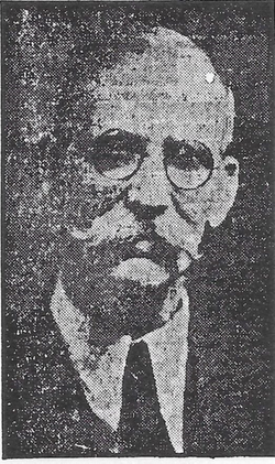
Family Members:
Spouse
Children


Flowers:


Nearby Cemetories:
1. Brightwell Baldwin St Bartholomews Churchyard
Brightwell Baldwin, South Oxfordshire District, England
Coordinate: 51.6500670, -1.0569610
2. Holy Rood Churchyard
Cuxham, South Oxfordshire District, England
Coordinate: 51.6516250, -1.0376070
3. St Peter Churchyard
Easington, South Oxfordshire District, England
Coordinate: 51.6684300, -1.0443070
4. St Mary's Church Cemetery
Chalgrove, South Oxfordshire District, England
Coordinate: 51.6641000, -1.0802000
5. St Nicholas Churchyard
Britwell Salome, South Oxfordshire District, England
Coordinate: 51.6376983, -1.0262075
6. St. Leonard's Churchyard
Watlington, South Oxfordshire District, England
Coordinate: 51.6474030, -1.0117420
7. St Mary Churchyard
Pyrton, South Oxfordshire District, England
Coordinate: 51.6558520, -1.0076830
8. Watlington War Memorial
Watlington, South Oxfordshire District, England
Coordinate: 51.6456450, -1.0065781
9. St. Mary the Virgin Churchyard
Ewelme, South Oxfordshire District, England
Coordinate: 51.6177310, -1.0674850
10. All Saints Churchyard
Shirburn, South Oxfordshire District, England
Coordinate: 51.6577000, -0.9945000
11. St Giles Churchyard
Newington, South Oxfordshire District, England
Coordinate: 51.6638800, -1.1207600
12. Benson War Memorial
Benson, South Oxfordshire District, England
Coordinate: 51.6207890, -1.1108700
13. St. Mary Magdalene
Stoke Talmage, South Oxfordshire District, England
Coordinate: 51.6878240, -1.0183240
14. St. Helen Churchyard Extension
Benson, South Oxfordshire District, England
Coordinate: 51.6201400, -1.1121200
15. St. Helen's Churchyard
Benson, South Oxfordshire District, England
Coordinate: 51.6200200, -1.1127400
16. St. Andrew's Churchyard
Wheatfield, South Oxfordshire District, England
Coordinate: 51.6879720, -1.0050930
17. St. Botolph's New Graveyard
Swyncombe, South Oxfordshire District, England
Coordinate: 51.6064829, -1.0167999
18. Friends Burying Ground
Warborough, South Oxfordshire District, England
Coordinate: 51.6374080, -1.1354510
19. St Laurence Churchyard
Warborough, South Oxfordshire District, England
Coordinate: 51.6383330, -1.1358310
20. St. Botolph Old Cemetery
Swyncombe, South Oxfordshire District, England
Coordinate: 51.6065347, -1.0157358
21. St Leonard and St Catherine
Drayton St Leonard, South Oxfordshire District, England
Coordinate: 51.6640020, -1.1387005
22. St John the Baptist Churchyard
Stadhampton, South Oxfordshire District, England
Coordinate: 51.6848390, -1.1279600
23. St. Mary's Churchyard
Adwell, South Oxfordshire District, England
Coordinate: 51.6906560, -0.9938380
24. Wallingford Cemetery
Wallingford, South Oxfordshire District, England
Coordinate: 51.6058200, -1.1232000