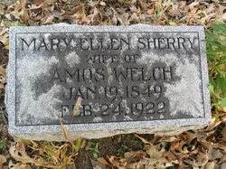
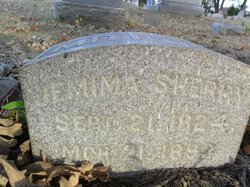
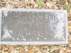
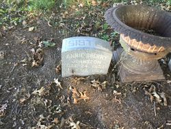
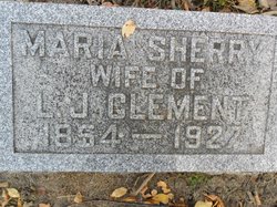
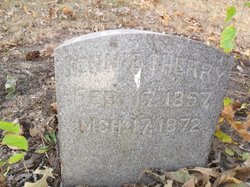
Mary Ellen Sherry Welch
| Birth | : | 19 Jan 1849 Indiana, USA |
| Death | : | 22 Feb 1922 Tippecanoe County, Indiana, USA |
| Burial | : | Christ Church Gentleshaw, Rugeley, Cannock Chase District, England |
| Coordinate | : | 52.7050151, -1.9264458 |
| Description | : | wife of Amos Welch Mrs. Mary Ellen Welch, wife of Amos Welch, died at her home near West Point, Friday afternoon at 3:30 o'clock. Mrs. Welch had been slightly indisposed for some time, but her illness occasioned no uneasiness until she suffered a severe stroke of paralysis on Monday morning. The Sherrys came to Tippecanoe county in 1828 and entered a large tract of land on the Wea Plains a few miles southwest of Lafayette. Mary Ellen Sherry was born in the old Sherry homestead, a landmark now said to be over one hundred years old.... Read More |
frequently asked questions (FAQ):
-
Where is Mary Ellen Sherry Welch's memorial?
Mary Ellen Sherry Welch's memorial is located at: Christ Church Gentleshaw, Rugeley, Cannock Chase District, England.
-
When did Mary Ellen Sherry Welch death?
Mary Ellen Sherry Welch death on 22 Feb 1922 in Tippecanoe County, Indiana, USA
-
Where are the coordinates of the Mary Ellen Sherry Welch's memorial?
Latitude: 52.7050151
Longitude: -1.9264458
Family Members:
Parent
Spouse
Siblings
Flowers:
Nearby Cemetories:
1. Christ Church Gentleshaw
Rugeley, Cannock Chase District, England
Coordinate: 52.7050151, -1.9264458
2. St John's Church Cemetery
Burntwood, Lichfield District, England
Coordinate: 52.6901000, -1.9349300
3. Chase and District Memorial Park
Burntwood, Lichfield District, England
Coordinate: 52.6817140, -1.9339150
4. St Matthew's Hospital Burial Ground
Burntwood, Lichfield District, England
Coordinate: 52.6804500, -1.8937800
5. Christchurch Cemetery
Burntwood, Lichfield District, England
Coordinate: 52.6787639, -1.8969201
6. St. James the Great Churchyard
Longdon, Lichfield District, England
Coordinate: 52.7250710, -1.8800360
7. St. Anne Churchyard Chasetown
Burntwood, Lichfield District, England
Coordinate: 52.6693850, -1.9381720
8. St John Churchyard
Heath Hayes, Cannock Chase District, England
Coordinate: 52.6914160, -1.9846280
9. Stile Cop Cemetery
Rugeley, Cannock Chase District, England
Coordinate: 52.7423710, -1.9448220
10. St. Peter's Churchyard
Hednesford, Cannock Chase District, England
Coordinate: 52.7050630, -1.9918330
11. St. Michael's Churchyard
Brereton, Cannock Chase District, England
Coordinate: 52.7451169, -1.9228718
12. Hawkesyard Priory
Rugeley, Cannock Chase District, England
Coordinate: 52.7439175, -1.9032955
13. Our Lady of Lourdes Churchyard
Hednesford, Cannock Chase District, England
Coordinate: 52.7051311, -1.9969935
14. St John the Baptist Churchyard
Armitage with Handsacre, Lichfield District, England
Coordinate: 52.7458638, -1.8851159
15. Stychbrook Cemetery
Lichfield District, England
Coordinate: 52.6998096, -1.8347392
16. Christ Church Churchyard
Lichfield, Lichfield District, England
Coordinate: 52.6812150, -1.8405800
17. St. Augustine's Churchyard
Rugeley, Cannock Chase District, England
Coordinate: 52.7644253, -1.9345868
18. The Old Chancel
Rugeley, Cannock Chase District, England
Coordinate: 52.7648400, -1.9355010
19. Rugeley Cemetery
Rugeley, Cannock Chase District, England
Coordinate: 52.7650720, -1.9370440
20. Lichfield Cathedral
Lichfield, Lichfield District, England
Coordinate: 52.6855650, -1.8304500
21. Cannock Cemetery
Cannock, Cannock Chase District, England
Coordinate: 52.7008790, -2.0288950
22. Grey Friars Churchyard
Lichfield, Lichfield District, England
Coordinate: 52.6829030, -1.8282720
23. St. Luke's Churchyard
Cannock, Cannock Chase District, England
Coordinate: 52.6889919, -2.0287352
24. St. John's Churchyard
Wall, Lichfield District, England
Coordinate: 52.6575100, -1.8553200

