
| Memorials | : | 0 |
| Location | : | Cannock, Cannock Chase District, England |
| Phone | : | 01543 502131 |
| Website | : | www.stlukescannock.org.uk |
| Coordinate | : | 52.6889919, -2.0287352 |
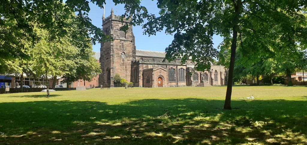
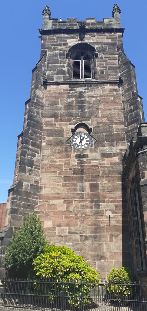
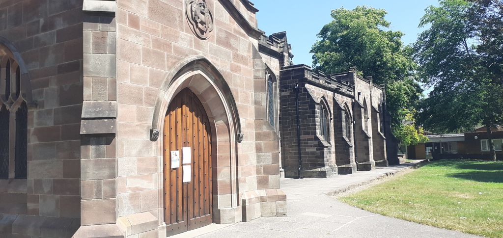
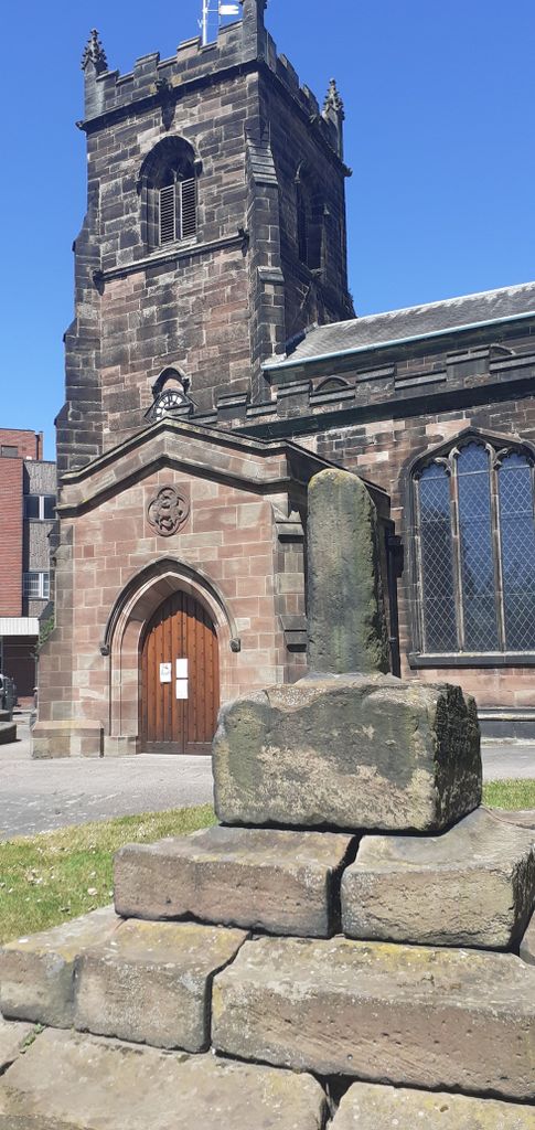
| Description | : | At the beginning of the 14th century, the disputes between Penkridge and Lichfield over who had authority over Cannock were still simmering away under the surface, but from now on things seem to have settled down, with Lichfield in control. In 1330, the churchyard in Cannock was consecrated for burial and the Dean and Chapter of Lichfield planned to start work on the chancel. During the 14th century the Church was almost rebuilt. Most of the internal walling in the western part of the nave near the north door is of this period, and also the 4 western-most pillars of the... Read More |
frequently asked questions (FAQ):
-
Where is St. Luke's Churchyard?
St. Luke's Churchyard is located at Church Street Cannock, Cannock Chase District ,Staffordshire , WS11 1DEEngland.
-
St. Luke's Churchyard cemetery's updated grave count on graveviews.com?
0 memorials
-
Where are the coordinates of the St. Luke's Churchyard?
Latitude: 52.6889919
Longitude: -2.0287352
Nearby Cemetories:
1. St Mary Roman Catholic Churchyard
Cannock, Cannock Chase District, England
Coordinate: 52.6867620, -2.0283360
2. Cannock Cemetery
Cannock, Cannock Chase District, England
Coordinate: 52.7008790, -2.0288950
3. St. Mark's Churchyard
Great Wyrley, South Staffordshire Borough, England
Coordinate: 52.6664250, -2.0231955
4. St. Saviour Churchyard
Hatherton, South Staffordshire Borough, England
Coordinate: 52.6841730, -2.0660840
5. Great Wyrley Cemetery
Great Wyrley, South Staffordshire Borough, England
Coordinate: 52.6642130, -2.0269380
6. Our Lady of Lourdes Churchyard
Hednesford, Cannock Chase District, England
Coordinate: 52.7051311, -1.9969935
7. St John Churchyard
Heath Hayes, Cannock Chase District, England
Coordinate: 52.6914160, -1.9846280
8. St. Peter's Churchyard
Hednesford, Cannock Chase District, England
Coordinate: 52.7050630, -1.9918330
9. Cheslyn Hay Cemetery
Cheslyn Hay, South Staffordshire Borough, England
Coordinate: 52.6581170, -2.0431790
10. Strawberry Lane Cemetery
Cheslyn Hay, South Staffordshire Borough, England
Coordinate: 52.6485291, -2.0300821
11. Cannock Chase German Military Cemetery
Cannock, Cannock Chase District, England
Coordinate: 52.7370580, -2.0265050
12. Cannock Chase War Cemetery
Cannock, Cannock Chase District, England
Coordinate: 52.7370710, -2.0266340
13. St John's Church Cemetery
Burntwood, Lichfield District, England
Coordinate: 52.6901000, -1.9349300
14. North Walsall Cemetery
Bloxwich, Metropolitan Borough of Walsall, England
Coordinate: 52.6321680, -2.0151070
15. Chase and District Memorial Park
Burntwood, Lichfield District, England
Coordinate: 52.6817140, -1.9339150
16. St. Anne Churchyard Chasetown
Burntwood, Lichfield District, England
Coordinate: 52.6693850, -1.9381720
17. Christ Church
Gailey, South Staffordshire Borough, England
Coordinate: 52.6933900, -2.1308200
18. Christ Church Gentleshaw
Rugeley, Cannock Chase District, England
Coordinate: 52.7050151, -1.9264458
19. St. Michael & All Angels Churchyard
Penkridge, South Staffordshire Borough, England
Coordinate: 52.7245874, -2.1181258
20. Bloxwich Cemetery
Bloxwich, Metropolitan Borough of Walsall, England
Coordinate: 52.6188070, -1.9963110
21. Stile Cop Cemetery
Rugeley, Cannock Chase District, England
Coordinate: 52.7423710, -1.9448220
22. All Saints Church Cemetery
Bloxwich, Metropolitan Borough of Walsall, England
Coordinate: 52.6147940, -2.0050330
23. St. James Churchyard
Acton Trussell, South Staffordshire Borough, England
Coordinate: 52.7546980, -2.0943120
24. Bushbury Cemetery and Crematorium
Bushbury, Metropolitan Borough of Wolverhampton, England
Coordinate: 52.6247480, -2.1083690