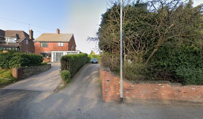
| Memorials | : | 0 |
| Location | : | Hednesford, Cannock Chase District, England |
| Phone | : | 01543 422576 |
| Website | : | ladyoflourdes.co.uk/ |
| Coordinate | : | 52.7051311, -1.9969935 |
| Description | : | Roman Catholic parish church, including boundary walls and railings, built in 1928-33, designed by George Bernard Cox of the Birmingham firm of Harrison and Cox, in a French-Gothic Style. The Churchyard was laid by Fr Joseph Healy in 1930 and is dominated by figures of the Crucified Christ, flanked by Our Lady and St John, it is sculpted in Portland stone. It is a private churchyard and is available to parishioners from Hednesford. The current church was preceded by a school and Catholic chapel dedicated to St Joseph and St Philomena at Hill Top, Hednesford, built in the 1890s. The... Read More |
frequently asked questions (FAQ):
-
Where is Our Lady of Lourdes Churchyard?
Our Lady of Lourdes Churchyard is located at Uxbridge Street, Hednesford, Staffordshire Hednesford, Cannock Chase District ,Staffordshire , WS12 1DBEngland.
-
Our Lady of Lourdes Churchyard cemetery's updated grave count on graveviews.com?
0 memorials
-
Where are the coordinates of the Our Lady of Lourdes Churchyard?
Latitude: 52.7051311
Longitude: -1.9969935
Nearby Cemetories:
1. St. Peter's Churchyard
Hednesford, Cannock Chase District, England
Coordinate: 52.7050630, -1.9918330
2. St John Churchyard
Heath Hayes, Cannock Chase District, England
Coordinate: 52.6914160, -1.9846280
3. Cannock Cemetery
Cannock, Cannock Chase District, England
Coordinate: 52.7008790, -2.0288950
4. St. Luke's Churchyard
Cannock, Cannock Chase District, England
Coordinate: 52.6889919, -2.0287352
5. St Mary Roman Catholic Churchyard
Cannock, Cannock Chase District, England
Coordinate: 52.6867620, -2.0283360
6. Cannock Chase German Military Cemetery
Cannock, Cannock Chase District, England
Coordinate: 52.7370580, -2.0265050
7. Cannock Chase War Cemetery
Cannock, Cannock Chase District, England
Coordinate: 52.7370710, -2.0266340
8. St John's Church Cemetery
Burntwood, Lichfield District, England
Coordinate: 52.6901000, -1.9349300
9. St. Mark's Churchyard
Great Wyrley, South Staffordshire Borough, England
Coordinate: 52.6664250, -2.0231955
10. Christ Church Gentleshaw
Rugeley, Cannock Chase District, England
Coordinate: 52.7050151, -1.9264458
11. Great Wyrley Cemetery
Great Wyrley, South Staffordshire Borough, England
Coordinate: 52.6642130, -2.0269380
12. Chase and District Memorial Park
Burntwood, Lichfield District, England
Coordinate: 52.6817140, -1.9339150
13. St. Saviour Churchyard
Hatherton, South Staffordshire Borough, England
Coordinate: 52.6841730, -2.0660840
14. Stile Cop Cemetery
Rugeley, Cannock Chase District, England
Coordinate: 52.7423710, -1.9448220
15. St. Anne Churchyard Chasetown
Burntwood, Lichfield District, England
Coordinate: 52.6693850, -1.9381720
16. Cheslyn Hay Cemetery
Cheslyn Hay, South Staffordshire Borough, England
Coordinate: 52.6581170, -2.0431790
17. Strawberry Lane Cemetery
Cheslyn Hay, South Staffordshire Borough, England
Coordinate: 52.6485291, -2.0300821
18. St. Michael's Churchyard
Brereton, Cannock Chase District, England
Coordinate: 52.7451169, -1.9228718
19. Christchurch Cemetery
Burntwood, Lichfield District, England
Coordinate: 52.6787639, -1.8969201
20. St Matthew's Hospital Burial Ground
Burntwood, Lichfield District, England
Coordinate: 52.6804500, -1.8937800
21. Hawkesyard Priory
Rugeley, Cannock Chase District, England
Coordinate: 52.7439175, -1.9032955
22. Rugeley Cemetery
Rugeley, Cannock Chase District, England
Coordinate: 52.7650720, -1.9370440
23. St. Augustine's Churchyard
Rugeley, Cannock Chase District, England
Coordinate: 52.7644253, -1.9345868
24. The Old Chancel
Rugeley, Cannock Chase District, England
Coordinate: 52.7648400, -1.9355010

