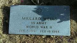
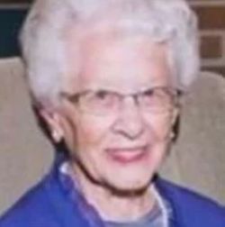
Millard “Bud” Wells
| Birth | : | 7 Feb 1919 Valentine, Cherry County, Nebraska, USA |
| Death | : | 15 Feb 1988 Grand Island, Hall County, Nebraska, USA |
| Burial | : | Hardwick Hill Cemetery, Banbury, Cherwell District, England |
| Coordinate | : | 52.0864530, -1.3381430 |
| Description | : | Husb of Maxine (Wakelin) Wells Millard "Bud" Wells was born in Valentine, NE. He graduated from Clay Center High School. He served in the Army from 1942-1946. He worked at the Hastings Naval Ammunition Depot from 1946-1952 and for Morrison-Quirk from the late 1950s until 1969. He moved to Phoenix, AZ in in 1982 and returned to Nebraska in 1987. He was a member of the Glenvil and Sandy Creek school boards and of the Glenvil American Legion. He was survived by four daughters, Janis Stahl of Wilber, Glenda Krull of Glenvil, Patty Shaw of Sioux City, IA... Read More |
frequently asked questions (FAQ):
-
Where is Millard “Bud” Wells's memorial?
Millard “Bud” Wells's memorial is located at: Hardwick Hill Cemetery, Banbury, Cherwell District, England.
-
When did Millard “Bud” Wells death?
Millard “Bud” Wells death on 15 Feb 1988 in Grand Island, Hall County, Nebraska, USA
-
Where are the coordinates of the Millard “Bud” Wells's memorial?
Latitude: 52.0864530
Longitude: -1.3381430
Family Members:
Parent
Spouse
Siblings
Children
Flowers:
Nearby Cemetories:
1. Hardwick Hill Cemetery
Banbury, Cherwell District, England
Coordinate: 52.0864530, -1.3381430
2. Banbury Crematorium
Banbury, Cherwell District, England
Coordinate: 52.0865540, -1.3406860
3. St. Peters Churchyard
Hanwell, Cherwell District, England
Coordinate: 52.0887920, -1.3657000
4. Southam Road Cemetery
Banbury, Cherwell District, England
Coordinate: 52.0679120, -1.3405760
5. All Saints' Church Great Bourton
Bourton, Cherwell District, England
Coordinate: 52.1062460, -1.3349970
6. St. Mary the Virgin Churchyard
Banbury, Cherwell District, England
Coordinate: 52.0614620, -1.3391870
7. St. John the Evangelist Churchyard
Banbury, Cherwell District, England
Coordinate: 52.0598790, -1.3400100
8. St Peter's Churchyard
Drayton, Cherwell District, England
Coordinate: 52.0707360, -1.3764670
9. St. Laurence Churchyard
Shotteswell, Stratford-on-Avon District, England
Coordinate: 52.1061720, -1.3787950
10. St. Mary the Virgin Churchyard
Cropredy, Cherwell District, England
Coordinate: 52.1163600, -1.3165570
11. St. Peter and St. Paul Churchyard
Chacombe, South Northamptonshire Borough, England
Coordinate: 52.0916900, -1.2850100
12. St Etheldreda Churchyard
Horley, Cherwell District, England
Coordinate: 52.0924610, -1.3930320
13. All Saints Churchyard
Wroxton, Cherwell District, England
Coordinate: 52.0726220, -1.3925790
14. St Mary Church
Warkworth, South Northamptonshire Borough, England
Coordinate: 52.0627000, -1.2917000
15. All Saint's Churchyard
Mollington, Cherwell District, England
Coordinate: 52.1238200, -1.3557600
16. All Saints Churchyard
Middleton Cheney, South Northamptonshire Borough, England
Coordinate: 52.0741984, -1.2740247
17. St. Mary Magdalene Churchyard
Wardington, Cherwell District, England
Coordinate: 52.1131949, -1.2841641
18. Middleton Cheney Cemetery
Middleton Cheney, South Northamptonshire Borough, England
Coordinate: 52.0745100, -1.2692900
19. Bodicote Cemetery
Bodicote, Cherwell District, England
Coordinate: 52.0391710, -1.3397380
20. Saint John the Baptist Churchyard
Bodicote, Cherwell District, England
Coordinate: 52.0356100, -1.3305700
21. St Michael Churchyard
Warmington, Stratford-on-Avon District, England
Coordinate: 52.1241420, -1.4028940
22. St Mary the Virgin Churchyard
Broughton, Cherwell District, England
Coordinate: 52.0417020, -1.3912030
23. St. John's Churchyard
Hornton, Cherwell District, England
Coordinate: 52.1020090, -1.4287560
24. St. Botolph's Churchyard
Farnborough, Stratford-on-Avon District, England
Coordinate: 52.1427340, -1.3675320


