
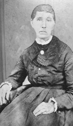
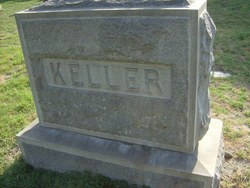
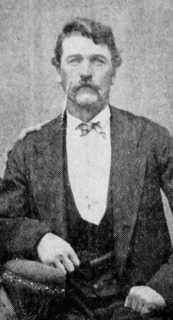
Nathan Keller
| Birth | : | 6 Apr 1810 Rowan County, North Carolina, USA |
| Death | : | 1850 San Bernardino, San Bernardino County, California, USA |
| Burial | : | Rochester Cemetery, Topeka, Shawnee County, USA |
| Coordinate | : | 39.1044006, -95.6800003 |
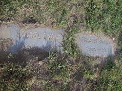
| Description | : | *Note about burials in Pioneer Cemetery: Pioneer Memorial Cemetery in San Bernardino, San Bernardino County, CA., is an extant (still in existence) burial place for the early settlers in the city. The cemetery was founded in Apr. 1857. Remains of area pioneers previously interred at the unmarked Seccombe Lake Cemetery were relocated to the Pioneer Memorial Cemetery. On Jan. 23, 1830, Nathan Keller and Drucilla Boren were married in Union county, IL., according to IL. Compiled Marriages for 1791-1850. *Paragraph from Nathan's son, Francis Marion Keller's obituary: Francis M. Keller was born in the year 1845 in... Read More |
frequently asked questions (FAQ):
-
Where is Nathan Keller's memorial?
Nathan Keller's memorial is located at: Rochester Cemetery, Topeka, Shawnee County, USA.
-
When did Nathan Keller death?
Nathan Keller death on 1850 in San Bernardino, San Bernardino County, California, USA
-
Where are the coordinates of the Nathan Keller's memorial?
Latitude: 39.1044006
Longitude: -95.6800003
Family Members:
Parent
Spouse
Siblings
Children

Flowers:


Nearby Cemetories:
1. Rochester Cemetery
Topeka, Shawnee County, USA
Coordinate: 39.1044006, -95.6800003
2. Bennie Lee Graham Memorial Cemetery
Shawnee County, USA
Coordinate: 39.1020584, -95.6836472
3. Curtis Family Cemetery
North Topeka, Shawnee County, USA
Coordinate: 39.0792870, -95.6702270
4. Topeka State Hospital Cemetery
Topeka, Shawnee County, USA
Coordinate: 39.0671005, -95.7080994
5. Prairie Home Cemetery
Topeka, Shawnee County, USA
Coordinate: 39.1077118, -95.7482910
6. Grace Episcopal Cathedral Columbarium
Topeka, Shawnee County, USA
Coordinate: 39.0511284, -95.6843719
7. Memorial Park Cemetery
Topeka, Shawnee County, USA
Coordinate: 39.0619011, -95.7221985
8. Grace Episcopal Cathedral Sanctuary
Topeka, Shawnee County, USA
Coordinate: 39.0506925, -95.6839273
9. Half-Day Cemetery
Elmont, Shawnee County, USA
Coordinate: 39.1584702, -95.7143402
10. Westminster Presbyterian Church Memorial Garden
Topeka, Shawnee County, USA
Coordinate: 39.0430400, -95.7021700
11. Mount Calvary Cemetery
Topeka, Shawnee County, USA
Coordinate: 39.0532990, -95.7360992
12. Topeka Cemetery
Topeka, Shawnee County, USA
Coordinate: 39.0388985, -95.6528015
13. Mount Auburn Cemetery
Topeka, Shawnee County, USA
Coordinate: 39.0393982, -95.6500015
14. Carnegie Hall
Topeka, Shawnee County, USA
Coordinate: 39.0350600, -95.6999100
15. Security Benefit Association Cemetery
Topeka, Shawnee County, USA
Coordinate: 39.0630989, -95.7606583
16. Saint Davids Episcopal Church Columbarium
Topeka, Shawnee County, USA
Coordinate: 39.0369860, -95.7259480
17. Old Grantville Cemetery
Grantville, Jefferson County, USA
Coordinate: 39.0949500, -95.5771300
18. Mount Hope Cemetery
Topeka, Shawnee County, USA
Coordinate: 39.0367393, -95.7386703
19. Grantville Cemetery
Grantville, Jefferson County, USA
Coordinate: 39.0957400, -95.5745800
20. Ritchie Cemetery
Topeka, Shawnee County, USA
Coordinate: 39.0228010, -95.7027530
21. Foster Cemetery
Topeka, Shawnee County, USA
Coordinate: 38.9942017, -95.7061005
22. Saint Aloysius Cemetery
Meriden, Jefferson County, USA
Coordinate: 39.1872482, -95.5795593
23. Abram Burnett Burial Site
Topeka, Shawnee County, USA
Coordinate: 39.0102997, -95.7685776
24. West Lawn Memorial Gardens
Topeka, Shawnee County, USA
Coordinate: 39.0518112, -95.8167419