
| Birth | : | 4 Dec 1859 Cherokee County, South Carolina, USA |
| Death | : | 16 Apr 1943 Union County, South Carolina, USA |
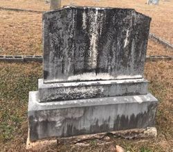
| Burial | : | Saint Anne's Church, Woodplumpton, City of Preston, England |
| Coordinate | : | 53.8038130, -2.7621940 |
| Description | : | "Tobe" Palmer married Josephine "Josie" Cudd, who died 14 January 1907 in Union County, SC, and whose burial place remains unknown. Besides those four children listed below, they also were the parents of Nannie Maude Palmer Vaughan and Willie Perkins Palmer. |
frequently asked questions (FAQ):
-
Where is Neely Parmenas “Tobe” Palmer's memorial?
Neely Parmenas “Tobe” Palmer's memorial is located at: Saint Anne's Church, Woodplumpton, City of Preston, England.
-
When did Neely Parmenas “Tobe” Palmer death?
Neely Parmenas “Tobe” Palmer death on 16 Apr 1943 in Union County, South Carolina, USA
-
Where are the coordinates of the Neely Parmenas “Tobe” Palmer's memorial?
Latitude: 53.8038130
Longitude: -2.7621940
Family Members:
Parent

Siblings
Children
Flowers:


Nearby Cemetories:
1. Saint Anne's Church
Woodplumpton, City of Preston, England
Coordinate: 53.8038130, -2.7621940
2. St Andrew George Haydock Roman Catholic Churchyard
Cottam, City of Preston, England
Coordinate: 53.7879280, -2.7591570
3. St Mary's Newhouse
Barton, City of Preston, England
Coordinate: 53.8205240, -2.7406500
4. St. John Baptist Churchyard
Broughton-in-Amounderness, City of Preston, England
Coordinate: 53.8033700, -2.7170400
5. St. Lawrence Churchyard
Barton, City of Preston, England
Coordinate: 53.8289213, -2.7366654
6. St. Mary's Churchyard
Lea, City of Preston, England
Coordinate: 53.7733810, -2.7942770
7. St. Andrew's Churchyard
Ashton-on-Ribble, City of Preston, England
Coordinate: 53.7687030, -2.7359180
8. St. John the Evangelist Churchyard
Clifton, Fylde Borough, England
Coordinate: 53.7758600, -2.8158500
9. Christ Church Churchyard
Fulwood, City of Preston, England
Coordinate: 53.7771920, -2.7028700
10. St. Peters Churchyard
Inskip with Sowerby, Wyre Borough, England
Coordinate: 53.8347100, -2.8175200
11. Christ Churchyard
Treales, Fylde Borough, England
Coordinate: 53.8045970, -2.8440710
12. St Walburge's RC Church
Preston, City of Preston, England
Coordinate: 53.7629690, -2.7149620
13. St. Mary's Churchyard
Preston, City of Preston, England
Coordinate: 53.8010830, -2.6779600
14. St. Hilda's Churchyard
Bilsborrow, Wyre Borough, England
Coordinate: 53.8522170, -2.7420090
15. Inskip Baptist Churchyard
Inskip with Sowerby, Wyre Borough, England
Coordinate: 53.8353150, -2.8299610
16. Saint Peter Churchyard
Preston, City of Preston, England
Coordinate: 53.7634100, -2.7080700
17. St Mary Churchyard
Penwortham, South Ribble Borough, England
Coordinate: 53.7551800, -2.7234210
18. Grey Friars' Church
Preston, City of Preston, England
Coordinate: 53.7601480, -2.7084600
19. Holy Trinity
Preston, City of Preston, England
Coordinate: 53.7613030, -2.7030580
20. Friends Meeting House Burial Ground (Defunct)
Preston, City of Preston, England
Coordinate: 53.7610250, -2.7030380
21. Christ Church Churchyard
Preston, City of Preston, England
Coordinate: 53.7573210, -2.7103080
22. St. Ignatius RC Churchyard
Preston, City of Preston, England
Coordinate: 53.7635270, -2.6965870
23. St. George the Martyr
Preston, City of Preston, England
Coordinate: 53.7591220, -2.7025660
24. St. Wilfrid's Catholic Cemetery
Preston, City of Preston, England
Coordinate: 53.7581670, -2.7044930