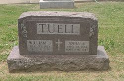
Phillip Tuell
| Birth | : | May 1872 USA |
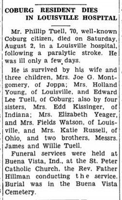
| Death | : | 2 Aug 1941 Louisville, Jefferson County, Kentucky, USA |
| Burial | : | Saint Peter's Churchyard, Deene, East Northamptonshire Borough, England |
| Coordinate | : | 52.5242490, -0.5984740 |
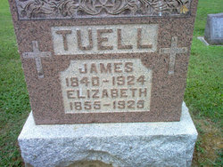
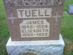
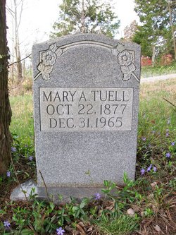
| Description | : | According to the 1900 census Phillip may have been born in May of 1872. Phillip's father is James and his mother is undetermined. His death certificate gives his mother's name as Mary. Margaret Duggins, James Tuell's first wife, is thought to have already died before the birth of Phillip. If birth is right Phillip would have been about 8 months old when James Tuell married his second wife Elizabeth Bramer. Sometime between 1900 and 1910 Phillip moved to the area of Taylor/Adair Co., KY. Phillip Tuell married Mary A. Pike. According to the... Read More |
frequently asked questions (FAQ):
-
Where is Phillip Tuell's memorial?
Phillip Tuell's memorial is located at: Saint Peter's Churchyard, Deene, East Northamptonshire Borough, England.
-
When did Phillip Tuell death?
Phillip Tuell death on 2 Aug 1941 in Louisville, Jefferson County, Kentucky, USA
-
Where are the coordinates of the Phillip Tuell's memorial?
Latitude: 52.5242490
Longitude: -0.5984740
Family Members:
Parent
Spouse
Siblings
Children
Flowers:
Nearby Cemetories:
1. Saint Peter's Churchyard
Deene, East Northamptonshire Borough, England
Coordinate: 52.5242490, -0.5984740
2. Deene Park
Deene, East Northamptonshire Borough, England
Coordinate: 52.5242960, -0.6010350
3. St. Nicholas' Churchyard
Bulwick, East Northamptonshire Borough, England
Coordinate: 52.5376000, -0.5818000
4. All Saints Churchyard
Laxton, East Northamptonshire Borough, England
Coordinate: 52.5535760, -0.5992450
5. Holy Trinity Churchyard
Blatherwycke, East Northamptonshire Borough, England
Coordinate: 52.5514375, -0.5646654
6. St. James Churchyard
Gretton, Corby Borough, England
Coordinate: 52.5403000, -0.6763400
7. St. Mary Churchyard
Benefield, East Northamptonshire Borough, England
Coordinate: 52.4854100, -0.5460660
8. Saint John The Baptist Churchyard
Harringworth, East Northamptonshire Borough, England
Coordinate: 52.5671000, -0.6491000
9. Church of Saint John the Baptist
Wakerley, East Northamptonshire Borough, England
Coordinate: 52.5817323, -0.5929850
10. All Saints Churchyard
Kings Cliffe, East Northamptonshire Borough, England
Coordinate: 52.5622450, -0.5160080
11. St. Peter's Churchyard
Barrowden, Rutland Unitary Authority, England
Coordinate: 52.5888800, -0.6063600
12. Kings Cliffe Cemetery
Kings Cliffe, East Northamptonshire Borough, England
Coordinate: 52.5605586, -0.5102005
13. All Hallows Churchyard
Seaton, Rutland Unitary Authority, England
Coordinate: 52.5745730, -0.6670810
14. St Leonard's Churchyard
Glapthorn, East Northamptonshire Borough, England
Coordinate: 52.5001397, -0.4924849
15. Shire Lodge Cemetery
Corby, Corby Borough, England
Coordinate: 52.5073610, -0.7084990
16. Brigstock Parish Cemetery
Brigstock, East Northamptonshire Borough, England
Coordinate: 52.4552481, -0.6061781
17. St Leonard Churchyard
Apethorpe, East Northamptonshire Borough, England
Coordinate: 52.5495140, -0.4899340
18. St Mary Churchyard
Woodnewton, East Northamptonshire Borough, England
Coordinate: 52.5392210, -0.4795790
19. St. John the Evangelist Churchyard
Caldecott, Rutland Unitary Authority, England
Coordinate: 52.5341600, -0.7213400
20. St Mary the Virgin Churchyard
Morcott, Rutland Unitary Authority, England
Coordinate: 52.5967800, -0.6366200
21. Church of St Mary
Duddington, East Northamptonshire Borough, England
Coordinate: 52.5969190, -0.5432540
22. St Mary the Virgin Churchyard
South Luffenham, Rutland Unitary Authority, England
Coordinate: 52.6067200, -0.6114100
23. Oundle Cemetery
Oundle, East Northamptonshire Borough, England
Coordinate: 52.4799120, -0.4803840
24. St. Andrew's Churchyard
Glaston, Rutland Unitary Authority, England
Coordinate: 52.5953628, -0.6781534

