
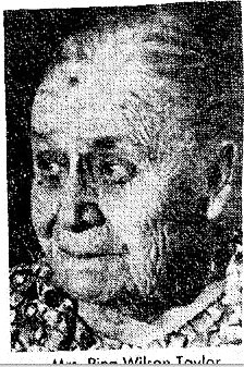
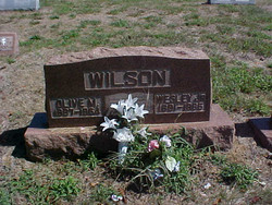
Pina Wilson Taylor
| Birth | : | 12 Apr 1876 |
| Death | : | 7 Sep 1979 |
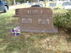
| Burial | : | Saint Joseph Cemetery, Council Bluffs, Pottawattamie County, USA |
| Coordinate | : | 41.2722015, -95.8208008 |
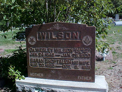
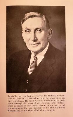
| Description | : | Mrs Pina Wilson Taylor died Friday in Dellaren Nursing Home in Yankeetown. Husband Lewis former president of Indiana Farm Bureau died in 1936. In 1910 she was one of 10 women to petition Purdue University President Stone to put home ecomonics in the curriculum. For many years she and her husband was employed by Purdue as representatives of Purdue Extension Department. Wife of Lewis daughter of Wesley and Sarah Shoptaugh Wilson. Grandaughter of Noah and Cynthia McKinney Shoptaugh. |
frequently asked questions (FAQ):
-
Where is Pina Wilson Taylor's memorial?
Pina Wilson Taylor's memorial is located at: Saint Joseph Cemetery, Council Bluffs, Pottawattamie County, USA.
-
When did Pina Wilson Taylor death?
Pina Wilson Taylor death on 7 Sep 1979 in
-
Where are the coordinates of the Pina Wilson Taylor's memorial?
Latitude: 41.2722015
Longitude: -95.8208008
Family Members:
Parent

Spouse
Siblings
Children
Flowers:


Nearby Cemetories:
1. Saint Joseph Cemetery
Council Bluffs, Pottawattamie County, USA
Coordinate: 41.2722015, -95.8208008
2. Bikhor Cholim Cemetery
Council Bluffs, Pottawattamie County, USA
Coordinate: 41.2703670, -95.8229350
3. Oak Hill Cemetery
Council Bluffs, Pottawattamie County, USA
Coordinate: 41.2700900, -95.8226400
4. Green Valley Cemetery
Council Bluffs, Pottawattamie County, USA
Coordinate: 41.2743988, -95.8225021
5. Cedar Lawn Cemetery
Council Bluffs, Pottawattamie County, USA
Coordinate: 41.2694016, -95.8182983
6. Walnut Hill Cemetery
Council Bluffs, Pottawattamie County, USA
Coordinate: 41.2719002, -95.8255997
7. Ridgewood Cemetery
Council Bluffs, Pottawattamie County, USA
Coordinate: 41.2694016, -95.8272018
8. Memorial Park Cemetery
Council Bluffs, Pottawattamie County, USA
Coordinate: 41.2644005, -95.8261032
9. Clark Cemetery
Pottawattamie County, USA
Coordinate: 41.2551610, -95.8223390
10. Fairview Cemetery
Council Bluffs, Pottawattamie County, USA
Coordinate: 41.2703018, -95.8480988
11. Garner Cemetery
Council Bluffs, Pottawattamie County, USA
Coordinate: 41.2956161, -95.8001709
12. Stoker-Graybill Cemetery
Council Bluffs, Pottawattamie County, USA
Coordinate: 41.2532620, -95.7751770
13. Maple Grove Cemetery
Council Bluffs, Pottawattamie County, USA
Coordinate: 41.2265560, -95.8187100
14. Evans Cemetery
Crescent, Pottawattamie County, USA
Coordinate: 41.3255997, -95.8368988
15. Lewis Township Cemetery
Council Bluffs, Pottawattamie County, USA
Coordinate: 41.2117004, -95.7938995
16. Gregg Cemetery
Weston, Pottawattamie County, USA
Coordinate: 41.3330000, -95.7931000
17. Council Point Cemetery
Council Bluffs, Pottawattamie County, USA
Coordinate: 41.2110830, -95.8788610
18. Hazel Dell Cemetery
Council Bluffs, Pottawattamie County, USA
Coordinate: 41.3489723, -95.7939911
19. Trinity Cathedral Columbarium
Omaha, Douglas County, USA
Coordinate: 41.2603900, -95.9393660
20. Saint Columbanus Cemetery
Weston, Pottawattamie County, USA
Coordinate: 41.3429440, -95.7435260
21. Crescent Cemetery
Crescent, Pottawattamie County, USA
Coordinate: 41.3664894, -95.8566208
22. Prospect Hill Cemetery
Omaha, Douglas County, USA
Coordinate: 41.2780991, -95.9593964
23. First Central Congregational Columbarium
Omaha, Douglas County, USA
Coordinate: 41.2563456, -95.9658365
24. Saint Pauls Evangelical Country Church Cemetery
Dumfries, Pottawattamie County, USA
Coordinate: 41.1748352, -95.7492371