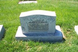
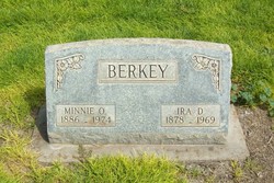
Reta Luella Berkey Chaney
| Birth | : | 6 Aug 1910 |
| Death | : | 16 Aug 2010 |
| Burial | : | Spring Hill Baptist Church Cemetery, Eaton, Gibson County, USA |
| Coordinate | : | 35.9859520, -89.1221080 |
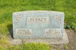
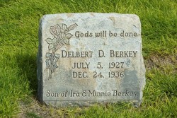
| Description | : | Reta Luella (Berkey) Chaney, 100, formerly of Sterling, died Aug. 16, 2010, in Berthoud. Closed casket services will be held at 10 a.m. Monday, Aug. 23, at Chaney-Reager Funeral Home, with the Rev. Norman Long officiating. Interment will be at Riverside Cemetery. She was born Aug. 6, 1910, in Platte, S.D., to Ira D. and Minnie (Smith) Berkey. The family moved to Colorado in January 1911 to a homestead 16 miles south of Haxtun. They lived in a sod house until 1917, when they moved to a farm 2 3/4 miles east of Haxtun. Mrs. Chaney graduated from Philorado Grade School in... Read More |
frequently asked questions (FAQ):
-
Where is Reta Luella Berkey Chaney's memorial?
Reta Luella Berkey Chaney's memorial is located at: Spring Hill Baptist Church Cemetery, Eaton, Gibson County, USA.
-
When did Reta Luella Berkey Chaney death?
Reta Luella Berkey Chaney death on 16 Aug 2010 in
-
Where are the coordinates of the Reta Luella Berkey Chaney's memorial?
Latitude: 35.9859520
Longitude: -89.1221080
Family Members:
Parent
Siblings
Children
Flowers:
Nearby Cemetories:
1. Spring Hill Baptist Church Cemetery
Eaton, Gibson County, USA
Coordinate: 35.9859520, -89.1221080
2. Springhill MB Church Cemetery
Eaton, Gibson County, USA
Coordinate: 35.9871860, -89.1210420
3. Wilson Cemetery
Gibson County, USA
Coordinate: 35.9706001, -89.0980988
4. Concidine Gravesite
Gibson County, USA
Coordinate: 35.9930000, -89.0800000
5. Old Mayfield Cemetery
Eaton, Gibson County, USA
Coordinate: 35.9894960, -89.1666780
6. Mayfield Cemetery
Eaton, Gibson County, USA
Coordinate: 35.9910230, -89.1678300
7. Walnut Grove Cemetery
Trenton, Gibson County, USA
Coordinate: 35.9947014, -89.0764008
8. Roberts Family Cemetery
Eaton, Gibson County, USA
Coordinate: 35.9882200, -89.0734100
9. Salem Primitive Baptist Cemetery
Hickory Grove, Gibson County, USA
Coordinate: 35.9681400, -89.0709700
10. Elizabeth Methodist Church Cemetery
Elizabeth, Crockett County, USA
Coordinate: 35.9605010, -89.1770140
11. Olive Branch Methodist Church Cemetery
Eaton, Gibson County, USA
Coordinate: 35.9678001, -89.0607986
12. Bethesda Cemetery
Wilcox, Crockett County, USA
Coordinate: 35.9361230, -89.1557970
13. Young & Williams Cemetery
Elizabeth, Crockett County, USA
Coordinate: 35.9707990, -89.1937240
14. Hogue Cemetery
Yorkville, Gibson County, USA
Coordinate: 36.0495580, -89.0985780
15. Balentine Family Cemetery
Dyer, Gibson County, USA
Coordinate: 36.0544690, -89.0928070
16. Shaw Cemetery
Tatumville, Dyer County, USA
Coordinate: 36.0435982, -89.1868973
17. Hall Family Cemetery
Dyer, Gibson County, USA
Coordinate: 36.0302900, -89.0393600
18. Duck Hill Cemetery
Trenton, Gibson County, USA
Coordinate: 36.0331001, -89.0413971
19. Mays Chapel Cemetery
Friendship, Crockett County, USA
Coordinate: 35.9363540, -89.2006050
20. Hartsfield Cemetery
Gibson County, USA
Coordinate: 35.9155500, -89.0721100
21. Warren Cemetery
Crockett Mills, Crockett County, USA
Coordinate: 35.9074790, -89.1521770
22. Williams Chapel Baptist Church Cemetery
Friendship, Crockett County, USA
Coordinate: 35.9258940, -89.1916320
23. Sanders Cemetery
Crockett Mills, Crockett County, USA
Coordinate: 35.9096750, -89.1609030
24. Ward's Grove C.M.E. Church Cemetery
Trenton, Gibson County, USA
Coordinate: 35.9097929, -89.0770110


