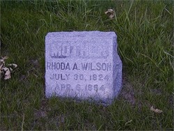
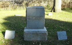
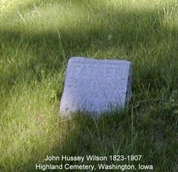
Rhoda Ann Phinney Wilson
| Birth | : | 30 Jul 1824 Hamilton County, Ohio, USA |
| Death | : | 6 Apr 1884 Cedar Falls, Black Hawk County, Iowa, USA |
| Burial | : | Perrysville United Methodist Cemetery, Perrysville, Carroll County, USA |
| Coordinate | : | 40.4625510, -81.0973610 |
| Description | : | daughter of John and Margaret Collum Phinney, she married John Hussey Wilson, the son of Seth and Sarah Hussey Wilson on February 6, 1842 in Tazewell County, Illinois. |
frequently asked questions (FAQ):
-
Where is Rhoda Ann Phinney Wilson's memorial?
Rhoda Ann Phinney Wilson's memorial is located at: Perrysville United Methodist Cemetery, Perrysville, Carroll County, USA.
-
When did Rhoda Ann Phinney Wilson death?
Rhoda Ann Phinney Wilson death on 6 Apr 1884 in Cedar Falls, Black Hawk County, Iowa, USA
-
Where are the coordinates of the Rhoda Ann Phinney Wilson's memorial?
Latitude: 40.4625510
Longitude: -81.0973610
Family Members:
Spouse
Children
Flowers:
Nearby Cemetories:
1. Perrysville United Methodist Cemetery
Perrysville, Carroll County, USA
Coordinate: 40.4625510, -81.0973610
2. Perrysville Methodist Episcopal Church Cemetery
Perrysville, Carroll County, USA
Coordinate: 40.4655991, -81.0982971
3. New Perrysville Cemetery
Perrysville, Carroll County, USA
Coordinate: 40.4569016, -81.1016998
4. Hagey Family Cemetery
Perrysville, Carroll County, USA
Coordinate: 40.4525980, -81.0996160
5. Arabia Cemetery
Perrysville, Carroll County, USA
Coordinate: 40.4803009, -81.0678024
6. Mount Olive Cemetery
Carroll County, USA
Coordinate: 40.4488983, -81.1382980
7. Mount Tabor Cemetery
Carroll County, USA
Coordinate: 40.4817009, -81.1483002
8. Allen Memorial Cemetery
Carroll County, USA
Coordinate: 40.4364014, -81.0511017
9. Wood Cemetery
Scio, Harrison County, USA
Coordinate: 40.4193500, -81.0707690
10. Palermo Cemetery
Carroll County, USA
Coordinate: 40.4894444, -81.1522220
11. Swinehart Cemetery
Carroll County, USA
Coordinate: 40.4327000, -81.1642170
12. Mount Pleasant Cemetery
Carrollton, Carroll County, USA
Coordinate: 40.5238991, -81.1003036
13. Conotton Cemetery
Harrison County, USA
Coordinate: 40.4103012, -81.1489029
14. Abel Cemetery
Carroll County, USA
Coordinate: 40.4578018, -81.0113983
15. Methodist Episcopal Church Cemetery
Scio, Harrison County, USA
Coordinate: 40.3970800, -81.0864600
16. Grandview Cemetery
Scio, Harrison County, USA
Coordinate: 40.3903008, -81.0978012
17. New Hagerstown Cemetery
New Hagerstown, Carroll County, USA
Coordinate: 40.4446983, -81.1893997
18. Bethel Cemetery
Leavittsville, Carroll County, USA
Coordinate: 40.4921989, -81.1841965
19. Kilgore Cemetery
Kilgore, Carroll County, USA
Coordinate: 40.4632988, -81.0014038
20. Kilgore Presbyterian Cemetery
Carroll County, USA
Coordinate: 40.4603004, -81.0002975
21. Longview Cemetery
Bowerston, Harrison County, USA
Coordinate: 40.4324989, -81.1872025
22. United Brethren Cemetery
Harrison County, USA
Coordinate: 40.4043999, -81.0353012
23. New Rumley Methodist Cemetery
New Rumley, Harrison County, USA
Coordinate: 40.4028015, -81.0346985
24. Seceders Cemetery
Carroll County, USA
Coordinate: 40.5332985, -81.1446991


