
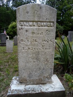

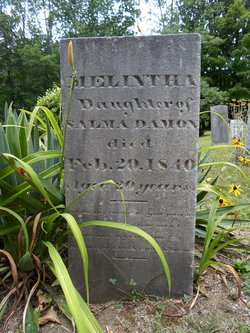
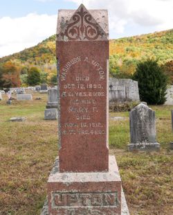
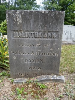
Salma Damon
| Birth | : | 1 Feb 1796 Chesterfield, Hampshire County, Massachusetts, USA |
| Death | : | 26 Oct 1878 Chesterfield, Hampshire County, Massachusetts, USA |
| Burial | : | St. Lawrence Churchyard, Barton, City of Preston, England |
| Coordinate | : | 53.8289213, -2.7366654 |
frequently asked questions (FAQ):
-
Where is Salma Damon's memorial?
Salma Damon's memorial is located at: St. Lawrence Churchyard, Barton, City of Preston, England.
-
When did Salma Damon death?
Salma Damon death on 26 Oct 1878 in Chesterfield, Hampshire County, Massachusetts, USA
-
Where are the coordinates of the Salma Damon's memorial?
Latitude: 53.8289213
Longitude: -2.7366654
Family Members:
Parent

Spouse
Siblings

Children
Flowers:


Nearby Cemetories:
1. St Mary's Newhouse
Barton, City of Preston, England
Coordinate: 53.8205240, -2.7406500
2. St. Hilda's Churchyard
Bilsborrow, Wyre Borough, England
Coordinate: 53.8522170, -2.7420090
3. St. John Baptist Churchyard
Broughton-in-Amounderness, City of Preston, England
Coordinate: 53.8033700, -2.7170400
4. Saint Anne's Church
Woodplumpton, City of Preston, England
Coordinate: 53.8038130, -2.7621940
5. St. Mary the Virgin Churchyard
Goosnargh, City of Preston, England
Coordinate: 53.8266470, -2.6707030
6. St Andrew George Haydock Roman Catholic Churchyard
Cottam, City of Preston, England
Coordinate: 53.7879280, -2.7591570
7. St. Mary's Churchyard
Preston, City of Preston, England
Coordinate: 53.8010830, -2.6779600
8. Whittingham Hospital Cemetery
Goosnargh, City of Preston, England
Coordinate: 53.8208401, -2.6613468
9. St Thomas Churchyard
Claughton-on-Brock, Wyre Borough, England
Coordinate: 53.8752030, -2.7199160
10. St. Peters Churchyard
Inskip with Sowerby, Wyre Borough, England
Coordinate: 53.8347100, -2.8175200
11. Church of St James
Goosnargh, City of Preston, England
Coordinate: 53.8657750, -2.6719410
12. Inskip Baptist Churchyard
Inskip with Sowerby, Wyre Borough, England
Coordinate: 53.8353150, -2.8299610
13. Christ Church Churchyard
Fulwood, City of Preston, England
Coordinate: 53.7771920, -2.7028700
14. St. Helen's Churchyard
Kirkland (Churchtown), Wyre Borough, England
Coordinate: 53.8790700, -2.7901000
15. St. Michael’s Churchyard
St Michael's on Wyre, Wyre Borough, England
Coordinate: 53.8628050, -2.8195430
16. St. Andrew's Churchyard
Ashton-on-Ribble, City of Preston, England
Coordinate: 53.7687030, -2.7359180
17. St. Mary's Churchyard
Lea, City of Preston, England
Coordinate: 53.7733810, -2.7942770
18. St. Michael's Churchyard
Grimsargh, City of Preston, England
Coordinate: 53.7990710, -2.6352530
19. St Walburge's RC Church
Preston, City of Preston, England
Coordinate: 53.7629690, -2.7149620
20. Saint Peter Churchyard
Preston, City of Preston, England
Coordinate: 53.7634100, -2.7080700
21. Christ Churchyard
Treales, Fylde Borough, England
Coordinate: 53.8045970, -2.8440710
22. St. Ignatius RC Churchyard
Preston, City of Preston, England
Coordinate: 53.7635270, -2.6965870
23. Holy Trinity
Preston, City of Preston, England
Coordinate: 53.7613030, -2.7030580
24. St. John the Evangelist Churchyard
Clifton, Fylde Borough, England
Coordinate: 53.7758600, -2.8158500