| Birth | : | 6 Jun 1857 |
| Death | : | 28 Nov 1941 Council Bluffs, Pottawattamie County, Iowa, USA |
| Burial | : | Gilroes Cemetery and Crematorium, Leicester, Leicester Unitary Authority, England |
| Coordinate | : | 52.6514359, -1.1721700 |
| Plot | : | section 10, lot # 009, grave # 4.5 |
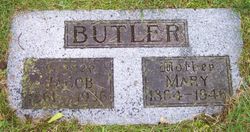
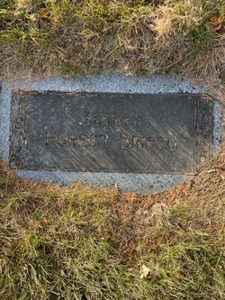
| Description | : | Obituary provided by Walnut Hill/Cutler Cemeteries, Council Bluffs, Iowa: Mrs. Sarah Elizabeth Brisco, 84, wife of Winfield Scott Brisco, died Friday afternoon at her home at 3510 Fourth avenue of complications following an illness of nine days. Born June 6, 1857, in Indiana. She had been a resident of Council Bluffs since 1902. She was a member of the Christian church. Funeral services will be held at 2 p. m. Monday at the Cutler chapel with burial in Walnut Hill cemetery. Other survivors are a son, Forrest, and a sister, Mrs. May Butler, both... Read More |
frequently asked questions (FAQ):
-
Where is Sarah E Wright Briscoe's memorial?
Sarah E Wright Briscoe's memorial is located at: Gilroes Cemetery and Crematorium, Leicester, Leicester Unitary Authority, England.
-
When did Sarah E Wright Briscoe death?
Sarah E Wright Briscoe death on 28 Nov 1941 in Council Bluffs, Pottawattamie County, Iowa, USA
-
Where are the coordinates of the Sarah E Wright Briscoe's memorial?
Latitude: 52.6514359
Longitude: -1.1721700
Family Members:
Parent
Spouse
Siblings
Children
Flowers:
Nearby Cemetories:
1. Gilroes Cemetery and Crematorium
Leicester, Leicester Unitary Authority, England
Coordinate: 52.6514359, -1.1721700
2. St Peter's Church
Glenfield, Blaby District, England
Coordinate: 52.6490490, -1.2063180
3. Leicester Abbey
Leicester, Leicester Unitary Authority, England
Coordinate: 52.6489600, -1.1369470
4. Anstey Cemetery
Anstey, Charnwood Borough, England
Coordinate: 52.6680480, -1.1955570
5. St Mary's Church
Anstey, Charnwood Borough, England
Coordinate: 52.6720090, -1.1888250
6. All Saints Church
Leicester, Leicester Unitary Authority, England
Coordinate: 52.6381940, -1.1403170
7. St Margaret Churchyard
Leicester, Leicester Unitary Authority, England
Coordinate: 52.6403430, -1.1363440
8. St. Nicholas Church
Leicester, Leicester Unitary Authority, England
Coordinate: 52.6351400, -1.1408940
9. Great Meeting Unitarian Chapel
Leicester, Leicester Unitary Authority, England
Coordinate: 52.6379400, -1.1360390
10. Leicester Cathedral
Leicester, Leicester Unitary Authority, England
Coordinate: 52.6347430, -1.1370210
11. St. Mary de Castro Churchyard
Leicester, Leicester Unitary Authority, England
Coordinate: 52.6322610, -1.1404000
12. Church of the Annunciation of St. Mary
Leicester, Leicester Unitary Authority, England
Coordinate: 52.6308229, -1.1417201
13. Belgrave Cemetery
Belgrave, Leicester Unitary Authority, England
Coordinate: 52.6653570, -1.1311220
14. St. Peter's Churchyard
Belgrave, Leicester Unitary Authority, England
Coordinate: 52.6594208, -1.1255690
15. St Peter's Churchyard
Braunstone, Blaby District, England
Coordinate: 52.6208940, -1.1812900
16. St George's Church
Leicester, Leicester Unitary Authority, England
Coordinate: 52.6344300, -1.1267420
17. St. Philip and St. James Churchyard
Groby, Hinckley and Bosworth Borough, England
Coordinate: 52.6639220, -1.2278540
18. Greengate Lane Cemetery
Birstall, Charnwood Borough, England
Coordinate: 52.6800110, -1.1346940
19. Groby Village Cemetery
Groby, Hinckley and Bosworth Borough, England
Coordinate: 52.6542170, -1.2348310
20. St Bartholomew Churchyard
Kirby Muxloe, Blaby District, England
Coordinate: 52.6371750, -1.2320940
21. St James the Great Churchyard
Birstall, Charnwood Borough, England
Coordinate: 52.6741150, -1.1189210
22. All Saints Churchyard
Thurcaston, Charnwood Borough, England
Coordinate: 52.6906870, -1.1647320
23. Kirby Muxloe Cemetery
Kirby Muxloe, Blaby District, England
Coordinate: 52.6373740, -1.2337780
24. St Peter's Church (Defunct)
Leicester, Leicester Unitary Authority, England
Coordinate: 52.6300260, -1.1164980


