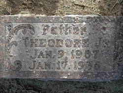
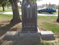
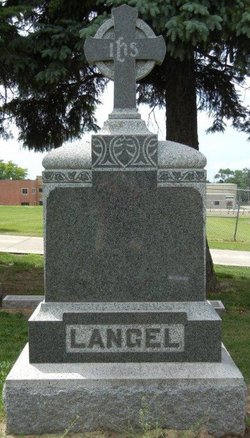
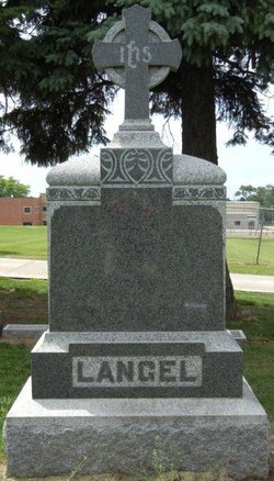
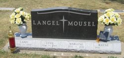
Theodore Langel Jr.
| Birth | : | 9 Jan 1907 Le Mars, Plymouth County, Iowa, USA |
| Death | : | 17 Jan 1936 Elgin Township, Plymouth County, Iowa, USA |
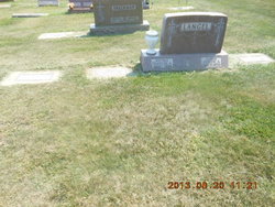
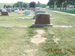
| Burial | : | Union Cemetery, Merrickville, Leeds and Grenville United Counties, Canada |
| Coordinate | : | 44.9343200, -75.8244200 |
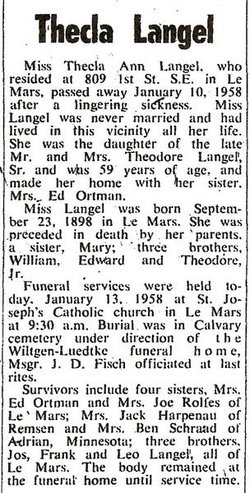
| Description | : | According to his death certificate, he died in Elgin Township. +++ Le Mars Semi-Weekly Sentinel, IA, Tuesday, January 21, 1936, pg. 1, col. 2 Theodore Langel Young Farmer Taken By Death Life Long Resident Succumbs To Heart Trouble At An Early Age Theodore Langer, well known and prominent young farmer of this vicinity, died at his home east of town, January 17, following a lingering illness. Mr. Langel had been ailing for several months with heart trouble and complications and for the next five weeks had been confined to bed. Mr. Langel was a... Read More |
frequently asked questions (FAQ):
-
Where is Theodore Langel Jr.'s memorial?
Theodore Langel Jr.'s memorial is located at: Union Cemetery, Merrickville, Leeds and Grenville United Counties, Canada.
-
When did Theodore Langel Jr. death?
Theodore Langel Jr. death on 17 Jan 1936 in Elgin Township, Plymouth County, Iowa, USA
-
Where are the coordinates of the Theodore Langel Jr.'s memorial?
Latitude: 44.9343200
Longitude: -75.8244200
Family Members:
Parent
Spouse
Siblings
Children
Flowers:
Nearby Cemetories:
1. Union Cemetery
Merrickville, Leeds and Grenville United Counties, Canada
Coordinate: 44.9343200, -75.8244200
2. McGuigan Cemetery
Merrickville, Leeds and Grenville United Counties, Canada
Coordinate: 44.9453160, -75.8155560
3. Saint Ann's Catholic Cemetery
Merrickville, Leeds and Grenville United Counties, Canada
Coordinate: 44.9054200, -75.8306800
4. Collar Hill Cemetery
Merrickville, Leeds and Grenville United Counties, Canada
Coordinate: 44.9006330, -75.8139040
5. Barton Family Burial Site
Merrickville, Leeds and Grenville United Counties, Canada
Coordinate: 44.9021940, -75.8770240
6. Christ Church Anglican Cemetery
Ottawa Municipality, Canada
Coordinate: 44.9844500, -75.7991667
7. VanDusen Cemetery
Rosedale, Lanark County, Canada
Coordinate: 44.8953400, -75.9472800
8. Wolford Rural Cemetery
Jasper, Leeds and Grenville United Counties, Canada
Coordinate: 44.8611300, -75.9256100
9. Baldwin Cemetery
Merrickville, Leeds and Grenville United Counties, Canada
Coordinate: 44.8328970, -75.7950960
10. Christ Church Pioneer Cemetery
Montague, Lanark County, Canada
Coordinate: 45.0025270, -75.9364830
11. Burk Cemetery
Hemlock Corners, Leeds and Grenville United Counties, Canada
Coordinate: 44.8287100, -75.8159410
12. Easton's Corners United Church Cemetery
Eastons Corners, Leeds and Grenville United Counties, Canada
Coordinate: 44.8365570, -75.8842990
13. St. Anne's Anglican Cemetery
Jasper, Leeds and Grenville United Counties, Canada
Coordinate: 44.8362400, -75.8833400
14. Bishops Mills Cemetery
Bishops Mills, Leeds and Grenville United Counties, Canada
Coordinate: 44.8908700, -75.6850700
15. North Rideau Methodist Cemetery
Becketts Landing, Ottawa Municipality, Canada
Coordinate: 45.0233710, -75.7330285
16. Oxford Mills Union Cemetery
Oxford Mills, Leeds and Grenville United Counties, Canada
Coordinate: 44.9619500, -75.6738300
17. Oxford Mills Anglican Cemetery
Oxford Mills, Leeds and Grenville United Counties, Canada
Coordinate: 44.9615300, -75.6732500
18. Saint Bede's Anglican Cemetery
Smiths Falls, Lanark County, Canada
Coordinate: 44.9549520, -75.9801190
19. Patterson's Corners Presbyterian Cemetery
Pattersons Corners, Leeds and Grenville United Counties, Canada
Coordinate: 44.9276960, -75.6595480
20. Holy Cross Cemetery
Kemptville, Leeds and Grenville United Counties, Canada
Coordinate: 45.0131000, -75.6544000
21. Saint John's Anglican Church Cemetery
Smiths Falls, Lanark County, Canada
Coordinate: 44.9110110, -76.0260180
22. Maple Vale Cemetery
South Elmsley, Leeds and Grenville United Counties, Canada
Coordinate: 44.8774300, -76.0152600
23. Saint James Anglican Cemetery
Kemptville, Leeds and Grenville United Counties, Canada
Coordinate: 45.0160300, -75.6489300
24. Saint Francis de Sales Cemetery
Numogate, Lanark County, Canada
Coordinate: 44.9432300, -76.0354700

