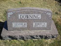
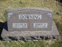
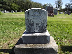
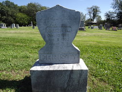
Virginia M Christy Downing
| Birth | : | 18 Nov 1890 Davis County, Iowa, USA |
| Death | : | 1955 Davis County, Iowa, USA |
| Burial | : | St Andrew Churchyard, Langton, Ryedale District, England |
| Coordinate | : | 54.0934510, -0.7834680 |
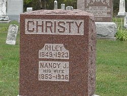
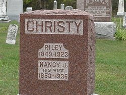
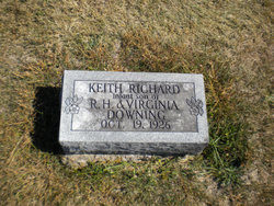
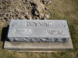
| Description | : | Virginia M Christy married Robert Downing on 4 August 1906 in Davis co., Iowa. They were the parents of Keith R, Orlena V and Kenneth Downing. Mrs. Virginia M. Downing, 65, died in her sleep Monday night or early Tuesdy morning at her home at 311 South Madison street in Ottumwa. Services will be held at the Wagler Funeral Home Friday afternoon at 1:30, conducted by Rev. Marie Harrington, assisted by Rev. Elam. Burial will be in the Troy cemetery. Mrs. Downing was born in Davis county near Floris November 18, 1890, the daughter of Riley and Jane Christy. She... Read More |
frequently asked questions (FAQ):
-
Where is Virginia M Christy Downing's memorial?
Virginia M Christy Downing's memorial is located at: St Andrew Churchyard, Langton, Ryedale District, England.
-
When did Virginia M Christy Downing death?
Virginia M Christy Downing death on 1955 in Davis County, Iowa, USA
-
Where are the coordinates of the Virginia M Christy Downing's memorial?
Latitude: 54.0934510
Longitude: -0.7834680
Family Members:
Parent
Spouse
Siblings
Children
Flowers:
Nearby Cemetories:
1. St Andrew Churchyard
Langton, Ryedale District, England
Coordinate: 54.0934510, -0.7834680
2. Burythorpe Churchyard
Burythorpe, Ryedale District, England
Coordinate: 54.0752951, -0.7955984
3. St Mary Churchyard
Birdsall, Ryedale District, England
Coordinate: 54.0780000, -0.7508000
4. St. Mary's Churchyard
Westow, Ryedale District, England
Coordinate: 54.0846190, -0.8406850
5. St Peter Churchyard
Norton, Ryedale District, England
Coordinate: 54.1289040, -0.7861910
6. Norton Cemetery
Norton, Ryedale District, England
Coordinate: 54.1306400, -0.7834200
7. St. Nicholas Churchyard
North Grimston, Ryedale District, England
Coordinate: 54.0989220, -0.7148680
8. St. Margaret's Churchyard
Huttons Ambo, Ryedale District, England
Coordinate: 54.1066490, -0.8490640
9. St. Leonard with St. Mary Churchyard
Malton, Ryedale District, England
Coordinate: 54.1348110, -0.7946110
10. Malton Cemetery
Malton, Ryedale District, England
Coordinate: 54.1392670, -0.7980300
11. All Saints Churchyard
Settrington, Ryedale District, England
Coordinate: 54.1212780, -0.7178830
12. Settrington Cemetery
Settrington, Ryedale District, England
Coordinate: 54.1254200, -0.7221700
13. St Mary the Virgin Priory Churchyard
Malton, Ryedale District, England
Coordinate: 54.1427520, -0.7786450
14. St John the Baptist
Acklam, Ryedale District, England
Coordinate: 54.0451010, -0.8006330
15. Old Malton Cemetery
Malton, Ryedale District, England
Coordinate: 54.1443200, -0.7808900
16. Kirkham Priory
Kirkham, Ryedale District, England
Coordinate: 54.0826180, -0.8768470
17. St Michael Churchyard
Crambe, Ryedale District, England
Coordinate: 54.0744550, -0.8809390
18. St. Martin Churchyard
Wharram Percy, Ryedale District, England
Coordinate: 54.0665700, -0.6901300
19. St. Mary's Churchyard
Wharram le Street, Ryedale District, England
Coordinate: 54.0820040, -0.6810779
20. Howsham Churchyard
Howsham, Ryedale District, England
Coordinate: 54.0565520, -0.8755670
21. Castle Howard Mausoleum
Castle Howard, Ryedale District, England
Coordinate: 54.1173870, -0.8886900
22. St. Mary's Churchyard
Thixendale, Ryedale District, England
Coordinate: 54.0387360, -0.7154888
23. St John the Evangelist Churchyard
Welburn (Malton), Ryedale District, England
Coordinate: 54.1008850, -0.8985440
24. St Helen Churchyard
Amotherby, Ryedale District, England
Coordinate: 54.1512000, -0.8521000

