
| Birth | : | 1599 |
| Death | : | 1672 |
| Burial | : | St Mary le Strand Church, Strand, City of Westminster, England |
| Coordinate | : | 51.5121540, -0.1169360 |
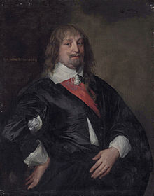
| Description | : | Knight of Tollesbury Hall, Essex. |
frequently asked questions (FAQ):
-
Where is William Howard's memorial?
William Howard's memorial is located at: St Mary le Strand Church, Strand, City of Westminster, England.
-
When did William Howard death?
William Howard death on 1672 in
-
Where are the coordinates of the William Howard's memorial?
Latitude: 51.5121540
Longitude: -0.1169360
Family Members:
Parent
Siblings


Nearby Cemetories:
1. St Mary le Strand Church
Strand, City of Westminster, England
Coordinate: 51.5121540, -0.1169360
2. St Clement Danes Churchyard
City of Westminster, England
Coordinate: 51.5131070, -0.1138980
3. Portugal Street Burial Ground (Defunct)
London, City of London, England
Coordinate: 51.5142280, -0.1162410
4. Savoy Chapel Churchyard
Strand, City of Westminster, England
Coordinate: 51.5105360, -0.1199210
5. Royal College of Surgeons of England
City of Westminster, England
Coordinate: 51.5152780, -0.1158330
6. St. Paul's Churchyard
Covent Garden, London Borough of Camden, England
Coordinate: 51.5114594, -0.1239310
7. Lincoln's Inn
Holborn, London Borough of Camden, England
Coordinate: 51.5161310, -0.1136610
8. St Dunstan in the West Burial Ground
Fleet Street, City of London, England
Coordinate: 51.5142540, -0.1102480
9. Lincoln's Inn Chapel
Holborn, London Borough of Camden, England
Coordinate: 51.5164400, -0.1132400
10. Sir John Soane's Museum
Holborn, London Borough of Camden, England
Coordinate: 51.5170370, -0.1174070
11. Gough Square
London, City of London, England
Coordinate: 51.5150590, -0.1077440
12. St. Martin-in-the-Fields Churchyard
Westminster, City of Westminster, England
Coordinate: 51.5087624, -0.1269620
13. St Bride Churchyard
Fleet Street, City of London, England
Coordinate: 51.5137970, -0.1057060
14. St. George's Churchyard
Bloomsbury, City of Westminster, England
Coordinate: 51.5177160, -0.1248090
15. St Giles in the Fields Churchyard
Holborn, London Borough of Camden, England
Coordinate: 51.5153070, -0.1285300
16. St John the Evangelist Churchyard
Waterloo, London Borough of Lambeth, England
Coordinate: 51.5044620, -0.1123090
17. St. Andrew's Churchyard
Holborn, London Borough of Camden, England
Coordinate: 51.5173050, -0.1066050
18. St. Ann Blackfriars
London, City of London, England
Coordinate: 51.5129180, -0.1021170
19. Blackfriars Priory
Blackfriars, City of London, England
Coordinate: 51.5129730, -0.1021110
20. St. Anne's Church
London, City of London, England
Coordinate: 51.5124321, -0.1318976
21. British Museum
London, City of London, England
Coordinate: 51.5190500, -0.1271778
22. Christ Church Churchyard
Southwark, London Borough of Southwark, England
Coordinate: 51.5061200, -0.1053500
23. St Martin Churchyard
Ludgate, City of London, England
Coordinate: 51.5140390, -0.1020430
24. St Anne Churchyard
Soho, City of Westminster, England
Coordinate: 51.5123910, -0.1322610