
| Memorials | : | 0 |
| Location | : | Mapperton, West Dorset District, England |
| Phone | : | 01308 862645 |
| Website | : | mapperton.com |
| Coordinate | : | 50.7943046, -2.7060315 |
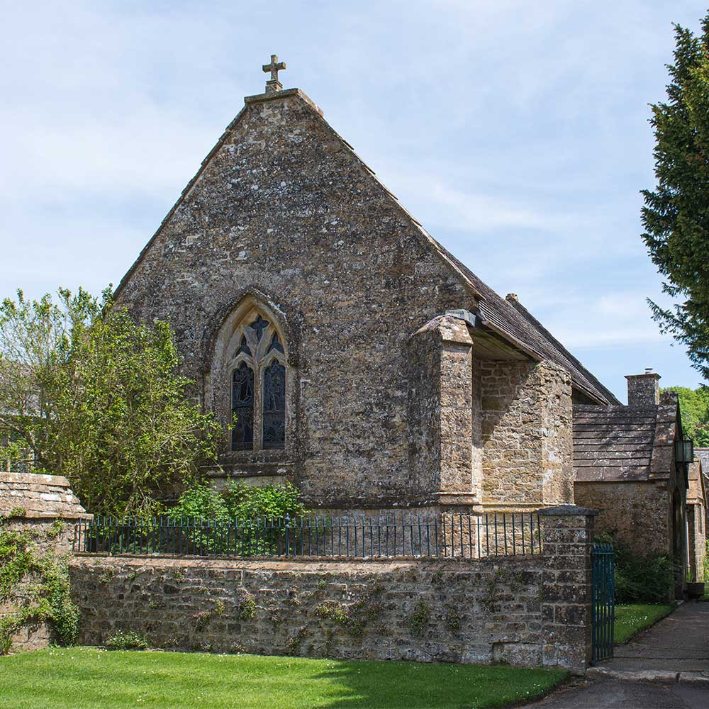
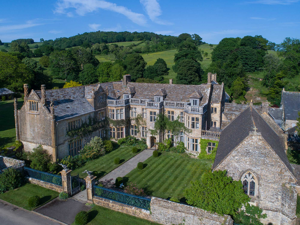
| Description | : | The medieval church of All Saints stands beside the later Tudor manor of Mapperton House. There is not a traditional grave yard on the church grounds, but the grave of a previous owner is just outside the church door. The church dates to the 12th century, though the first written record comes from 1291 when it was mentioned as a chapel of Netherbury church. The now truncated west tower is of 15th century origin. The medieval building was restored in 1704 by Richard Brodrepp and once again in 1846, using the golden-colored Ham Hill stone that makes the exterior... Read More |
frequently asked questions (FAQ):
-
Where is All Saints Churchyard?
All Saints Churchyard is located at Mapperton Estate, Mapperton, Beaminster, Dorset Mapperton, West Dorset District ,Dorset , DT8 3NREngland.
-
All Saints Churchyard cemetery's updated grave count on graveviews.com?
0 memorials
-
Where are the coordinates of the All Saints Churchyard?
Latitude: 50.7943046
Longitude: -2.7060315
Nearby Cemetories:
1. St Michaels Cemetery
Melplash, West Dorset District, England
Coordinate: 50.7832180, -2.7306110
2. Parnham House
Beaminster, West Dorset District, England
Coordinate: 50.7995080, -2.7418580
3. Christ's Churchyard
Melplash, West Dorset District, England
Coordinate: 50.7751300, -2.7324000
4. St Mary of the Annunciation Churchyard
Beaminster, West Dorset District, England
Coordinate: 50.8085130, -2.7409170
5. Holy Trinity Churchyard
Beaminster, West Dorset District, England
Coordinate: 50.8125230, -2.7376500
6. St. Giles' Churchyard
Hooke, West Dorset District, England
Coordinate: 50.7991490, -2.6606080
7. St Mary Churchyard
Netherbury, West Dorset District, England
Coordinate: 50.7922890, -2.7529110
8. St. Mary the Virgin Churchyard
Powerstock, West Dorset District, England
Coordinate: 50.7632920, -2.6863210
9. St Mary Magdalene Churchyard
Loders, West Dorset District, England
Coordinate: 50.7458420, -2.7226110
10. St. Mary's Churchyard
Corscombe, West Dorset District, England
Coordinate: 50.8413300, -2.6797630
11. Holy Trinity Churchyard
Bradpole, West Dorset District, England
Coordinate: 50.7458520, -2.7378410
12. St James Cemetery
Chedington, West Dorset District, England
Coordinate: 50.8473070, -2.7275580
13. St Saviour's Churchyard
Dottery, West Dorset District, England
Coordinate: 50.7536000, -2.7694000
14. St Michael and All Angels Churchyard
Rampisham, West Dorset District, England
Coordinate: 50.8177970, -2.6236380
15. St John the Baptist Churchyard
Broadwindsor, West Dorset District, England
Coordinate: 50.8205790, -2.7996230
16. Bridport Cemetery
Bridport, West Dorset District, England
Coordinate: 50.7335280, -2.7423070
17. Saint Mary's Church
Mosterton, West Dorset District, England
Coordinate: 50.8466690, -2.7723670
18. St. Michael and All Angels Churchyard
Askerswell, West Dorset District, England
Coordinate: 50.7309450, -2.6675050
19. St Swithun Churchyard
Allington, West Dorset District, England
Coordinate: 50.7349230, -2.7642530
20. St. Mary's Churchyard
Bridport, West Dorset District, England
Coordinate: 50.7305630, -2.7580380
21. Quaker Burial Ground
Bridport, West Dorset District, England
Coordinate: 50.7285000, -2.7577000
22. Old Church Cemetery
Bothenhampton, West Dorset District, England
Coordinate: 50.7230130, -2.7449430
23. St. Osmund's Churchyard
Evershot, West Dorset District, England
Coordinate: 50.8383970, -2.6082280
24. St Andrew Churchyard
Burstock, West Dorset District, England
Coordinate: 50.8228330, -2.8216970