
| Memorials | : | 18 |
| Location | : | Stoke Lyne, Cherwell District, England |
| Coordinate | : | 51.9505340, -1.1771680 |
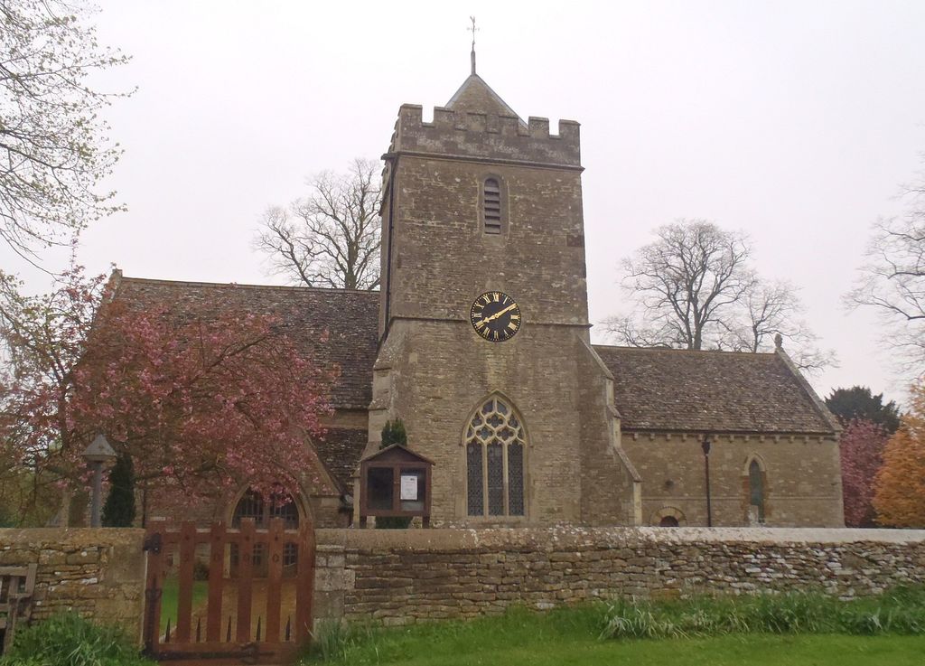
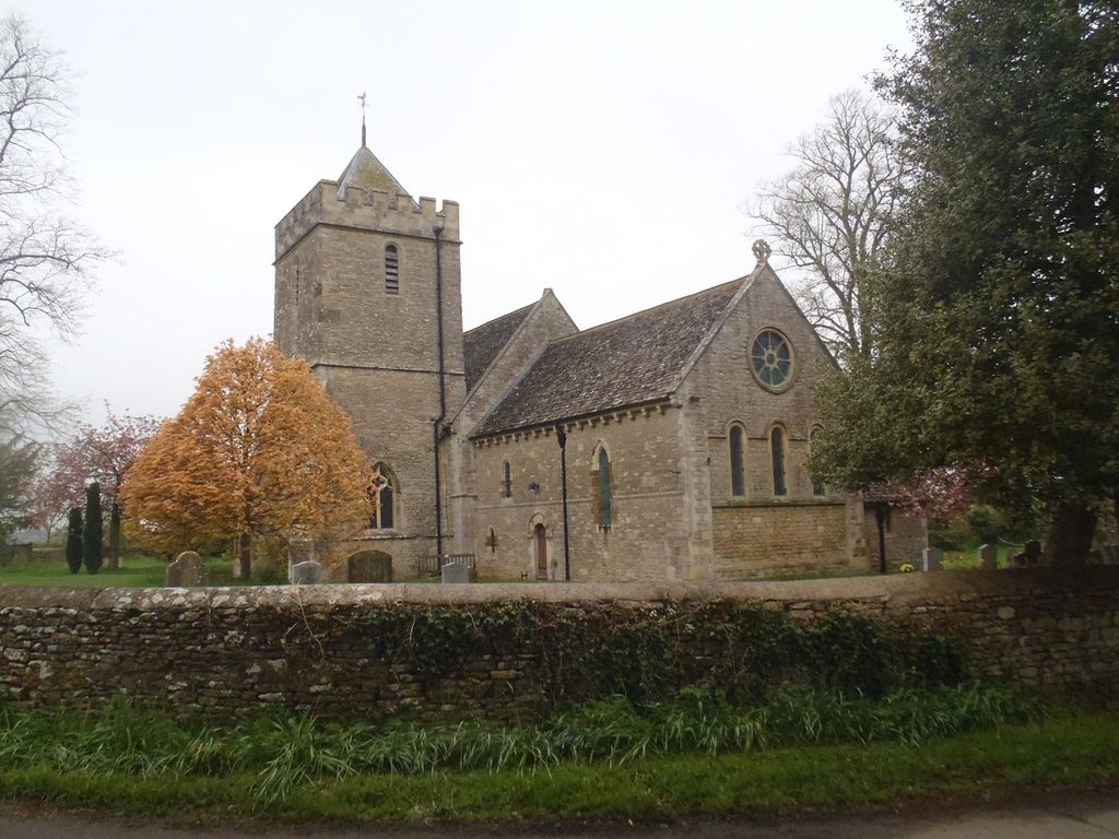
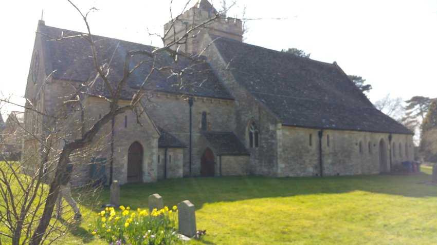
| Description | : | The Church of England parish church of Saint Peter has a late Norman nave and chancel. A north aisle was added in the 13th century and a south tower was added early in the 14th century. Most of the north aisle was demolished, leaving just the easternmost bay as a north transept.St. Peter's is a Grade II* listed building. The tower has three bells, all cast by the Whitechapel Bell Foundry. Thomas II Mears cast the second bell in 1812, while Mears and Stainbank cast the treble in 1869 and the tenor in 1925. The parish is now part of... Read More |
frequently asked questions (FAQ):
-
Where is St Peters Churchyard?
St Peters Churchyard is located at Stoke Lyne, Cherwell District ,Oxfordshire , OX27 8RUEngland.
-
St Peters Churchyard cemetery's updated grave count on graveviews.com?
14 memorials
-
Where are the coordinates of the St Peters Churchyard?
Latitude: 51.9505340
Longitude: -1.1771680
Nearby Cemetories:
1. St Mary the Virgin Churchyard
Hardwick, Cherwell District, England
Coordinate: 51.9616750, -1.1615570
2. Holy Trinity Churchyard
Hethe, Cherwell District, England
Coordinate: 51.9615600, -1.1452100
3. St. Mary's Churchyard
Ardley, Cherwell District, England
Coordinate: 51.9422140, -1.2122580
4. Fewcott All Saints Churchyard
Albury, South Oxfordshire District, England
Coordinate: 51.9477100, -1.2170700
5. St Peter's Churchyard
Bucknell, Cherwell District, England
Coordinate: 51.9263400, -1.1861700
6. St. Edmund and St. George Churchyard
Hethe, Cherwell District, England
Coordinate: 51.9604830, -1.1384690
7. St Laurence Churchyard
Caversfield, Cherwell District, England
Coordinate: 51.9223030, -1.1571690
8. St. Mary's Churchyard
Cottisford, Cherwell District, England
Coordinate: 51.9749070, -1.1464410
9. St Michaels and All Angels Churchyard
Fringford, Cherwell District, England
Coordinate: 51.9573680, -1.1189880
10. St Olave Churchyard
Fritwell, Cherwell District, England
Coordinate: 51.9596980, -1.2381180
11. Fritwell Parish Council Cemetery
Fritwell, Cherwell District, England
Coordinate: 51.9599490, -1.2380650
12. SS Mary & Edburga Churchyard
Stratton Audley, Cherwell District, England
Coordinate: 51.9294810, -1.1164160
13. St Mary the Virgin Churchyard
Souldern, Cherwell District, England
Coordinate: 51.9808600, -1.2399900
14. All Saints Churchyard
Croughton, South Northamptonshire Borough, England
Coordinate: 51.9977370, -1.2065760
15. Bicester Priory
Bicester, Cherwell District, England
Coordinate: 51.9000000, -1.1500000
16. Croughton Cemetery
Croughton, South Northamptonshire Borough, England
Coordinate: 52.0014880, -1.2031960
17. All Saints Churchyard
Middleton Stoney, Cherwell District, England
Coordinate: 51.9053470, -1.2295300
18. St Edburg Churchyard
Bicester, Cherwell District, England
Coordinate: 51.8960060, -1.1541930
19. Independent Chapel Cemetery
Bicester, Cherwell District, England
Coordinate: 51.8960550, -1.1514940
20. St Michael & All Angels Churchyard
Newton Purcell, Cherwell District, England
Coordinate: 51.9723110, -1.0915630
21. Bicester Town Cemetery
Bicester, Cherwell District, England
Coordinate: 51.8945880, -1.1553730
22. St Marys Churchyard
Launton, Cherwell District, England
Coordinate: 51.9006740, -1.1230300
23. St James Churchyard
Somerton, Cherwell District, England
Coordinate: 51.9539990, -1.2786200
24. St Mary Churchyard
Chesterton, Cherwell District, England
Coordinate: 51.8879880, -1.1851540