
| Memorials | : | 0 |
| Location | : | Corston, Wiltshire Unitary Authority, England |
| Coordinate | : | 51.5543570, -2.1085990 |
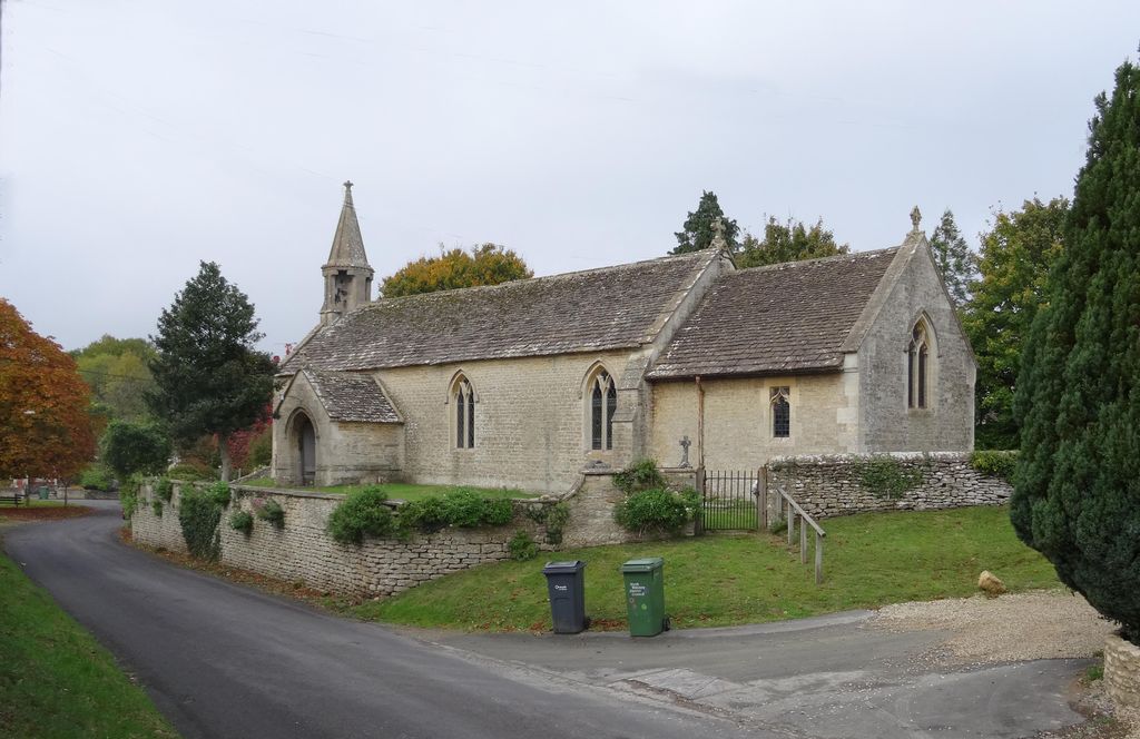
| Description | : | This church is located in the village of Corston, Wiltshire by the A429, 2.6 miles south of Malmesbury. |
frequently asked questions (FAQ):
-
Where is All Saints Churchyard?
All Saints Churchyard is located at Corston, Wiltshire Unitary Authority ,Wiltshire ,England.
-
All Saints Churchyard cemetery's updated grave count on graveviews.com?
0 memorials
-
Where are the coordinates of the All Saints Churchyard?
Latitude: 51.5543570
Longitude: -2.1085990
Nearby Cemetories:
1. St John the Baptist churchyard and extension
Brokenborough, Wiltshire Unitary Authority, England
Coordinate: 51.6022576, -2.1206102
2. St. James the Great Churchyard
Dauntsey, Wiltshire Unitary Authority, England
Coordinate: 51.5411100, -2.0301400
3. St. John the Baptist Churchyard
Charlton (North), Wiltshire Unitary Authority, England
Coordinate: 51.5995500, -2.0604800
4. All Saints Church
Christian Malford, Wiltshire Unitary Authority, England
Coordinate: 51.5050060, -2.0586920
5. St John The Baptist Churchyard
Shipton Moyne, Cotswold District, England
Coordinate: 51.6052510, -2.1571120
6. St Giles Churchyard
Alderton, Wiltshire Unitary Authority, England
Coordinate: 51.5461670, -2.2294570
7. St John the Baptist, Foxham
Bremhill, Wiltshire Unitary Authority, England
Coordinate: 51.4939942, -2.0348493
8. St Giles Church Tytherton Kellaways
Chippenham, Wiltshire Unitary Authority, England
Coordinate: 51.4805660, -2.0756870
9. Bradenstoke Priory
Bradenstoke, Wiltshire Unitary Authority, England
Coordinate: 51.5122220, -2.0036110
10. Holy Trinity Churchyard
Long Newnton, Cotswold District, England
Coordinate: 51.6308420, -2.1321200
11. Saint Mary the Virgin Churchyard
Bradenstoke, Wiltshire Unitary Authority, England
Coordinate: 51.5133061, -2.0006892
12. St Paul with Allington Mission
Allington, Wiltshire Unitary Authority, England
Coordinate: 51.4753340, -2.1530720
13. All Saints Churchyard
Crudwell, Wiltshire Unitary Authority, England
Coordinate: 51.6349050, -2.0644280
14. St Mary the Virgin and St Mary Magdalen Church
Tetbury, Cotswold District, England
Coordinate: 51.6356080, -2.1598860
15. St. Michael's Churchyard
Tetbury Upton, Cotswold District, England
Coordinate: 51.6359632, -2.1585792
16. St Saviours Churchyard
Tetbury, Cotswold District, England
Coordinate: 51.6380160, -2.1630450
17. St Andrew Churchyard
Castle Combe, Wiltshire Unitary Authority, England
Coordinate: 51.4933830, -2.2296560
18. London Road Cemetery
Chippenham, Wiltshire Unitary Authority, England
Coordinate: 51.4506852, -2.0978890
19. St Michael and All Angels Churchyard
Badminton, South Gloucestershire Unitary Authority, England
Coordinate: 51.5442200, -2.2800310
20. St Mary the Virgin Churchyard
Beverston, Cotswold District, England
Coordinate: 51.6447450, -2.2013030
21. Saint Michael's
Badminton, South Gloucestershire Unitary Authority, England
Coordinate: 51.5400900, -2.2818500
22. St Mary Churchyard
Acton Turville, South Gloucestershire Unitary Authority, England
Coordinate: 51.5263850, -2.2775330
23. Leighterton Church Cemetery
Leighterton, Cotswold District, England
Coordinate: 51.6176900, -2.2518400
24. St. Nicholas' Churchyard
Biddestone, Wiltshire Unitary Authority, England
Coordinate: 51.4606100, -2.2003700