
| Memorials | : | 1 |
| Location | : | Union, Boone County, USA |
| Coordinate | : | 38.9265990, -84.6450410 |
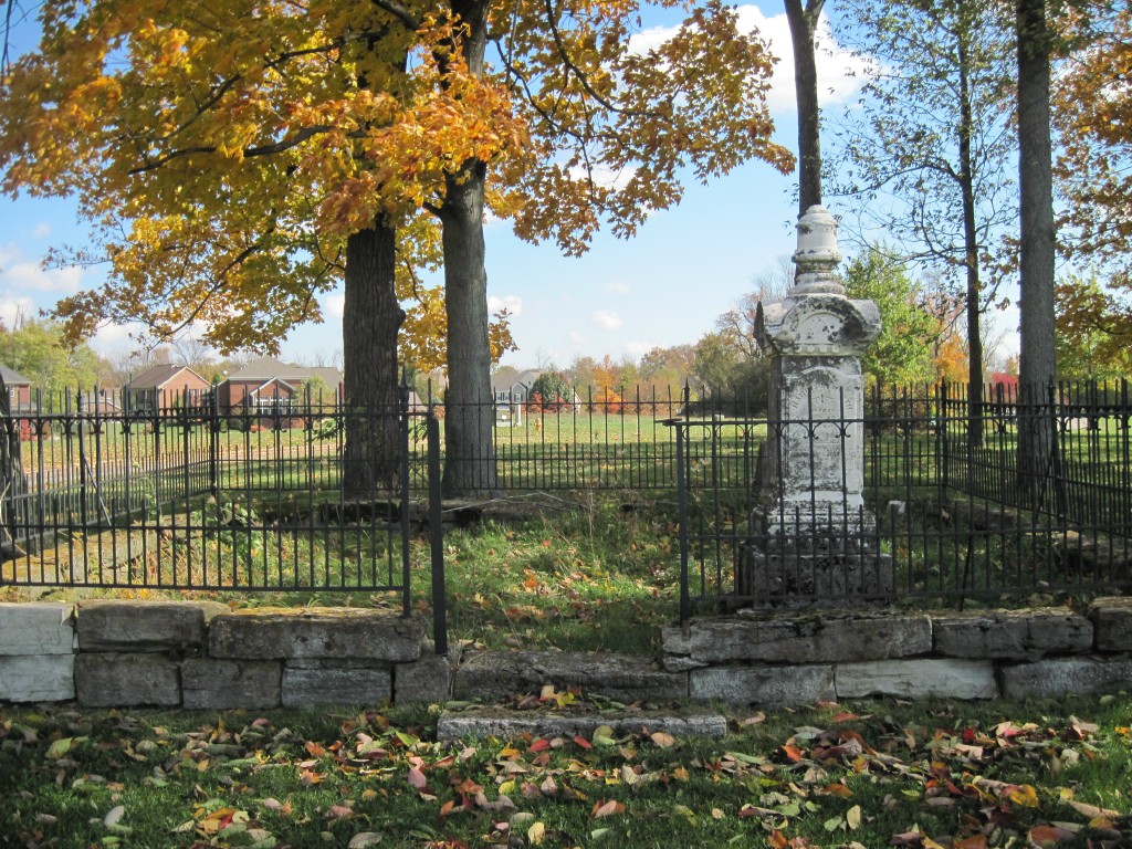
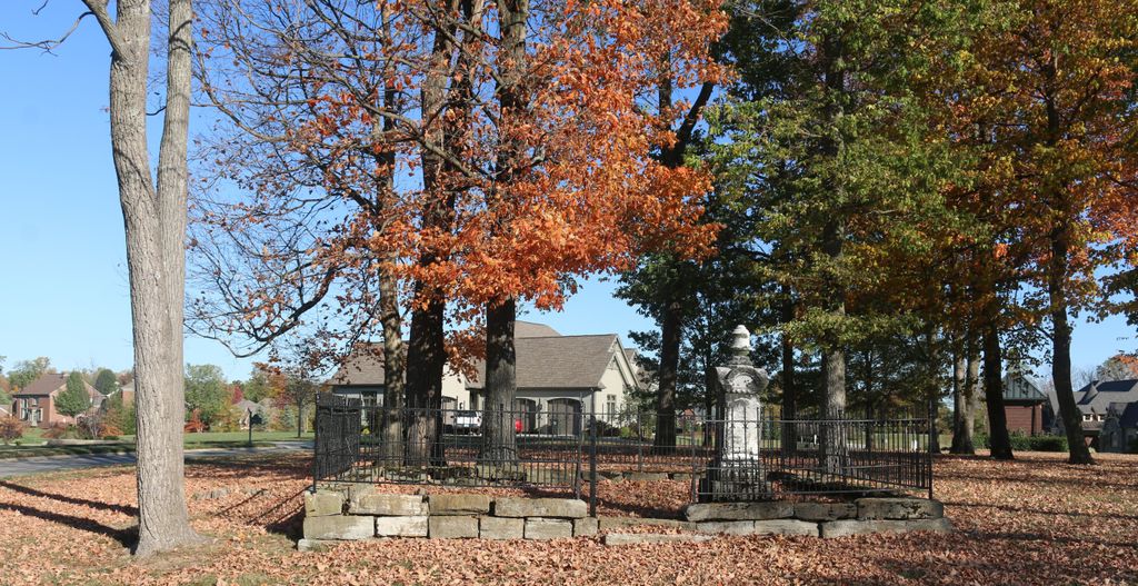
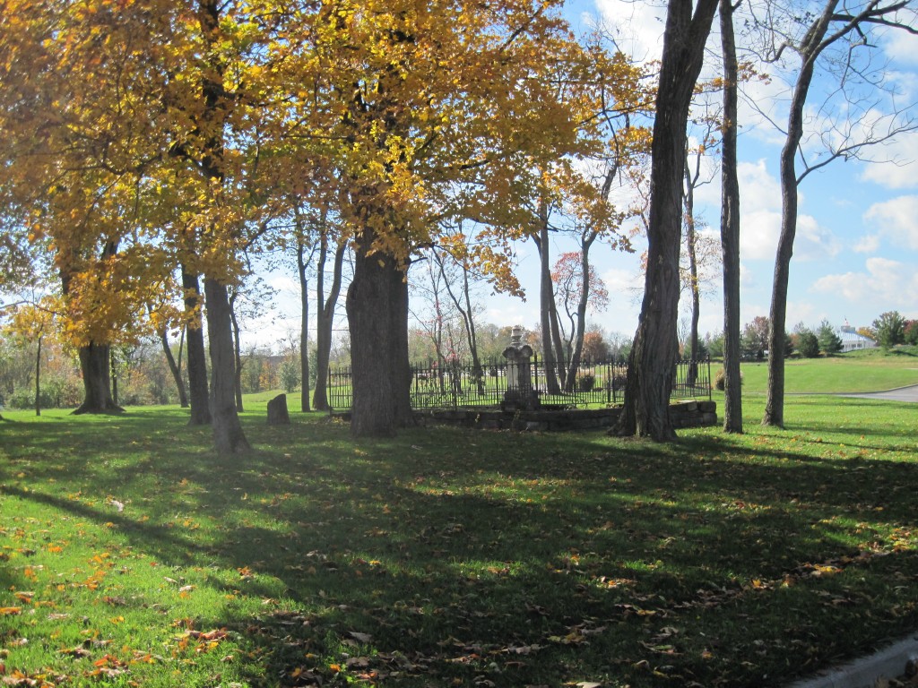
| Description | : | On property of Triple Crown Subdivision - SE of clubhouse The Boone County GIS unique ID assigned to this cemetery is 26 (Booth Cemetery). The cemetery has an index number of 26 (Booth) on the Boone County Kentucky Cemetery Map published in 2005 by the Boone County Planning Commission in conjunction with Johnson-Wilson Cemetery Stewards Association. The cemetery is identified as Booth in the index and listed as Booth Cemetery on page 141 of the book “Boone County, Kentucky Cemeteries” by Stephen W. Worrel, M.A. & Anne W. Fitzgerald, B.S., © 1996. The cemetery is identified as the Booth Cemetery in Boone County Family... Read More |
frequently asked questions (FAQ):
-
Where is Booth Family Cemetery?
Booth Family Cemetery is located at Seattle Slew Drive Union, Boone County ,Kentucky , 41091USA.
-
Booth Family Cemetery cemetery's updated grave count on graveviews.com?
1 memorials
-
Where are the coordinates of the Booth Family Cemetery?
Latitude: 38.9265990
Longitude: -84.6450410
Nearby Cemetories:
1. Butts-Snow-Loar Cemetery
Union, Boone County, USA
Coordinate: 38.9328660, -84.6396090
2. Carpenter Cemetery
Boone County, USA
Coordinate: 38.9258070, -84.6281840
3. Carter Family Cemetery
Union, Boone County, USA
Coordinate: 38.9370090, -84.6565470
4. Clarkson Family Cemetery
Union, Boone County, USA
Coordinate: 38.9401620, -84.6559290
5. Cleek Cemetery (Defunct)
Union, Boone County, USA
Coordinate: 38.9341620, -84.6634140
6. Marshall Family Cemetery
Union, Boone County, USA
Coordinate: 38.9438890, -84.6455560
7. Grubbs Cemetery
Richwood, Boone County, USA
Coordinate: 38.9366260, -84.6262810
8. Glackin Family Cemetery
Richwood, Boone County, USA
Coordinate: 38.9130050, -84.6302180
9. Bethel Baptist Church Cemetery
Union, Boone County, USA
Coordinate: 38.9356040, -84.6677790
10. Philip Baker Cemetery (Defunct)
Union, Boone County, USA
Coordinate: 38.9338890, -84.6730560
11. Lewis Rice Cemetery (Defunct)
Florence, Boone County, USA
Coordinate: 38.9427780, -84.6169440
12. Richwood Presbyterian Cemetery
Walton, Boone County, USA
Coordinate: 38.8994500, -84.6516300
13. Union Rice Cemetery
Union, Boone County, USA
Coordinate: 38.9481010, -84.6675034
14. Lampton Family Cemetery
Richwood, Boone County, USA
Coordinate: 38.9104350, -84.6151260
15. Piper Family Cemetery
Florence, Boone County, USA
Coordinate: 38.9555050, -84.6514690
16. Stansifer-Utz Cemetery
Union, Boone County, USA
Coordinate: 38.9419289, -84.6791534
17. Hugh Steers Burial Site
Florence, Boone County, USA
Coordinate: 38.9340280, -84.6865210
18. Hamilton Cemetery
Union, Boone County, USA
Coordinate: 38.9547410, -84.6687910
19. Hughes Cemetery
Walton, Boone County, USA
Coordinate: 38.8897220, -84.6438890
20. Rector Cemetery
Independence, Kenton County, USA
Coordinate: 38.9433300, -84.6002800
21. Dewire Cemetery
Ricedale, Kenton County, USA
Coordinate: 38.9361110, -84.5963890
22. Tanner Family Cemetery
Florence, Boone County, USA
Coordinate: 38.9653710, -84.6551220
23. Hudson Cemetery
Walton, Boone County, USA
Coordinate: 38.8872220, -84.6375000
24. Senour Family Burying Ground
Walton, Boone County, USA
Coordinate: 38.8844770, -84.6396230