
| Memorials | : | 4 |
| Location | : | Richwood, Boone County, USA |
| Coordinate | : | 38.9130050, -84.6302180 |
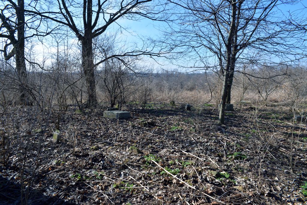
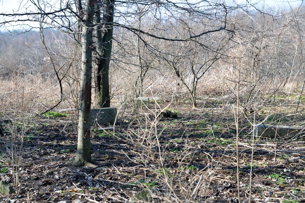
| Description | : | Glackin Family Cemetery Is on what was the family farm. 30 Richwood Rd. Rural Route #2 Walton, KY. The Boone County GIS unique ID assigned to this cemetery is 71 (Glacken Cemetery). The cemetery has an index number of 72 (Glacken) on the Boone County Kentucky Cemetery Map published in 2005 by the Boone County Planning Commission in conjunction with Johnson-Wilson Cemetery Stewards Association. The cemetery is identified as Glacken in the index and listed as Glacken Cemetery on page 145 of the book “Boone County, Kentucky Cemeteries” by Stephen W. Worrel, M.A. & Anne W. Fitzgerald, B.S., © 1996. The cemetery is identified as Glacken in... Read More |
frequently asked questions (FAQ):
-
Where is Glackin Family Cemetery?
Glackin Family Cemetery is located at Richwood Road (Kentucky State Highway 338) Richwood, Boone County ,Kentucky , 41094USA.
-
Glackin Family Cemetery cemetery's updated grave count on graveviews.com?
4 memorials
-
Where are the coordinates of the Glackin Family Cemetery?
Latitude: 38.9130050
Longitude: -84.6302180
Nearby Cemetories:
1. Lampton Family Cemetery
Richwood, Boone County, USA
Coordinate: 38.9104350, -84.6151260
2. Carpenter Cemetery
Boone County, USA
Coordinate: 38.9258070, -84.6281840
3. Booth Family Cemetery
Union, Boone County, USA
Coordinate: 38.9265990, -84.6450410
4. Butts-Snow-Loar Cemetery
Union, Boone County, USA
Coordinate: 38.9328660, -84.6396090
5. Richwood Presbyterian Cemetery
Walton, Boone County, USA
Coordinate: 38.8994500, -84.6516300
6. Grubbs Cemetery
Richwood, Boone County, USA
Coordinate: 38.9366260, -84.6262810
7. Hughes Cemetery
Walton, Boone County, USA
Coordinate: 38.8897220, -84.6438890
8. Hudson Cemetery
Walton, Boone County, USA
Coordinate: 38.8872220, -84.6375000
9. Robinson Cemetery
Walton, Boone County, USA
Coordinate: 38.8888890, -84.6100000
10. Senour Family Burying Ground
Walton, Boone County, USA
Coordinate: 38.8844770, -84.6396230
11. Lewis Rice Cemetery (Defunct)
Florence, Boone County, USA
Coordinate: 38.9427780, -84.6169440
12. Carter Family Cemetery
Union, Boone County, USA
Coordinate: 38.9370090, -84.6565470
13. Marshall Family Cemetery
Union, Boone County, USA
Coordinate: 38.9438890, -84.6455560
14. Cleek Cemetery (Defunct)
Union, Boone County, USA
Coordinate: 38.9341620, -84.6634140
15. Clarkson Family Cemetery
Union, Boone County, USA
Coordinate: 38.9401620, -84.6559290
16. Dewire Cemetery
Ricedale, Kenton County, USA
Coordinate: 38.9361110, -84.5963890
17. Bethel Baptist Church Cemetery
Union, Boone County, USA
Coordinate: 38.9356040, -84.6677790
18. Rector Cemetery
Independence, Kenton County, USA
Coordinate: 38.9433300, -84.6002800
19. Philip Baker Cemetery (Defunct)
Union, Boone County, USA
Coordinate: 38.9338890, -84.6730560
20. Percival Cemetery
Bank Lick, Kenton County, USA
Coordinate: 38.8875000, -84.5913890
21. Union Rice Cemetery
Union, Boone County, USA
Coordinate: 38.9481010, -84.6675034
22. Piper Family Cemetery
Florence, Boone County, USA
Coordinate: 38.9555050, -84.6514690
23. Wilson-Williams Cemetery
Ricedale, Kenton County, USA
Coordinate: 38.9409840, -84.5832880
24. Finnell-Burton-Roberts Cemetery
Walton, Boone County, USA
Coordinate: 38.8665940, -84.6216130