
| Memorials | : | 0 |
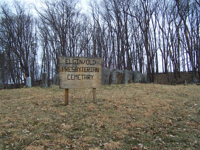
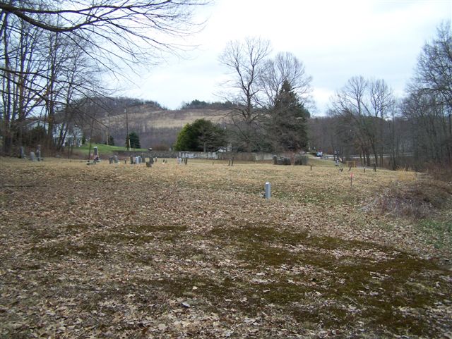
| Location | : | Rural Valley, Armstrong County, USA |
| Coordinate | : | 40.8046646, -79.3662949 |
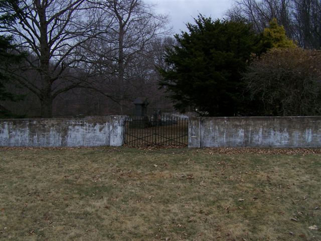
| Description | : | At the intersection of Water Street and State Route 85, in Rural Valley, Cowanshannock Township, Armstrong County, Pennsylvania, drive 2.79 miles West on Route 85, to the intersection of Sandstone Road, (Township Route 734) on the right. Turn right onto Sandstone Road and drive 200 yards to the cemetery on the right. There is no formal parking here, just pull off the road into the woods in one of the very few spaces big enough for a car. [Probably not advisable if it is wet or the ground is soft from a thaw.] |
frequently asked questions (FAQ):
-
Where is Elgin-Old Presbyterian Cemetery?
Elgin-Old Presbyterian Cemetery is located at Rural Valley, Armstrong County ,Pennsylvania , 16201USA.
-
Elgin-Old Presbyterian Cemetery cemetery's updated grave count on graveviews.com?
0 memorials
-
Where are the coordinates of the Elgin-Old Presbyterian Cemetery?
Latitude: 40.8046646
Longitude: -79.3662949
Nearby Cemetories:
1. Salem United Church of Christ Cemetery
Kittanning, Armstrong County, USA
Coordinate: 40.8244130, -79.3559970
2. Sowers Cemetery
Rural Valley, Armstrong County, USA
Coordinate: 40.7775993, -79.3703003
3. Simpson Church Cemetery
Kittanning, Armstrong County, USA
Coordinate: 40.7899000, -79.4083640
4. Pleasant Union Cemetery
Cowanshannock Township, Armstrong County, USA
Coordinate: 40.8314018, -79.3350449
5. Rural Valley Cemetery
Rural Valley, Armstrong County, USA
Coordinate: 40.8019714, -79.3118515
6. Saint Paul's Cemetery
Rural Valley, Armstrong County, USA
Coordinate: 40.7620583, -79.3640823
7. Harkleroad Cemetery
Rural Valley, Armstrong County, USA
Coordinate: 40.7718964, -79.3289719
8. Schrecengost Farm Cemetery
Armstrong County, USA
Coordinate: 40.8288070, -79.3177450
9. Scott Fox Memorial Site
Kittanning, Armstrong County, USA
Coordinate: 40.8457580, -79.3972170
10. Calhoun Cemetery
Armstrong County, USA
Coordinate: 40.8502426, -79.3848648
11. Mount Union Davis Cemetery
Armstrong County, USA
Coordinate: 40.8323850, -79.4236530
12. Echo Methodist Episcopal Church Cemetery
Armstrong County, USA
Coordinate: 40.8570420, -79.3275330
13. Pine Creek Methodist Cemetery
Pine Furnace, Armstrong County, USA
Coordinate: 40.8497870, -79.4309590
14. Saint Michael's Episcopal Cemetery
Rural Valley, Armstrong County, USA
Coordinate: 40.8542328, -79.3036499
15. Whitesburg United Methodist Church Cemetery
Whitesburg, Armstrong County, USA
Coordinate: 40.7384000, -79.3964000
16. Rupp Lutheran Church Cemetery
Kittanning, Armstrong County, USA
Coordinate: 40.7866516, -79.4561920
17. Whitesburg Presbyterian Cemetery
Armstrong County, USA
Coordinate: 40.7371000, -79.3959000
18. Pettigrew Cemetery
Elderton, Armstrong County, USA
Coordinate: 40.7330560, -79.3991670
19. Mount Zion Presbyterian Cemetery
Boggs Township, Armstrong County, USA
Coordinate: 40.8717100, -79.4171980
20. Mateer Cemetery
Armstrong County, USA
Coordinate: 40.8721000, -79.4175000
21. Lower Piney Cemetery
Armstrong County, USA
Coordinate: 40.8655920, -79.4395400
22. Bohan Family Farm Burial
Dayton, Armstrong County, USA
Coordinate: 40.7970470, -79.2572490
23. Pine Creek Baptist Church Cemetery
Kittanning, Armstrong County, USA
Coordinate: 40.8514748, -79.4601440
24. Rehobeth Reformed Presbyterian Church Cemetery
Kittanning, Armstrong County, USA
Coordinate: 40.8922670, -79.3695690