
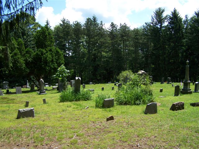
| Memorials | : | 1 |
| Location | : | Armstrong County, USA |
| Coordinate | : | 40.8570420, -79.3275330 |
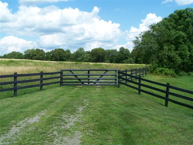
| Description | : | Driving directions: From the Village of Rural Valley, Armstrong County, PA, at the intersection of Pennsylvania State Route 85 and Water Street, drive west on Route 85 for 1.46 miles to the intersection of 85 and Little Rock Road. At this intersection turn right onto Little Rock Road and drive for 2.24 miles to the Pleasant Union Lutheran Church and Cemetery. There are several intersections here and it will be easy to select the wrong one. Therefore, follow this advice: Pull up to the Pleasant Union Church and the Church Sign and building should be just outside... Read More |
frequently asked questions (FAQ):
-
Where is Echo Methodist Episcopal Church Cemetery?
Echo Methodist Episcopal Church Cemetery is located at Armstrong County ,Pennsylvania ,USA.
-
Echo Methodist Episcopal Church Cemetery cemetery's updated grave count on graveviews.com?
1 memorials
-
Where are the coordinates of the Echo Methodist Episcopal Church Cemetery?
Latitude: 40.8570420
Longitude: -79.3275330

Nearby Cemetories:
1. Saint Michael's Episcopal Cemetery
Rural Valley, Armstrong County, USA
Coordinate: 40.8542328, -79.3036499
2. Pleasant Union Cemetery
Cowanshannock Township, Armstrong County, USA
Coordinate: 40.8314018, -79.3350449
3. Schrecengost Farm Cemetery
Armstrong County, USA
Coordinate: 40.8288070, -79.3177450
4. Concord Presbyterian Church Cemetery
Wayne Township, Armstrong County, USA
Coordinate: 40.8910599, -79.3240356
5. Salem United Church of Christ Cemetery
Kittanning, Armstrong County, USA
Coordinate: 40.8244130, -79.3559970
6. Belknap Cemetery
Dayton, Armstrong County, USA
Coordinate: 40.8926000, -79.2957000
7. Calhoun Cemetery
Armstrong County, USA
Coordinate: 40.8502426, -79.3848648
8. Rehobeth Reformed Presbyterian Church Cemetery
Kittanning, Armstrong County, USA
Coordinate: 40.8922670, -79.3695690
9. Scott Fox Memorial Site
Kittanning, Armstrong County, USA
Coordinate: 40.8457580, -79.3972170
10. Rural Valley Cemetery
Rural Valley, Armstrong County, USA
Coordinate: 40.8019714, -79.3118515
11. Elgin-Old Presbyterian Cemetery
Rural Valley, Armstrong County, USA
Coordinate: 40.8046646, -79.3662949
12. Jerusalem Lutheran Cemetery
Wayne Township, Armstrong County, USA
Coordinate: 40.9197006, -79.3566971
13. Mount Zion Presbyterian Cemetery
Boggs Township, Armstrong County, USA
Coordinate: 40.8717100, -79.4171980
14. Mateer Cemetery
Armstrong County, USA
Coordinate: 40.8721000, -79.4175000
15. Dayton Glade Run Cemetery
Dayton, Armstrong County, USA
Coordinate: 40.8710136, -79.2356262
16. McCreas Furnace Cemetery
McCrea Furnace, Armstrong County, USA
Coordinate: 40.9242060, -79.2952070
17. Milliron Family Cemetery
Putneyville, Armstrong County, USA
Coordinate: 40.9268490, -79.2997460
18. United Presbyterian Cemetery
Dayton, Armstrong County, USA
Coordinate: 40.8652000, -79.2297000
19. Emory Chapel Memorial Park
Dayton, Armstrong County, USA
Coordinate: 40.8882930, -79.2371320
20. Mount Union Davis Cemetery
Armstrong County, USA
Coordinate: 40.8323850, -79.4236530
21. Pine Creek Methodist Cemetery
Pine Furnace, Armstrong County, USA
Coordinate: 40.8497870, -79.4309590
22. Bohan Family Farm Burial
Dayton, Armstrong County, USA
Coordinate: 40.7970470, -79.2572490
23. Lower Piney Cemetery
Armstrong County, USA
Coordinate: 40.8655920, -79.4395400
24. Harkleroad Cemetery
Rural Valley, Armstrong County, USA
Coordinate: 40.7718964, -79.3289719