
| Memorials | : | 14 |
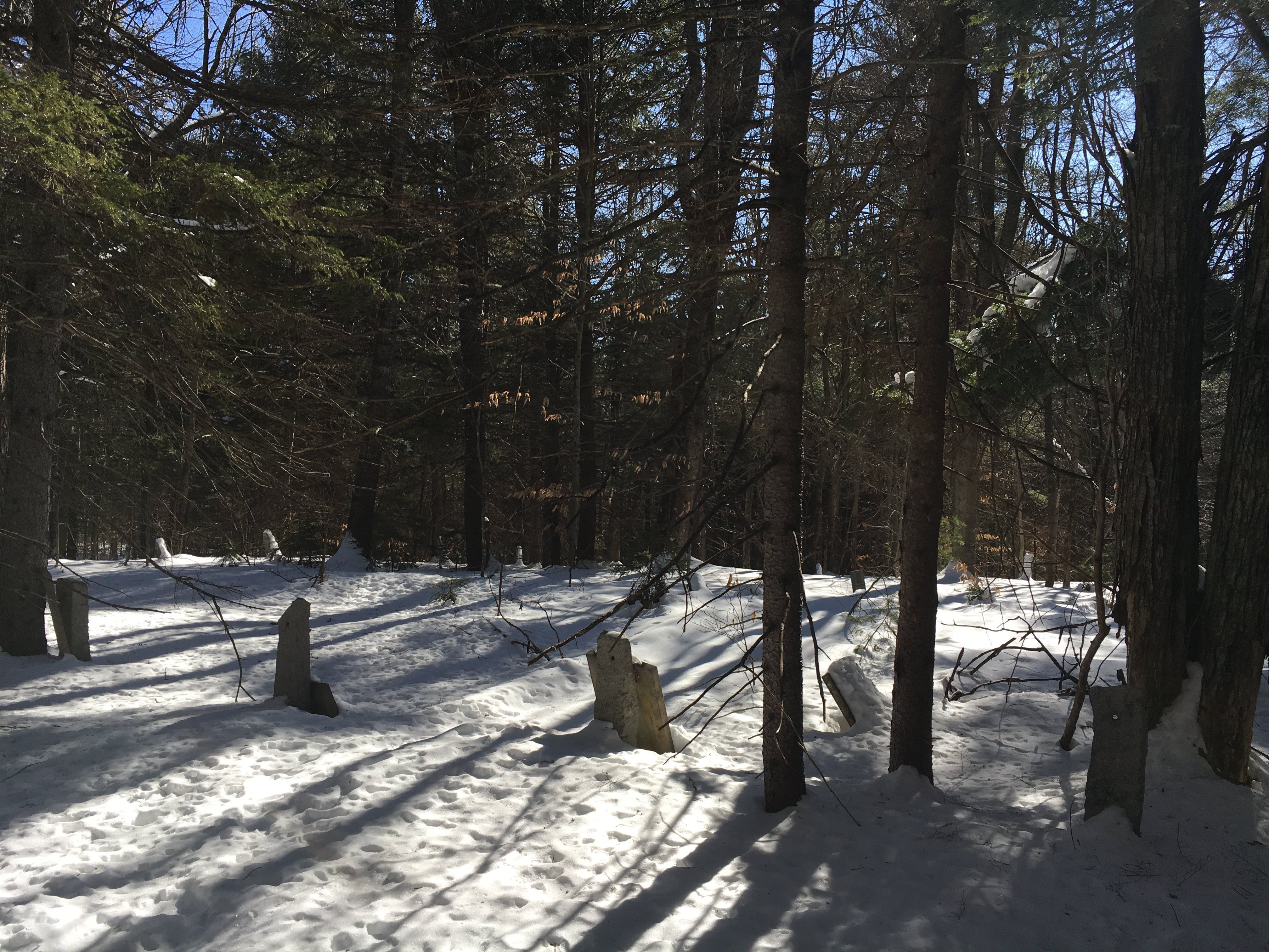
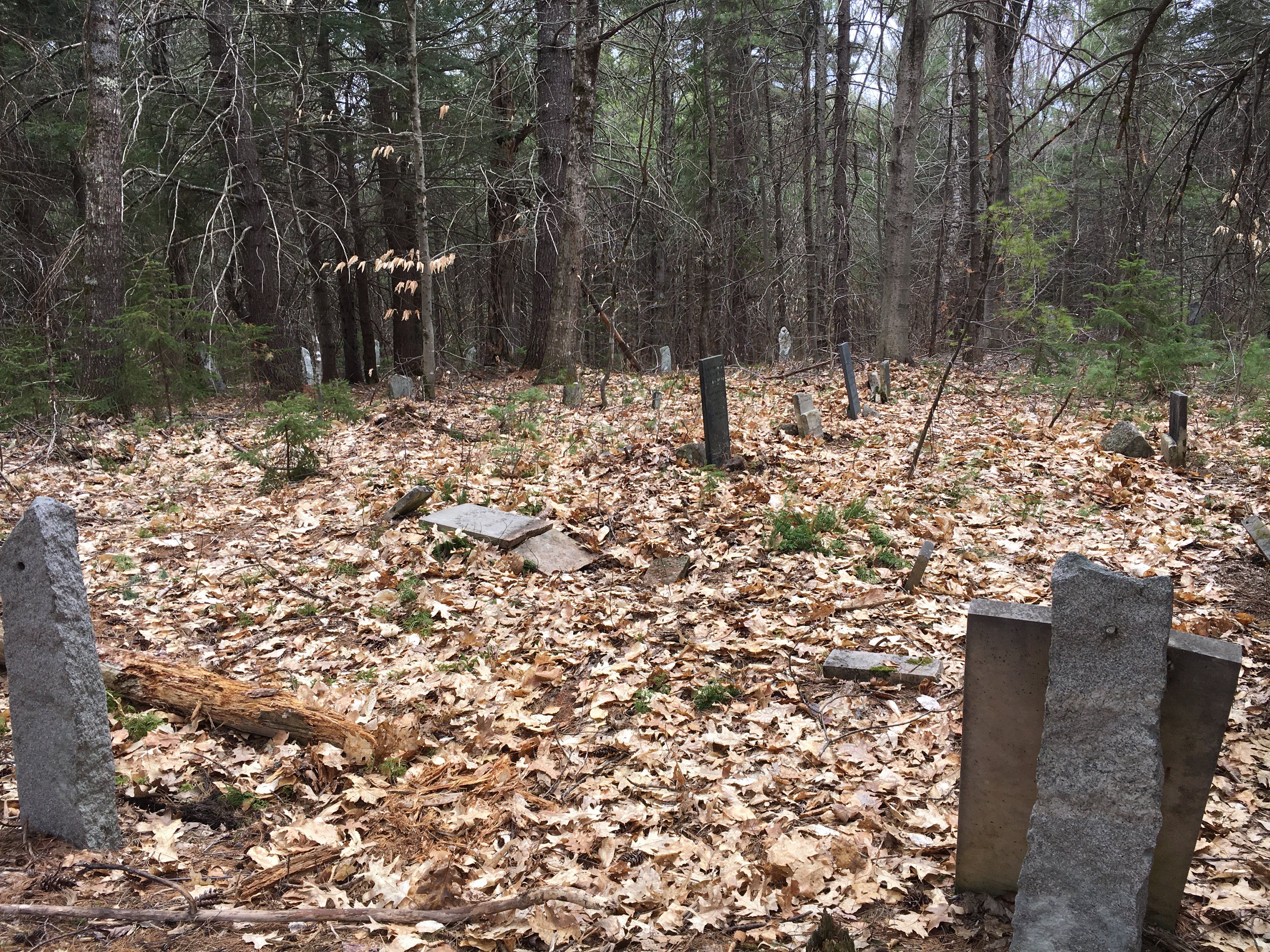
| Location | : | Eaton, Carroll County, USA |
| Coordinate | : | 43.9014700, -70.9997600 |
| Description | : | (It is easiest to reach this cemetery from Brownfield, ME, though you can also approach it from Old Carriage Road in Eaton. GPS is recommended.) From its intersection with Porter Road, drive southwest on Thurston Road. Continue straight on Thurston (dirt road) past the lefthand turnoff for Linscott Road. Follow Thurston Road 0.3 miles more until it makes a 90 degree turn left (south). Park here. Follow the old road on foot or ATV uphill to the west then southwest, over the state line. At 0.6 miles there is a cellar hole on the right (northwest) and left (southeast, not... Read More |
frequently asked questions (FAQ):
-
Where is Kenneson Cemetery?
Kenneson Cemetery is located at Eaton, Carroll County ,New Hampshire ,USA.
-
Kenneson Cemetery cemetery's updated grave count on graveviews.com?
14 memorials
-
Where are the coordinates of the Kenneson Cemetery?
Latitude: 43.9014700
Longitude: -70.9997600
Nearby Cemetories:
1. Linscott Cemetery
Brownfield, Oxford County, USA
Coordinate: 43.8984500, -70.9886100
2. Thurston-Meserve Cemetery
Eaton, Carroll County, USA
Coordinate: 43.9105100, -71.0027800
3. Frank Hart Cemetery
Eaton Center, Carroll County, USA
Coordinate: 43.9145100, -71.0039600
4. Joseph Meserve Cemetery
Brownfield, Oxford County, USA
Coordinate: 43.9104300, -70.9854200
5. George Hart Cemetery
Eaton Center, Carroll County, USA
Coordinate: 43.9161600, -70.9950900
6. Perkins Cemetery
Eaton, Carroll County, USA
Coordinate: 43.9115300, -71.0160000
7. Cole Cemetery
Brownfield, Oxford County, USA
Coordinate: 43.8956000, -70.9768700
8. Walker-Rounds Cemetery
Brownfield, Oxford County, USA
Coordinate: 43.8909100, -70.9765200
9. Hatch Perkins Cemetery
Eaton Center, Carroll County, USA
Coordinate: 43.9181000, -71.0170000
10. Gray Gravesite
Eaton Center, Carroll County, USA
Coordinate: 43.9227780, -71.0058330
11. Fernald Cemetery
Eaton, Carroll County, USA
Coordinate: 43.8825600, -71.0159200
12. McCartee Cemetery
Porter, Oxford County, USA
Coordinate: 43.8844430, -70.9770440
13. Flood Cemetery
Eaton Center, Carroll County, USA
Coordinate: 43.8988890, -71.0333330
14. Garland Cemetery
Eaton, Carroll County, USA
Coordinate: 43.9111500, -71.0320300
15. Dennett Cemetery
Brownfield, Oxford County, USA
Coordinate: 43.9289700, -70.9931000
16. Ward-Stuart Cemetery
Eaton, Carroll County, USA
Coordinate: 43.8995300, -71.0391100
17. Thompson-Stuart Cemetery
Eaton, Carroll County, USA
Coordinate: 43.9221000, -71.0274000
18. Nathaniel Hill Cemetery
Brownfield, Oxford County, USA
Coordinate: 43.8926100, -70.9615000
19. Merrow-Gannett Cemetery
Eaton Center, Carroll County, USA
Coordinate: 43.8745200, -71.0153300
20. Binford Cemetery
Brownfield, Oxford County, USA
Coordinate: 43.8936250, -70.9597380
21. Brown-Johnson Cemetery
Brownfield, Oxford County, USA
Coordinate: 43.9163710, -70.9617450
22. Sawyer-Drew Cemetery
Eaton Center, Carroll County, USA
Coordinate: 43.9022200, -71.0453300
23. Littlefield-Bean Cemetery
Eaton Center, Carroll County, USA
Coordinate: 43.9205560, -71.0372220
24. Brooks Cemetery
Eaton, Carroll County, USA
Coordinate: 43.8860600, -71.0409300