
| Memorials | : | 0 |
| Location | : | Launton, Cherwell District, England |
| Coordinate | : | 51.8979200, -1.1151020 |
frequently asked questions (FAQ):
-
Where is Bethel Congregational Church?
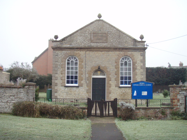
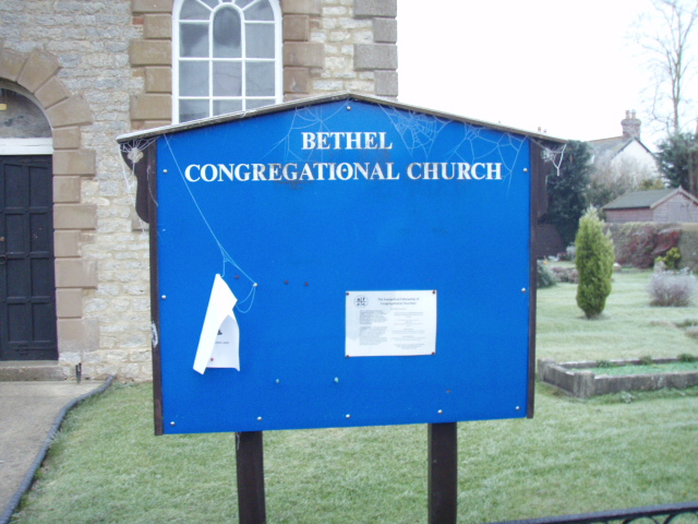
Bethel Congregational Church is located at Station Road Launton, Cherwell District ,Oxfordshire ,England.
-
Bethel Congregational Church cemetery's updated grave count on graveviews.com?
0 memorials
-
Where are the coordinates of the Bethel Congregational Church?
Latitude: 51.8979200
Longitude: -1.1151020
Nearby Cemetories:
1. St Marys Churchyard
Launton, Cherwell District, England
Coordinate: 51.9006740, -1.1230300
2. Bicester Priory
Bicester, Cherwell District, England
Coordinate: 51.9000000, -1.1500000
3. Independent Chapel Cemetery
Bicester, Cherwell District, England
Coordinate: 51.8960550, -1.1514940
4. St Edburg Churchyard
Bicester, Cherwell District, England
Coordinate: 51.8960060, -1.1541930
5. Bicester Town Cemetery
Bicester, Cherwell District, England
Coordinate: 51.8945880, -1.1553730
6. St Marys Churchyard
Ambrosden, Cherwell District, England
Coordinate: 51.8699990, -1.1255190
7. SS Mary & Edburga Churchyard
Stratton Audley, Cherwell District, England
Coordinate: 51.9294810, -1.1164160
8. Marsh Gibbon Cemetery
Bicester, Cherwell District, England
Coordinate: 51.9000250, -1.0607810
9. St Mary the Virgin Churchyard
Marsh Gibbon, Aylesbury Vale District, England
Coordinate: 51.9038310, -1.0601060
10. St Laurence Churchyard
Caversfield, Cherwell District, England
Coordinate: 51.9223030, -1.1571690
11. St Mary Churchyard
Chesterton, Cherwell District, England
Coordinate: 51.8879880, -1.1851540
12. St Swithuns Churchyard
Merton, Cherwell District, England
Coordinate: 51.8559670, -1.1633060
13. St Peter's Churchyard
Bucknell, Cherwell District, England
Coordinate: 51.9263400, -1.1861700
14. St Giles Churchyard
Wendlebury, Cherwell District, England
Coordinate: 51.8730580, -1.1901000
15. Holy Trinity
Godington, Cherwell District, England
Coordinate: 51.9452700, -1.0667470
16. St John the Baptist Churchyard
Piddington, Cherwell District, England
Coordinate: 51.8477859, -1.0723360
17. St Nicholas Churchyard
Piddington, Cherwell District, England
Coordinate: 51.8477520, -1.0723950
18. St Michaels and All Angels Churchyard
Fringford, Cherwell District, England
Coordinate: 51.9573680, -1.1189880
19. Assumption of BVM Churchyard
Twyford, Aylesbury Vale District, England
Coordinate: 51.9345860, -1.0341060
20. St Leonard Churchyard
Grendon Underwood, Aylesbury Vale District, England
Coordinate: 51.8832800, -1.0174800
21. St Michael and All Angels Churchyard
Edgcott, Aylesbury Vale District, England
Coordinate: 51.8995450, -1.0132210
22. St. Edmund and St. George Churchyard
Hethe, Cherwell District, England
Coordinate: 51.9604830, -1.1384690
23. St Peters Churchyard
Stoke Lyne, Cherwell District, England
Coordinate: 51.9505340, -1.1771680
24. St. Mary the Virgin Churchyard
Ludgershall, Aylesbury Vale District, England
Coordinate: 51.8495250, -1.0434220