
| Memorials | : | 0 |
| Location | : | Petherton, Wellington County, Canada |
| Coordinate | : | 43.8842850, -80.6084900 |
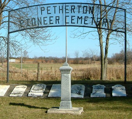
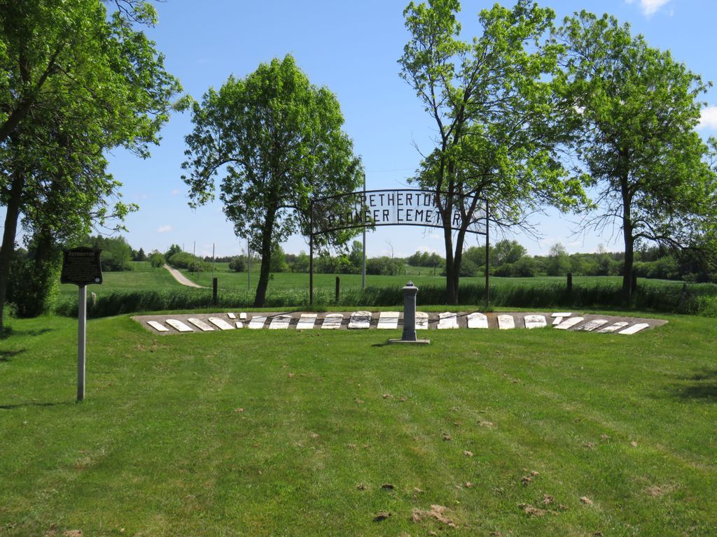
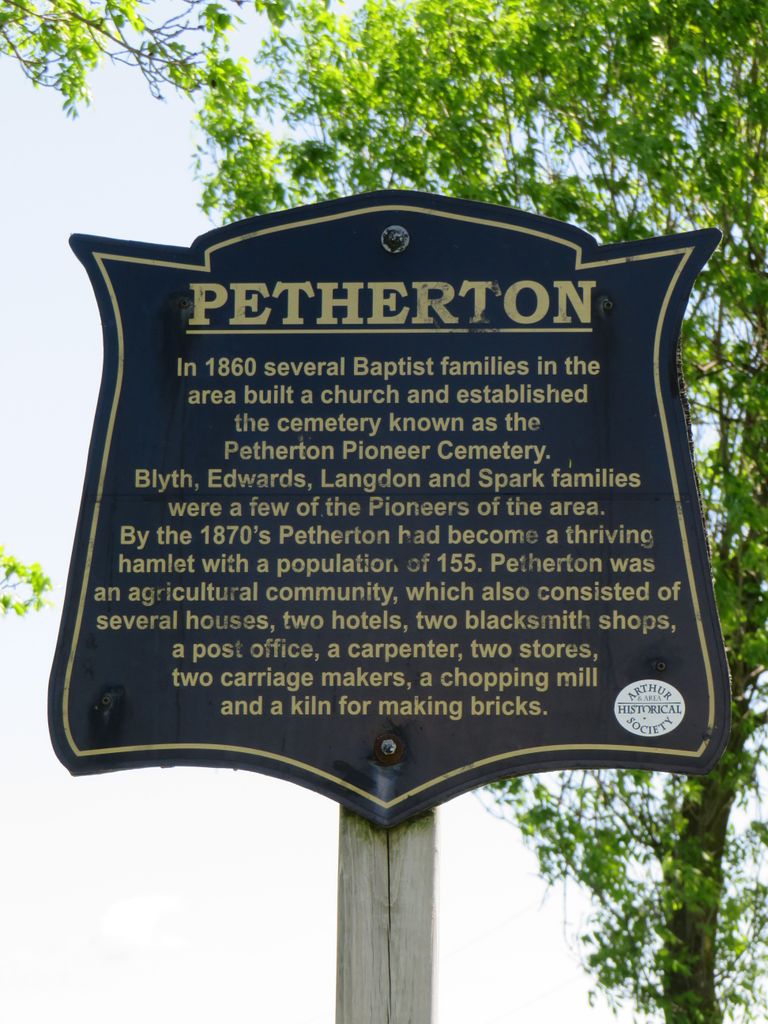
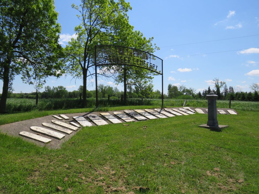
| Description | : | The South Arthur Baptist Church was built here in 1860 on land donated by the Spark family. The church was dismantled after a new church at Kenilworth was opened in 1892.The cemetery fell into neglect and in 1977 was restored by descendants of pioneers buried there, with the work done by Arthur Township. The stones have been cemented into a cairn. |
frequently asked questions (FAQ):
-
Where is Petherton Pioneer Baptist Cemetery?
Petherton Pioneer Baptist Cemetery is located at 8853 Hwy 6, Arthur Twp. Petherton, Wellington County ,Ontario ,Canada.
-
Petherton Pioneer Baptist Cemetery cemetery's updated grave count on graveviews.com?
0 memorials
-
Where are the coordinates of the Petherton Pioneer Baptist Cemetery?
Latitude: 43.8842850
Longitude: -80.6084900
Nearby Cemetories:
1. Kenilworth Methodist Cemetery
Kenilworth, Wellington County, Canada
Coordinate: 43.8926964, -80.6166458
2. Sacred Heart Roman Catholic Cemetery
Kenilworth, Wellington County, Canada
Coordinate: 43.9067993, -80.6410217
3. Kenilworth Pioneer Catholic Cemetery
Kenilworth, Wellington County, Canada
Coordinate: 43.9085900, -80.6464300
4. Greenfield Cemetery
Arthur, Wellington County, Canada
Coordinate: 43.8287070, -80.5598260
5. Saint John the Evangelist Roman Catholic Cemetery
Arthur, Wellington County, Canada
Coordinate: 43.8293300, -80.5559700
6. Farewell Mennonite Cemetery
Farewell, Wellington County, Canada
Coordinate: 43.9053140, -80.7182690
7. Derryadd Cemetery
Rothsay, Wellington County, Canada
Coordinate: 43.8168200, -80.6848900
8. Zion United Church Cemetery
Drayton, Wellington County, Canada
Coordinate: 43.7973382, -80.6375023
9. Bethel Pioneer Cemetery
Wellington County, Canada
Coordinate: 43.9274480, -80.7271960
10. Berea Mennonite Cemetery
Bosworth, Wellington County, Canada
Coordinate: 43.7793980, -80.6300350
11. Riverdale Mennonite Cemetery
Landerkin, Grey County, Canada
Coordinate: 43.9980545, -80.6197205
12. Drayton Victoria Cemetery
Drayton, Wellington County, Canada
Coordinate: 43.7651972, -80.6629083
13. Holy Cross Roman Catholic Cemetery
Mount Forest, Wellington County, Canada
Coordinate: 43.9679450, -80.7519100
14. Drayton Methodist Church and Cemetery
Drayton, Wellington County, Canada
Coordinate: 43.7525000, -80.6641670
15. Bethesda Community Cemetery
Moorefield, Wellington County, Canada
Coordinate: 43.7817530, -80.7380320
16. Saint Anthony's Roman Catholic Cemetery
Peel Township, Wellington County, Canada
Coordinate: 43.7419800, -80.5709000
17. Mount Forest Cemetery
Southgate Township, Grey County, Canada
Coordinate: 44.0039100, -80.7266500
18. Woodland Cemetery
Egremont Township, Grey County, Canada
Coordinate: 44.0238904, -80.6774183
19. Saint James Anglican Pioneer Cemetery
Rothsay, Wellington County, Canada
Coordinate: 43.7451500, -80.6815333
20. Maple View Mennonite Cemetery
Alma, Wellington County, Canada
Coordinate: 43.7482990, -80.5179980
21. Lymburner Cemetery
Kelvin, Brant County Municipality, Canada
Coordinate: 43.9968000, -80.4688000
22. Saint Patricks Roman Catholic Cemetery
Cedarville, Grey County, Canada
Coordinate: 44.0309029, -80.5493546
23. Ebenezer Primitive Methodist Cemetery
Goldstone, Wellington County, Canada
Coordinate: 43.7291794, -80.6049728
24. Saint Thomas Roman Catholic Cemetery
Wellington County, Canada
Coordinate: 43.9511810, -80.8071900