
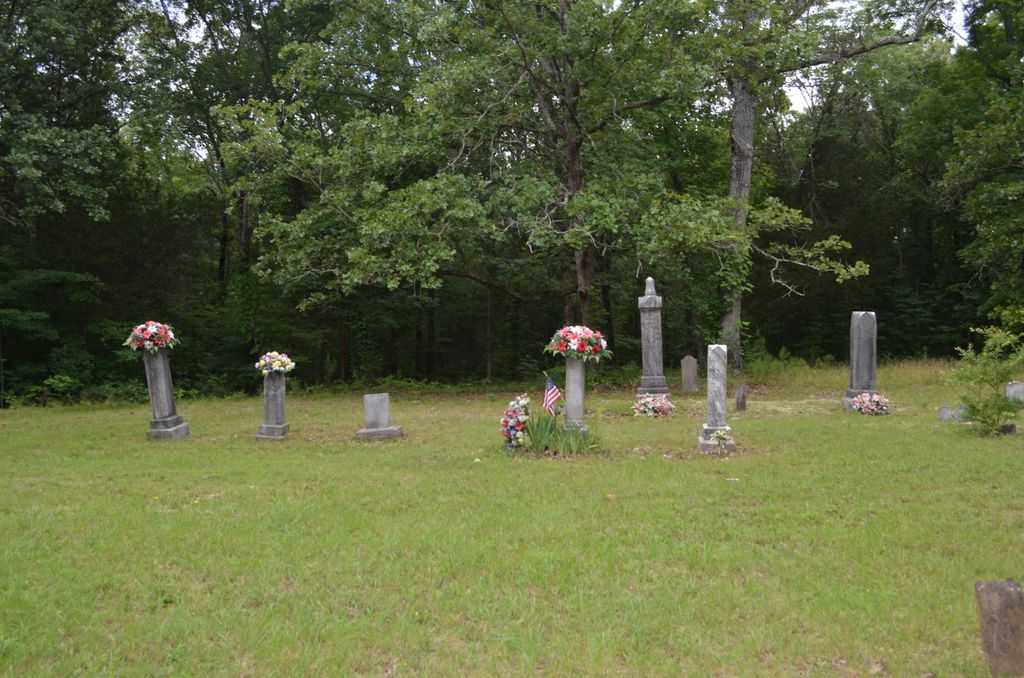
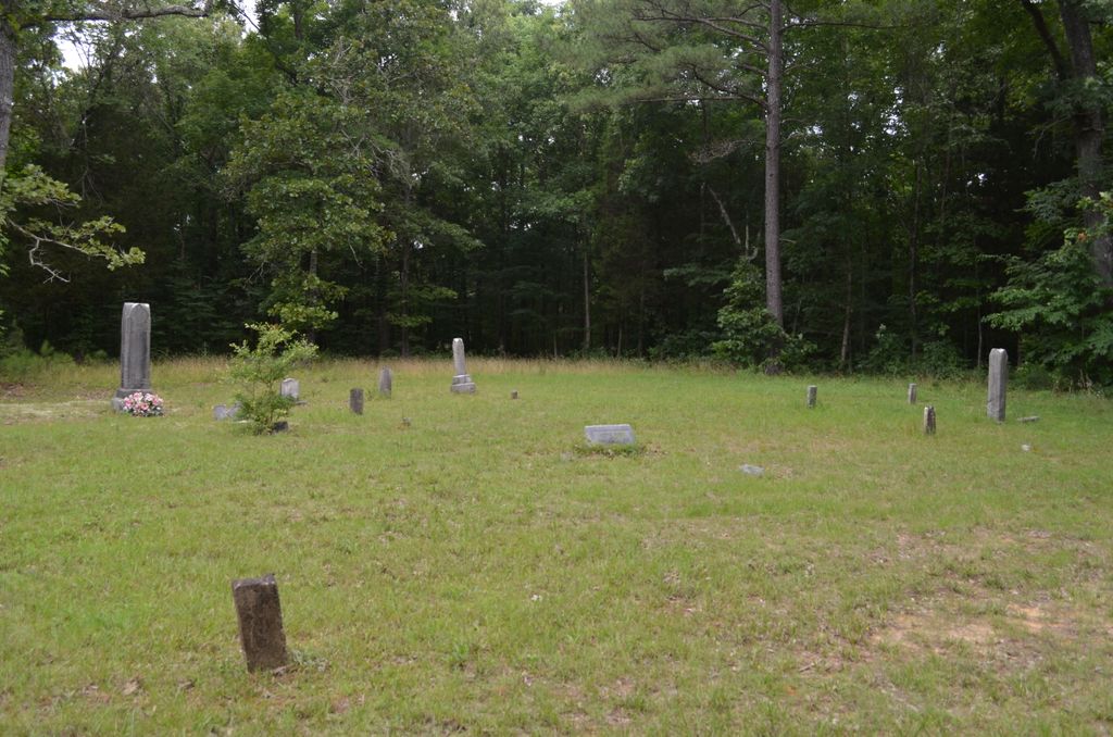
| Memorials | : | 0 |
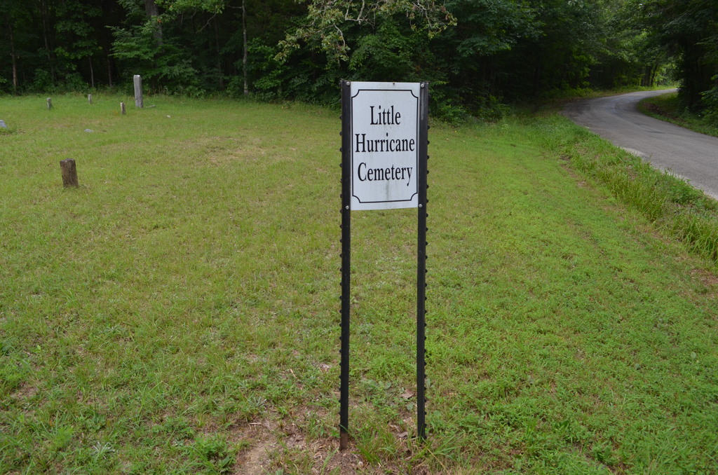
| Location | : | Sardis, Henderson County, USA |
| Coordinate | : | 35.4605060, -88.3302360 |
| Description | : | From the intersection of TN-22 N & TN-100 E, near Union Hill, travel south on TN-22 E for 2.0 mi., turning east (left) onto TN-201 N., going 3.2 mi., turning north (left) onto Doyle Rd. going 0.2 mi., to the cemetery on the west (left) side of the road in a cleared area of a wooded area. |
frequently asked questions (FAQ):
-
Where is Little Hurricane Cemetery?
Little Hurricane Cemetery is located at Doyle Road Sardis, Henderson County ,Tennessee ,USA.
-
Little Hurricane Cemetery cemetery's updated grave count on graveviews.com?
0 memorials
-
Where are the coordinates of the Little Hurricane Cemetery?
Latitude: 35.4605060
Longitude: -88.3302360
Nearby Cemetories:
1. Marl Bluff Cemetery
Sardis, Henderson County, USA
Coordinate: 35.4570870, -88.3561740
2. Pleasant View Cemetery
Sardis, Henderson County, USA
Coordinate: 35.4639730, -88.3019970
3. McBride Cemetery
Sardis, Henderson County, USA
Coordinate: 35.4406013, -88.3106003
4. Edge Cemetery
Reagan, Henderson County, USA
Coordinate: 35.4788830, -88.3620300
5. Benson Cemetery
Chester County, USA
Coordinate: 35.4453011, -88.3685989
6. Spring Hill Cemetery
Sardis, Henderson County, USA
Coordinate: 35.4277992, -88.3091965
7. Ridley Chapel Cemetery
Reagan, Henderson County, USA
Coordinate: 35.5026110, -88.3454170
8. Sardis Cemetery
Sardis, Henderson County, USA
Coordinate: 35.4366020, -88.2833100
9. Prospect Church Cemetery
Sardis, Henderson County, USA
Coordinate: 35.4584950, -88.2683120
10. Hurricane Church Cemetery
Hinkle, Hardin County, USA
Coordinate: 35.4080320, -88.3240380
11. Cedar Grove Pentecostal Cemetery
Sardis, Henderson County, USA
Coordinate: 35.4829530, -88.2698440
12. Cedar Grove Cemetery
Henderson County, USA
Coordinate: 35.4799600, -88.2678900
13. Roby Cemetery
Chester County, USA
Coordinate: 35.4644012, -88.3983002
14. Union Hill Church Cemetery
Reagan, Henderson County, USA
Coordinate: 35.4977250, -88.3826800
15. Granny Austin Cemetery
Scotts Hill, Henderson County, USA
Coordinate: 35.4949850, -88.2734300
16. Barren Springs Cemetery
Reagan, Henderson County, USA
Coordinate: 35.5183310, -88.3400860
17. Grove Springs Cemetery
Chester County, USA
Coordinate: 35.4413986, -88.4049988
18. Stone Hill Pentecostal Church Cemetery
Reagan, Henderson County, USA
Coordinate: 35.4931480, -88.4004280
19. Hanna Cemetery
Hinkle, Hardin County, USA
Coordinate: 35.3991600, -88.3006680
20. Mount Moriah Cemetery
Henderson County, USA
Coordinate: 35.5222500, -88.3593700
21. Fellowship Church Cemetery
Scotts Hill, Henderson County, USA
Coordinate: 35.4965940, -88.2602540
22. Doe Creek Cemetery
Scotts Hill, Henderson County, USA
Coordinate: 35.4692990, -88.2474350
23. Criner Cemetery
Roby, Chester County, USA
Coordinate: 35.4662000, -88.4141000
24. Lowery-Doe Creek Cemetery
Decatur County, USA
Coordinate: 35.4483120, -88.2468900