
| Memorials | : | 0 |
| Location | : | Wibsey, Metropolitan Borough of Bradford, England |
| Coordinate | : | 53.7636700, -1.7784700 |
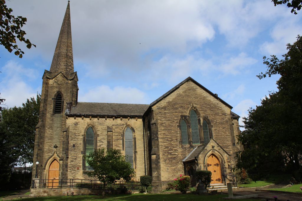
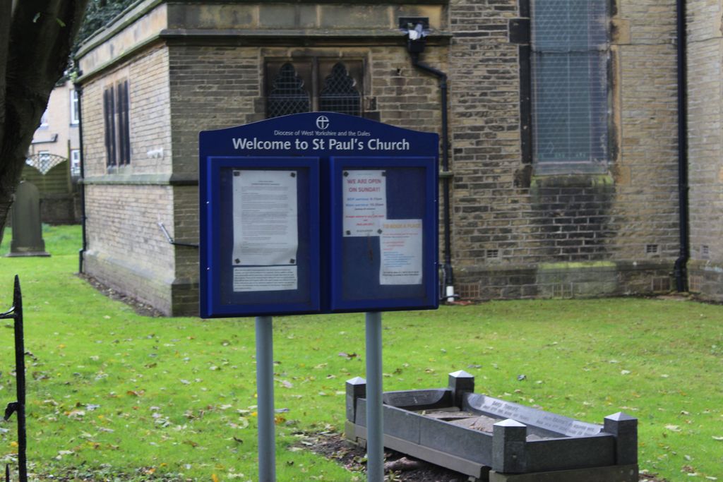
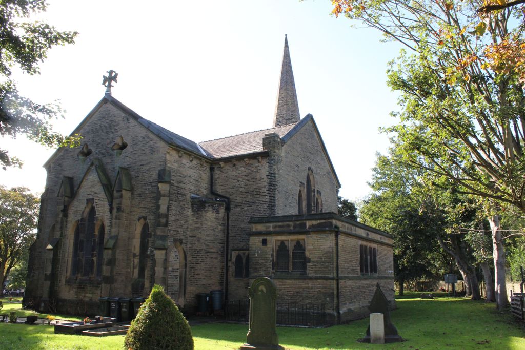
| Description | : | St Paul's Church stands within three minutes walk of the ancient village of Wibsey It was built in 1838 and consecrated in 1842 but because of the existence of Wibsey Chapel, built in 1606, the new church was designated as Buttershaw parish church, a part of the overall locality of Wibsey. The church, following traditional Early English design with lancet windows, was built and endowed at the expense of John Hardy, a director of the Low Moor Company. The parish boundaries were changed in 1924 and again in 1967. The graveyard has been cleared of all but a few monuments. Records relating to... Read More |
frequently asked questions (FAQ):
-
Where is St. Paul Churchyard?
St. Paul Churchyard is located at St Paul Wibsey, Metropolitan Borough of Bradford ,West Yorkshire , BD6 1STEngland.
-
St. Paul Churchyard cemetery's updated grave count on graveviews.com?
0 memorials
-
Where are the coordinates of the St. Paul Churchyard?
Latitude: 53.7636700
Longitude: -1.7784700
Nearby Cemetories:
1. North Bierley Municipal Cemetery
Bradford, Metropolitan Borough of Bradford, England
Coordinate: 53.7584470, -1.7781560
2. Wibsey Salvation Army Memorial Garden
Wibsey, Metropolitan Borough of Bradford, England
Coordinate: 53.7664200, -1.7702900
3. Zion Congregationalist Church Graveyard
Bradford, Metropolitan Borough of Bradford, England
Coordinate: 53.7681900, -1.7702550
4. St. Matthew Churchyard
Bradford, Metropolitan Borough of Bradford, England
Coordinate: 53.7689950, -1.7638640
5. St Mark Churchyard
Low Moor, Metropolitan Borough of Bradford, England
Coordinate: 53.7512500, -1.7696100
6. Holy Trinity Churchyard
Low Moor, Metropolitan Borough of Bradford, England
Coordinate: 53.7564900, -1.7590000
7. Friends Burial Ground
Bradford, Metropolitan Borough of Bradford, England
Coordinate: 53.7788470, -1.7747890
8. St. Michael & All Angels Churchyard
Shelf, Metropolitan Borough of Calderdale, England
Coordinate: 53.7573400, -1.8030500
9. Wesley Place Methodist Chapelyard
Low Moor, Metropolitan Borough of Bradford, England
Coordinate: 53.7528600, -1.7573100
10. Great Horton Methodist Churchyard
Bradford, Metropolitan Borough of Bradford, England
Coordinate: 53.7813052, -1.7849559
11. Pollard Family Burial Ground
Shelf, Metropolitan Borough of Calderdale, England
Coordinate: 53.7570244, -1.8072409
12. Bethel Methodist Chapelyard
Shelf, Metropolitan Borough of Calderdale, England
Coordinate: 53.7563530, -1.8079900
13. St Stephen Churchyard
West Bowling, Metropolitan Borough of Bradford, England
Coordinate: 53.7783440, -1.7578570
14. Witchfield Wesleyan Methodist Church
Shelf, Metropolitan Borough of Calderdale, England
Coordinate: 53.7559447, -1.8114241
15. Wade House Primitive Methodist Church
Shelf, Metropolitan Borough of Calderdale, England
Coordinate: 53.7543871, -1.8140742
16. Bowling Cemetery
West Bowling, Metropolitan Borough of Bradford, England
Coordinate: 53.7714844, -1.7370390
17. Scholemoor Cemetery and Crematorium
Bradford, Metropolitan Borough of Bradford, England
Coordinate: 53.7875404, -1.7963200
18. Clayton Heights Methodist Chapelyard
Bradford, Metropolitan Borough of Bradford, England
Coordinate: 53.7705400, -1.8227400
19. St. Mary the Virgin Churchyard
Wyke, Metropolitan Borough of Bradford, England
Coordinate: 53.7363400, -1.7715600
20. St. John the Evangelist Churchyard
Bradford, Metropolitan Borough of Bradford, England
Coordinate: 53.7705297, -1.7323057
21. Westfield United Reform Chapel
Wyke, Metropolitan Borough of Bradford, England
Coordinate: 53.7355456, -1.7629691
22. Congregational Chapel
Bradford, Metropolitan Borough of Bradford, England
Coordinate: 53.7910653, -1.7567839
23. Clayton Baptist Churchyard
Clayton, Metropolitan Borough of Bradford, England
Coordinate: 53.7830600, -1.8192200
24. Clayton Methodist Chapelyard
Clayton, Metropolitan Borough of Bradford, England
Coordinate: 53.7812800, -1.8232500