
| Memorials | : | 0 |
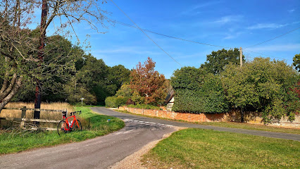
| Location | : | Mattingley, Hart District, England |
| Coordinate | : | 51.3164700, -0.9447000 |
| Description | : | Affiliated with the Church of England, and not dedicated to a specific Saint. |
frequently asked questions (FAQ):
-
Where is Mattingley Churchyard?
Mattingley Churchyard is located at Mattingley Green Mattingley, Hart District ,Hampshire , RG27 9BGEngland.
-
Mattingley Churchyard cemetery's updated grave count on graveviews.com?
0 memorials
-
Where are the coordinates of the Mattingley Churchyard?
Latitude: 51.3164700
Longitude: -0.9447000
Nearby Cemetories:
1. St Michael Churchyard
Heckfield, Hart District, England
Coordinate: 51.3389940, -0.9642430
2. Rotherwick Churchyard
Rotherwick, Hart District, England
Coordinate: 51.3010190, -0.9806320
3. Hook Cemetery
Hook, Hart District, England
Coordinate: 51.2840400, -0.9602700
4. St Mary Churchyard
Hartley Wintney, Hart District, England
Coordinate: 51.2970100, -0.9003200
5. St John the Evangelist Churchyard
Hook, Hart District, England
Coordinate: 51.2833900, -0.9601300
6. St Mary Churchyard
Hartley Wespall, Basingstoke and Deane Borough, England
Coordinate: 51.3197500, -0.9996400
7. All Souls Churchyard
Hartfordbridge, Hart District, England
Coordinate: 51.3141800, -0.8861300
8. St Mary Churchyard
Eversley, Hart District, England
Coordinate: 51.3420150, -0.8827520
9. St Nicholas Churchyard
Newnham, Basingstoke and Deane Borough, England
Coordinate: 51.2806190, -0.9922190
10. St Mary Churchyard
Stratfield Saye, Basingstoke and Deane Borough, England
Coordinate: 51.3474200, -1.0023700
11. St Mary the Virgin Churchyard
Winchfield, Hart District, England
Coordinate: 51.2764500, -0.9012600
12. Stratfield Saye House
Stratfield Saye, Basingstoke and Deane Borough, England
Coordinate: 51.3522220, -1.0058200
13. Nutbean Lane Cemetery
Swallowfield, Wokingham Borough, England
Coordinate: 51.3730630, -0.9430220
14. St. Swithun Churchyard
Nately Scures, Basingstoke and Deane Borough, England
Coordinate: 51.2719600, -1.0022200
15. St. Leonard's Churchyard
Sherfield on Loddon, Basingstoke and Deane Borough, England
Coordinate: 51.3061100, -1.0376400
16. All Saints Churchyard
Swallowfield, Wokingham Borough, England
Coordinate: 51.3775140, -0.9500010
17. St Stephen Churchyard
Up Nately, Basingstoke and Deane Borough, England
Coordinate: 51.2627500, -0.9971500
18. All Saints Churchyard
Dogmersfield, Hart District, England
Coordinate: 51.2674100, -0.8810800
19. All Saints Churchyard
Odiham, Hart District, England
Coordinate: 51.2529200, -0.9407000
20. Odiham Cemetery
Odiham, Hart District, England
Coordinate: 51.2521010, -0.9360700
21. St. Mary's Churchyard
Greywell, Hart District, England
Coordinate: 51.2536700, -0.9719700
22. Hope Cemetery
Fleet, Hart District, England
Coordinate: 51.2827800, -0.8495300
23. All Saints Churchyard
Fleet, Hart District, England
Coordinate: 51.2838060, -0.8427500
24. St James Churchyard
Finchampstead, Wokingham Borough, England
Coordinate: 51.3678500, -0.8625620