
| Memorials | : | 0 |
| Location | : | Up Nately, Basingstoke and Deane Borough, England |
| Coordinate | : | 51.2627500, -0.9971500 |
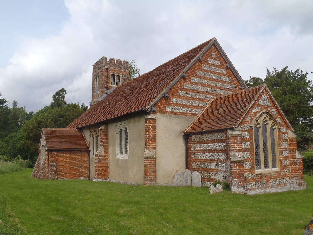
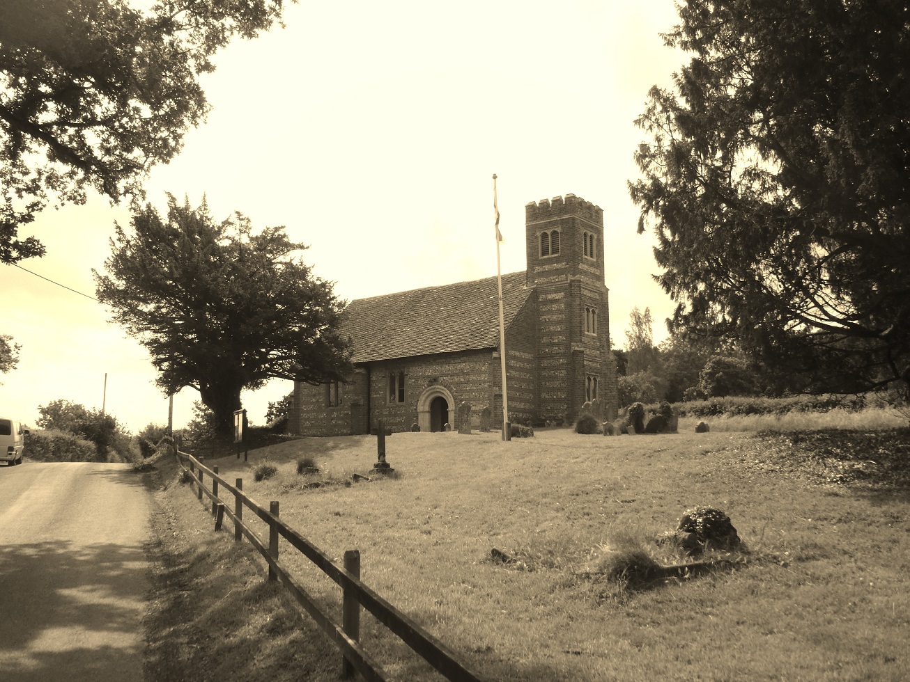
| Description | : | St Stephen's Church includes a memorial to Alfred James Clark. Clark had joined the Army in 1914. In 1916, the hospital where he had been a patient was bombed. When erected, the memorial was unusual, being the second such one-man memorial in the UK. The altar cloth has a mysterious inscription to the fallen of the Great War. It lists sixteen names of servicemen who are from different regiments, different parts of the country, and who died in different places. The association between them is unclear. The churchyard contains the war graves of Frank Evans and Alan Sidney Woodbridge. |
frequently asked questions (FAQ):
-
Where is St Stephen Churchyard?
St Stephen Churchyard is located at Greywell Road Up Nately, Basingstoke and Deane Borough ,Hampshire , RG27 9PREngland.
-
St Stephen Churchyard cemetery's updated grave count on graveviews.com?
0 memorials
-
Where are the coordinates of the St Stephen Churchyard?
Latitude: 51.2627500
Longitude: -0.9971500
Nearby Cemetories:
1. St. Swithun Churchyard
Nately Scures, Basingstoke and Deane Borough, England
Coordinate: 51.2719600, -1.0022200
2. St Mary Churchyard
Mapledurwell, Basingstoke and Deane Borough, England
Coordinate: 51.2538100, -1.0161300
3. St Nicholas Churchyard
Newnham, Basingstoke and Deane Borough, England
Coordinate: 51.2806190, -0.9922190
4. St. Mary's Churchyard
Greywell, Hart District, England
Coordinate: 51.2536700, -0.9719700
5. Old Basing Cemetery
Old Basing, Basingstoke and Deane Borough, England
Coordinate: 51.2736710, -1.0397679
6. St John the Evangelist Churchyard
Hook, Hart District, England
Coordinate: 51.2833900, -0.9601300
7. Hook Cemetery
Hook, Hart District, England
Coordinate: 51.2840400, -0.9602700
8. St. Mary's Churchyard
Upton Grey, Basingstoke and Deane Borough, England
Coordinate: 51.2307800, -1.0025200
9. St Mary Churchyard
Old Basing, Basingstoke and Deane Borough, England
Coordinate: 51.2715280, -1.0467700
10. All Saints Churchyard
Odiham, Hart District, England
Coordinate: 51.2529200, -0.9407000
11. Rotherwick Churchyard
Rotherwick, Hart District, England
Coordinate: 51.3010190, -0.9806320
12. Odiham Cemetery
Odiham, Hart District, England
Coordinate: 51.2521010, -0.9360700
13. All Saints Churchyard
Tunworth, Basingstoke and Deane Borough, England
Coordinate: 51.2312600, -1.0367400
14. St Andrew Churchyard
South Warnborough, Hart District, England
Coordinate: 51.2198000, -0.9684700
15. St Lawrence Churchyard
Weston Patrick, Basingstoke and Deane Borough, England
Coordinate: 51.2170740, -1.0121040
16. St. Leonard's Churchyard
Sherfield on Loddon, Basingstoke and Deane Borough, England
Coordinate: 51.3061100, -1.0376400
17. St Mary Churchyard
Basingstoke, Basingstoke and Deane Borough, England
Coordinate: 51.2652010, -1.0818960
18. Long Sutton Cemetery
Long Sutton, Hart District, England
Coordinate: 51.2193610, -0.9465190
19. All Saints Churchyard
Long Sutton, Hart District, England
Coordinate: 51.2207300, -0.9432800
20. St Mary Churchyard
Hartley Wespall, Basingstoke and Deane Borough, England
Coordinate: 51.3197500, -0.9996400
21. St. Michael's Churchyard
Basingstoke, Basingstoke and Deane Borough, England
Coordinate: 51.2652400, -1.0885200
22. South View Cemetery
Basingstoke, Basingstoke and Deane Borough, England
Coordinate: 51.2693510, -1.0911620
23. St Mary the Virgin Churchyard
Winchfield, Hart District, England
Coordinate: 51.2764500, -0.9012600
24. Mattingley Churchyard
Mattingley, Hart District, England
Coordinate: 51.3164700, -0.9447000