
| Memorials | : | 26 |
| Location | : | Greywell, Hart District, England |
| Coordinate | : | 51.2536700, -0.9719700 |
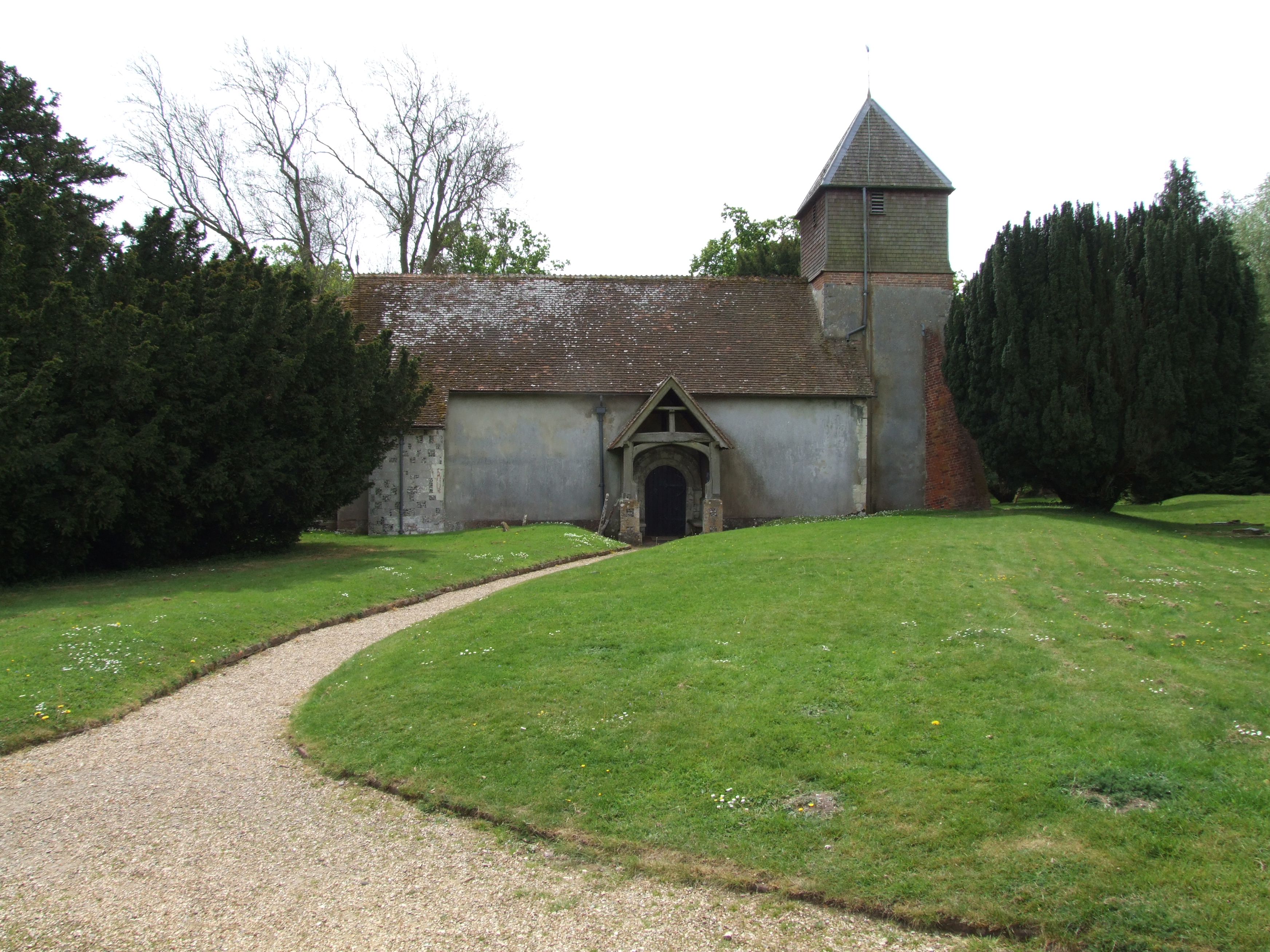
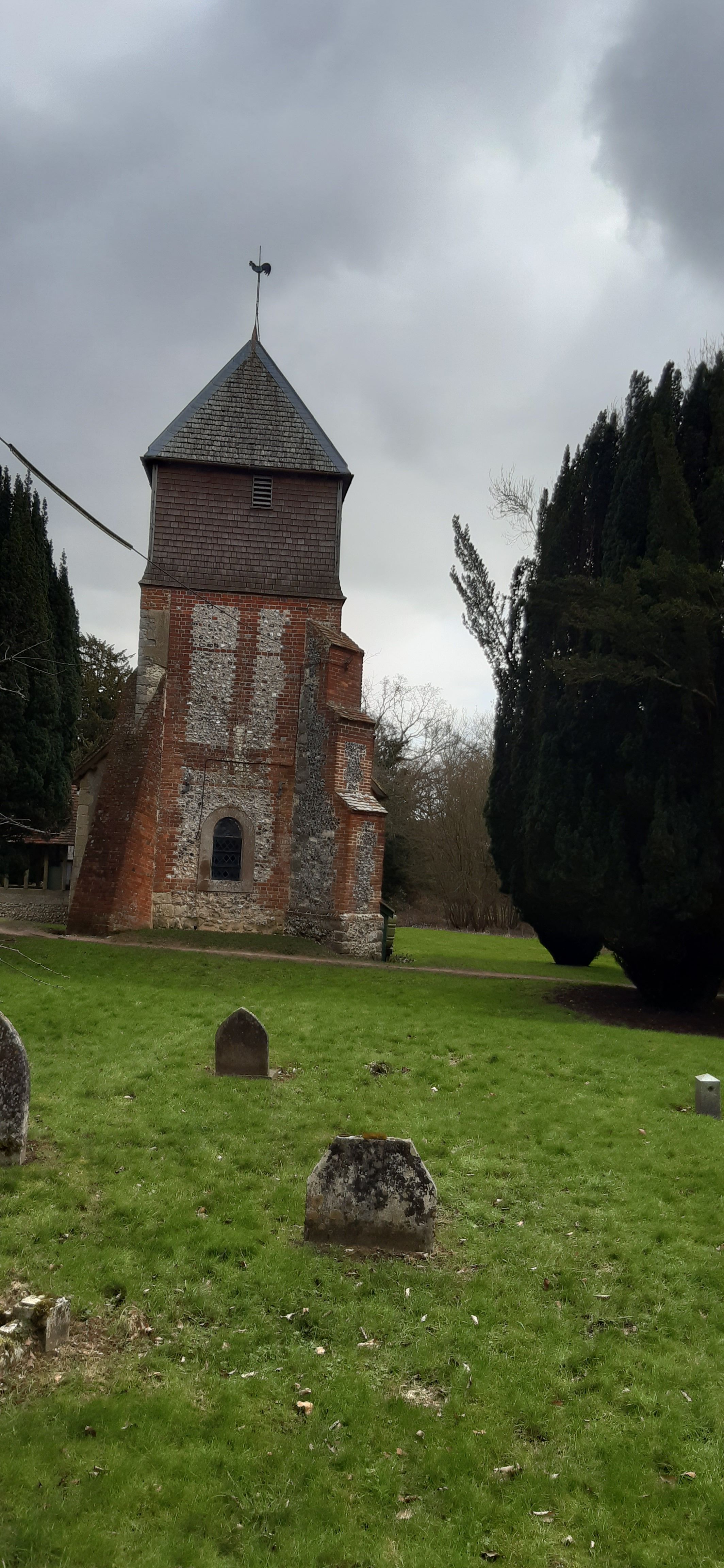
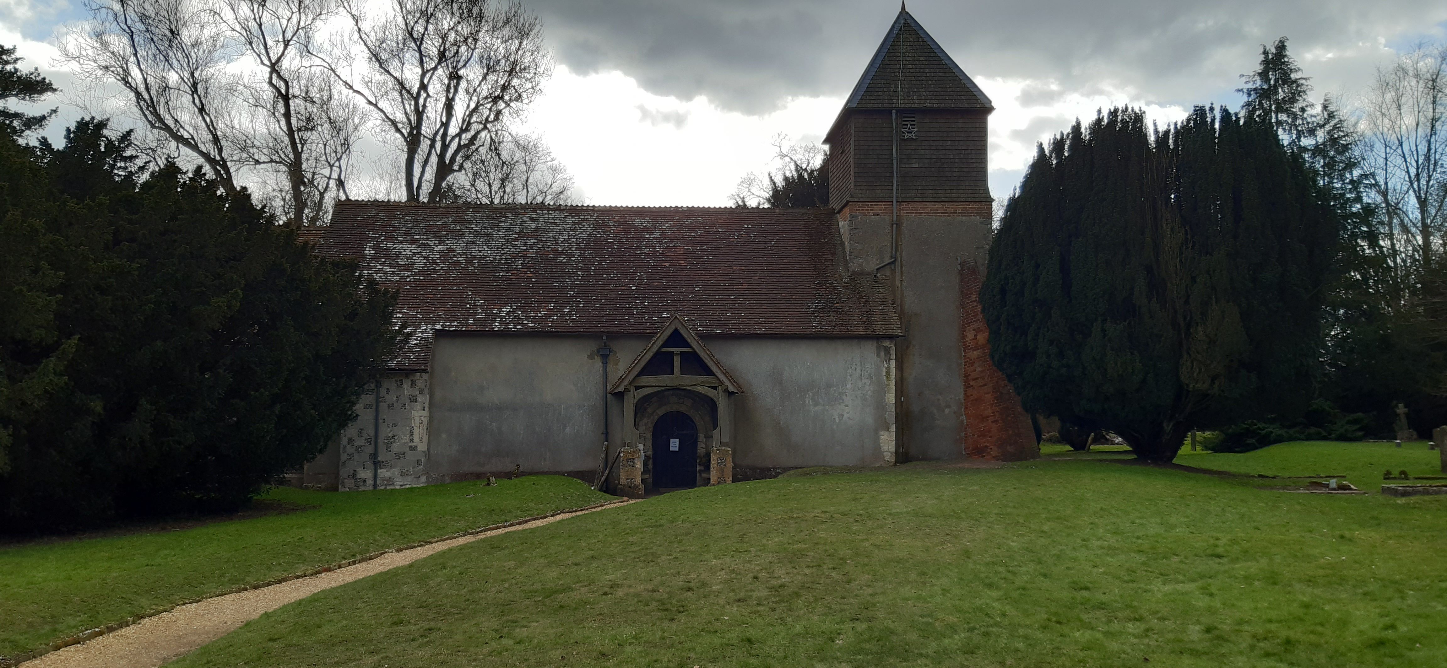
| Description | : | St Mary's church is set back from the road behind the lychgate - close to the river. Greywell is a small village and civil parish in Hampshire, England. It is on the other side of the M3 from Hook. It is about two miles from Odiham. Nearby medieval Odiham Castle is of historical interest.The Basingstoke Canal runs underneath part of the village through the Greywell Tunnel which is now no longer navigable due to a collapse which occurred in 1932. The upper reaches of the River Whitewater also run through the village. Greywell is home to two Sites of Special Scientific... Read More |
frequently asked questions (FAQ):
-
Where is St. Mary's Churchyard?
St. Mary's Churchyard is located at The Street Greywell, Hart District ,Hampshire , RG29 1DAEngland.
-
St. Mary's Churchyard cemetery's updated grave count on graveviews.com?
26 memorials
-
Where are the coordinates of the St. Mary's Churchyard?
Latitude: 51.2536700
Longitude: -0.9719700
Nearby Cemetories:
1. St Stephen Churchyard
Up Nately, Basingstoke and Deane Borough, England
Coordinate: 51.2627500, -0.9971500
2. All Saints Churchyard
Odiham, Hart District, England
Coordinate: 51.2529200, -0.9407000
3. Odiham Cemetery
Odiham, Hart District, England
Coordinate: 51.2521010, -0.9360700
4. St. Swithun Churchyard
Nately Scures, Basingstoke and Deane Borough, England
Coordinate: 51.2719600, -1.0022200
5. St Mary Churchyard
Mapledurwell, Basingstoke and Deane Borough, England
Coordinate: 51.2538100, -1.0161300
6. St Nicholas Churchyard
Newnham, Basingstoke and Deane Borough, England
Coordinate: 51.2806190, -0.9922190
7. St. Mary's Churchyard
Upton Grey, Basingstoke and Deane Borough, England
Coordinate: 51.2307800, -1.0025200
8. St John the Evangelist Churchyard
Hook, Hart District, England
Coordinate: 51.2833900, -0.9601300
9. Hook Cemetery
Hook, Hart District, England
Coordinate: 51.2840400, -0.9602700
10. St Andrew Churchyard
South Warnborough, Hart District, England
Coordinate: 51.2198000, -0.9684700
11. All Saints Churchyard
Long Sutton, Hart District, England
Coordinate: 51.2207300, -0.9432800
12. Long Sutton Cemetery
Long Sutton, Hart District, England
Coordinate: 51.2193610, -0.9465190
13. St Lawrence Churchyard
Weston Patrick, Basingstoke and Deane Borough, England
Coordinate: 51.2170740, -1.0121040
14. All Saints Churchyard
Tunworth, Basingstoke and Deane Borough, England
Coordinate: 51.2312600, -1.0367400
15. Old Basing Cemetery
Old Basing, Basingstoke and Deane Borough, England
Coordinate: 51.2736710, -1.0397679
16. Rotherwick Churchyard
Rotherwick, Hart District, England
Coordinate: 51.3010190, -0.9806320
17. St Mary the Virgin Churchyard
Winchfield, Hart District, England
Coordinate: 51.2764500, -0.9012600
18. St Mary Churchyard
Old Basing, Basingstoke and Deane Borough, England
Coordinate: 51.2715280, -1.0467700
19. All Saints Churchyard
Dogmersfield, Hart District, England
Coordinate: 51.2674100, -0.8810800
20. Froyle Cemetery
Froyle, East Hampshire District, England
Coordinate: 51.1941910, -0.9479140
21. St Mary Churchyard
Hartley Wintney, Hart District, England
Coordinate: 51.2970100, -0.9003200
22. Mattingley Churchyard
Mattingley, Hart District, England
Coordinate: 51.3164700, -0.9447000
23. St. Leonard's Churchyard
Sherfield on Loddon, Basingstoke and Deane Borough, England
Coordinate: 51.3061100, -1.0376400
24. St Mary Churchyard
Herriard, Basingstoke and Deane Borough, England
Coordinate: 51.2093000, -1.0515700